Higginbotham Topo Map Texas
To zoom in, hover over the map of Higginbotham
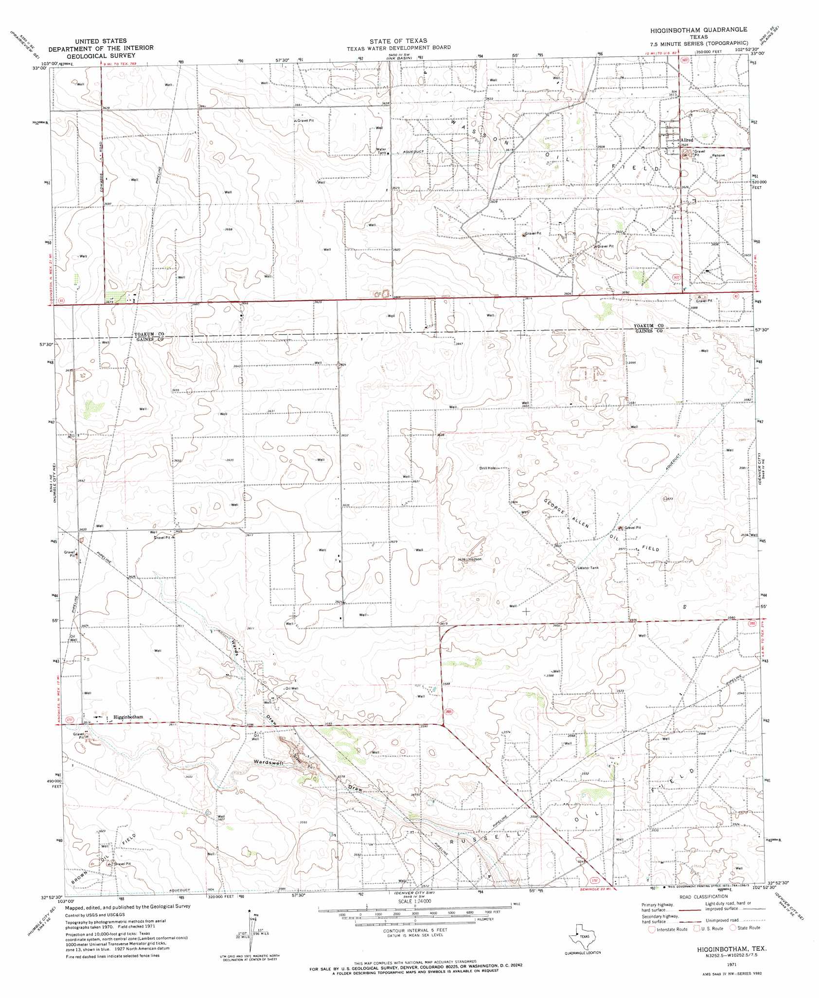
USGS Topo Quad 32102h8 - 1:24,000 scale
| Topo Map Name: | Higginbotham |
| USGS Topo Quad ID: | 32102h8 |
| Print Size: | ca. 21 1/4" wide x 27" high |
| Southeast Coordinates: | 32.875° N latitude / 102.875° W longitude |
| Map Center Coordinates: | 32.9375° N latitude / 102.9375° W longitude |
| U.S. State: | TX |
| Filename: | o32102h8.jpg |
| Download Map JPG Image: | Higginbotham topo map 1:24,000 scale |
| Map Type: | Topographic |
| Topo Series: | 7.5´ |
| Map Scale: | 1:24,000 |
| Source of Map Images: | United States Geological Survey (USGS) |
| Alternate Map Versions: |
Higginbotham TX 1971, updated 1973 Download PDF Buy paper map Higginbotham TX 2010 Download PDF Buy paper map Higginbotham TX 2012 Download PDF Buy paper map Higginbotham TX 2016 Download PDF Buy paper map |
1:24,000 Topo Quads surrounding Higginbotham
Prairieview Nw |
Prairieview Ne |
Plains Nw |
Plains |
Tokio Nw |
Prairieview |
Prairieview Se |
Ink Basin |
Plains Se |
Pleasant Hill |
Humble City Nw |
Humble City Ne |
Higginbotham |
Denver City |
Seagraves Nw |
Humble City |
Humble City Se |
Denver City Sw |
Denver City Se |
Seagraves Sw |
Hobbs West |
Hobbs East |
Paynes Corner Nw |
Paynes Corner |
Seminole |
> Back to 32102e1 at 1:100,000 scale
> Back to 32102a1 at 1:250,000 scale
> Back to U.S. Topo Maps home
Higginbotham topo map: Gazetteer
Higginbotham: Oilfields
George Allen Oil Field elevation 1094m 3589′Higginbotham: Populated Places
Allred elevation 1108m 3635′Higginbotham elevation 1103m 3618′
Higginbotham: Valleys
Wards Draw elevation 1090m 3576′Wards Draw elevation 1090m 3576′
Higginbotham digital topo map on disk
Buy this Higginbotham topo map showing relief, roads, GPS coordinates and other geographical features, as a high-resolution digital map file on DVD: