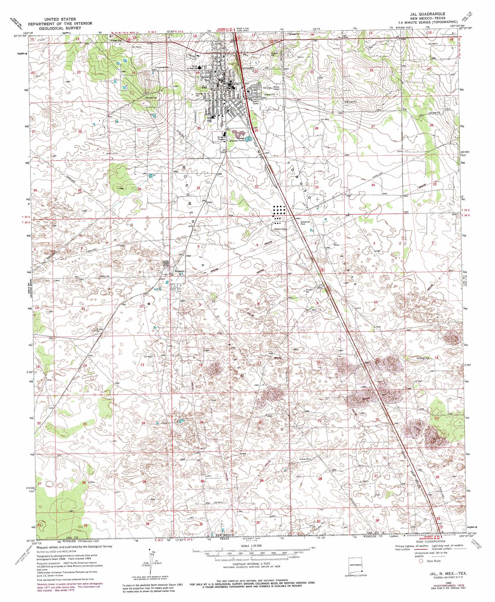
Jal Topo Map New Mexico
To zoom in, hover over the map of Jal
USGS Topo Quad 32103a2 - 1:24,000 scale
| Topo Map Name: | Jal |
| USGS Topo Quad ID: | 32103a2 |
| Print Size: | ca. 21 1/4" wide x 27" high |
| Southeast Coordinates: | 32° N latitude / 103.125° W longitude |
| Map Center Coordinates: | 32.0625° N latitude / 103.1875° W longitude |
| U.S. States: | NM, TX |
| Filename: | o32103a2.jpg |
| Download Map JPG Image: | Jal topo map 1:24,000 scale |
| Map Type: | Topographic |
| Topo Series: | 7.5´ |
| Map Scale: | 1:24,000 |
| Source of Map Images: | United States Geological Survey (USGS) |
| Alternate Map Versions: |
Jal NM 1969, updated 1972 Download PDF Buy paper map Jal NM 1969, updated 1980 Download PDF Buy paper map Jal NM 2010 Download PDF Buy paper map Jal NM 2013 Download PDF Buy paper map Jal NM 2017 Download PDF Buy paper map |
1:24,000 Topo Quads surrounding Jal
San Simon Sink |
East Lake |
Rattlesnake Canyon |
Eunice Se |
Frankel City Sw |
Woodley Flat |
Custer Mountain |
Jal Nw |
Jal Ne |
Figure Seven Ranch |
Andrews Place |
Javelina Basin |
Jal |
Jal Se |
Yt Ranch |
Brunson Ranch |
Cheyenne Draw |
Kermit Nw |
Vesrue |
Notrees Nw |
Cheyenne Draw Sw |
Cheyenne Draw Se |
Wink North |
Kermit |
Wheeler Ranch |
> Back to 32103a1 at 1:100,000 scale
> Back to 32102a1 at 1:250,000 scale
> Back to U.S. Topo Maps home
Jal topo map: Gazetteer
Jal: Flats
Toboso Flats elevation 911m 2988′Jal: Mines
Lea County Road Department Pit elevation 946m 3103′Jal: Populated Places
Bennett elevation 903m 2962′Jal elevation 936m 3070′
Jal: Post Offices
Bennett Post Office (historical) elevation 903m 2962′Jal digital topo map on disk
Buy this Jal topo map showing relief, roads, GPS coordinates and other geographical features, as a high-resolution digital map file on DVD: