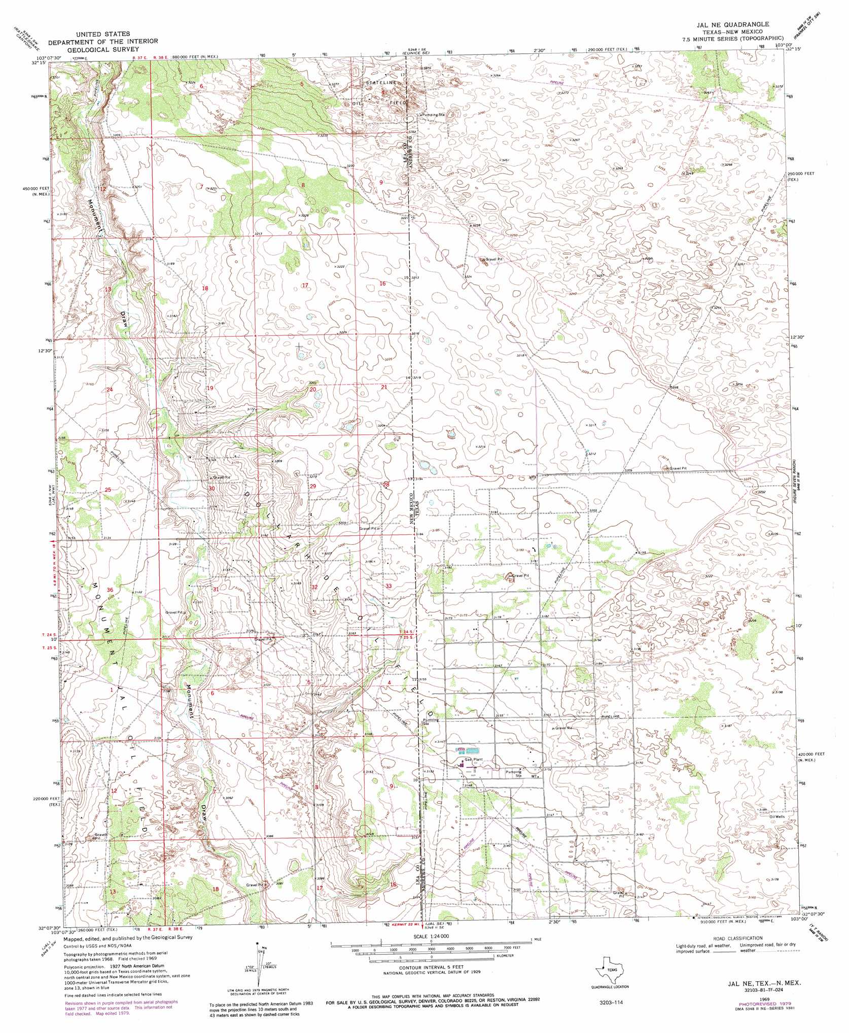
Jal Ne Topo Map New Mexico
To zoom in, hover over the map of Jal Ne
USGS Topo Quad 32103b1 - 1:24,000 scale
| Topo Map Name: | Jal Ne |
| USGS Topo Quad ID: | 32103b1 |
| Print Size: | ca. 21 1/4" wide x 27" high |
| Southeast Coordinates: | 32.125° N latitude / 103° W longitude |
| Map Center Coordinates: | 32.1875° N latitude / 103.0625° W longitude |
| U.S. States: | NM, TX |
| Filename: | o32103b1.jpg |
| Download Map JPG Image: | Jal Ne topo map 1:24,000 scale |
| Map Type: | Topographic |
| Topo Series: | 7.5´ |
| Map Scale: | 1:24,000 |
| Source of Map Images: | United States Geological Survey (USGS) |
| Alternate Map Versions: |
Jal NE TX 1969, updated 1972 Download PDF Buy paper map Jal NE TX 1969, updated 1980 Download PDF Buy paper map Jal NE TX 1969, updated 1985 Download PDF Buy paper map Jal NE TX 2010 Download PDF Buy paper map Jal NE TX 2012 Download PDF Buy paper map Jal NE TX 2016 Download PDF Buy paper map |
1:24,000 Topo Quads surrounding Jal Ne
Oil Center |
Eunice |
Eunice Ne |
Jumbo Hill |
Frankel City |
East Lake |
Rattlesnake Canyon |
Eunice Se |
Frankel City Sw |
Whalen Lake |
Custer Mountain |
Jal Nw |
Jal Ne |
Figure Seven Ranch |
Sand Ranch |
Javelina Basin |
Jal |
Jal Se |
Yt Ranch |
Bedford Ranch |
Cheyenne Draw |
Kermit Nw |
Vesrue |
Notrees Nw |
Notrees |
> Back to 32103a1 at 1:100,000 scale
> Back to 32102a1 at 1:250,000 scale
> Back to U.S. Topo Maps home
Jal Ne topo map: Gazetteer
Jal Ne: Oilfields
Dollarhide Oil Field elevation 968m 3175′Dollarhide Oil Field elevation 972m 3188′
Jal Ne digital topo map on disk
Buy this Jal Ne topo map showing relief, roads, GPS coordinates and other geographical features, as a high-resolution digital map file on DVD: