Tip Top Wells Topo Map New Mexico
To zoom in, hover over the map of Tip Top Wells
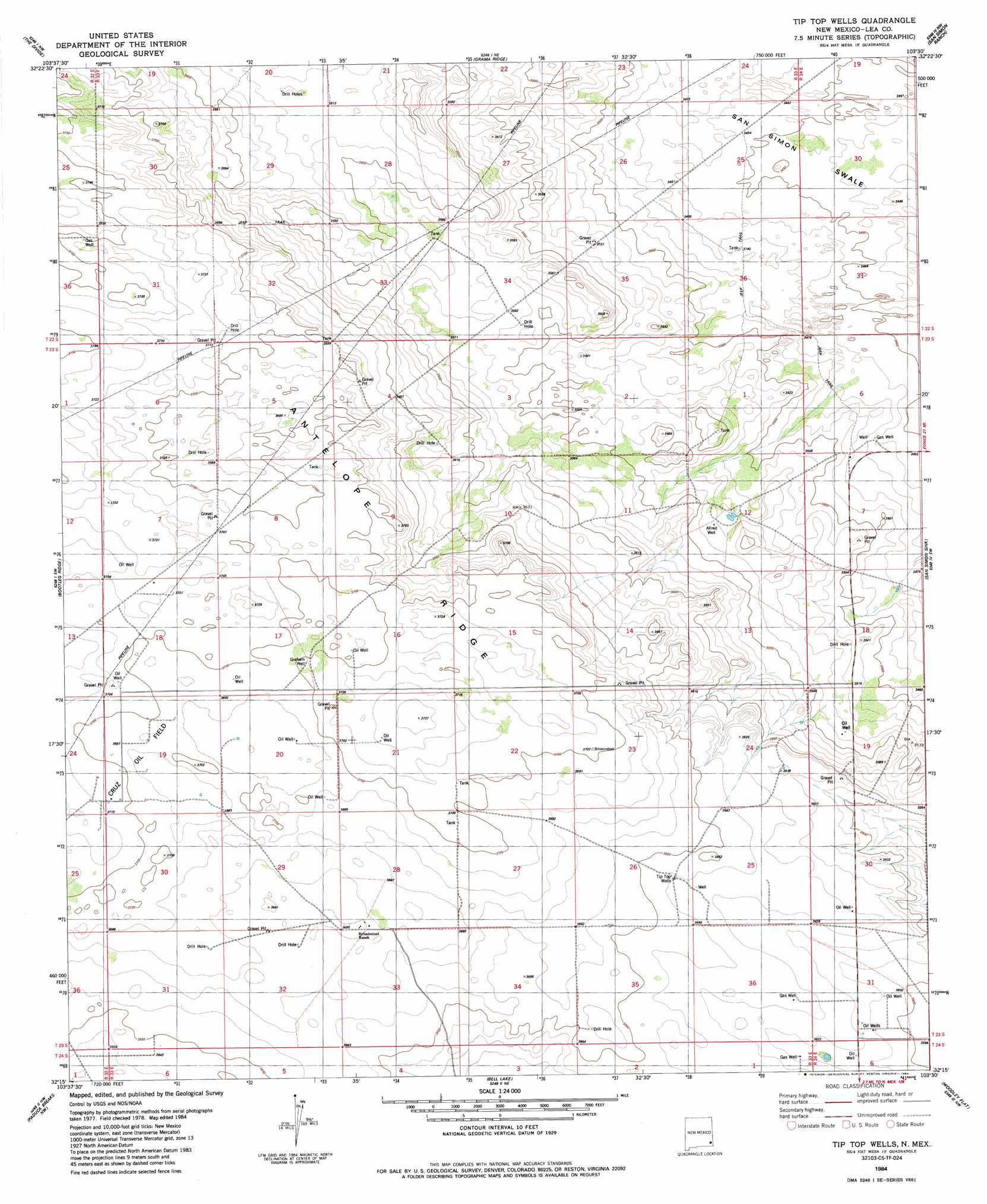
USGS Topo Quad 32103c5 - 1:24,000 scale
| Topo Map Name: | Tip Top Wells |
| USGS Topo Quad ID: | 32103c5 |
| Print Size: | ca. 21 1/4" wide x 27" high |
| Southeast Coordinates: | 32.25° N latitude / 103.5° W longitude |
| Map Center Coordinates: | 32.3125° N latitude / 103.5625° W longitude |
| U.S. State: | NM |
| Filename: | o32103c5.jpg |
| Download Map JPG Image: | Tip Top Wells topo map 1:24,000 scale |
| Map Type: | Topographic |
| Topo Series: | 7.5´ |
| Map Scale: | 1:24,000 |
| Source of Map Images: | United States Geological Survey (USGS) |
| Alternate Map Versions: |
Tip Top Wells NM 1984, updated 1984 Download PDF Buy paper map Tip Top Wells NM 2010 Download PDF Buy paper map Tip Top Wells NM 2013 Download PDF Buy paper map Tip Top Wells NM 2017 Download PDF Buy paper map |
1:24,000 Topo Quads surrounding Tip Top Wells
Williams Sink |
Laguna Gatuna |
Lea |
Monument Sw |
Monument South |
Livingston Ridge |
The Divide |
Grama Ridge |
San Simon Ranch |
Oil Center |
Los Medanos |
Bootleg Ridge |
Tip Top Wells |
San Simon Sink |
East Lake |
Big Sinks |
Paduca Breaks Nw |
Bell Lake |
Woodley Flat |
Custer Mountain |
Phatom Banks |
Paduca Breaks West |
Paduca Breaks East |
Andrews Place |
Javelina Basin |
> Back to 32103a1 at 1:100,000 scale
> Back to 32102a1 at 1:250,000 scale
> Back to U.S. Topo Maps home
Tip Top Wells topo map: Gazetteer
Tip Top Wells: Basins
San Simon Swale elevation 1054m 3458′Tip Top Wells: Mines
Airport Pit ID Number 2901648 elevation 1101m 3612′Tip Top Wells: Oilfields
Bell Lake Oil Field elevation 1100m 3608′Cruz Oil Field elevation 1127m 3697′
Tip Top Wells: Ridges
Antelope Ridge elevation 1129m 3704′Tip Top Wells: Wells
Allred Well elevation 1076m 3530′Graham Well elevation 1128m 3700′
Tip Top Wells elevation 1110m 3641′
Tip Top Wells digital topo map on disk
Buy this Tip Top Wells topo map showing relief, roads, GPS coordinates and other geographical features, as a high-resolution digital map file on DVD: