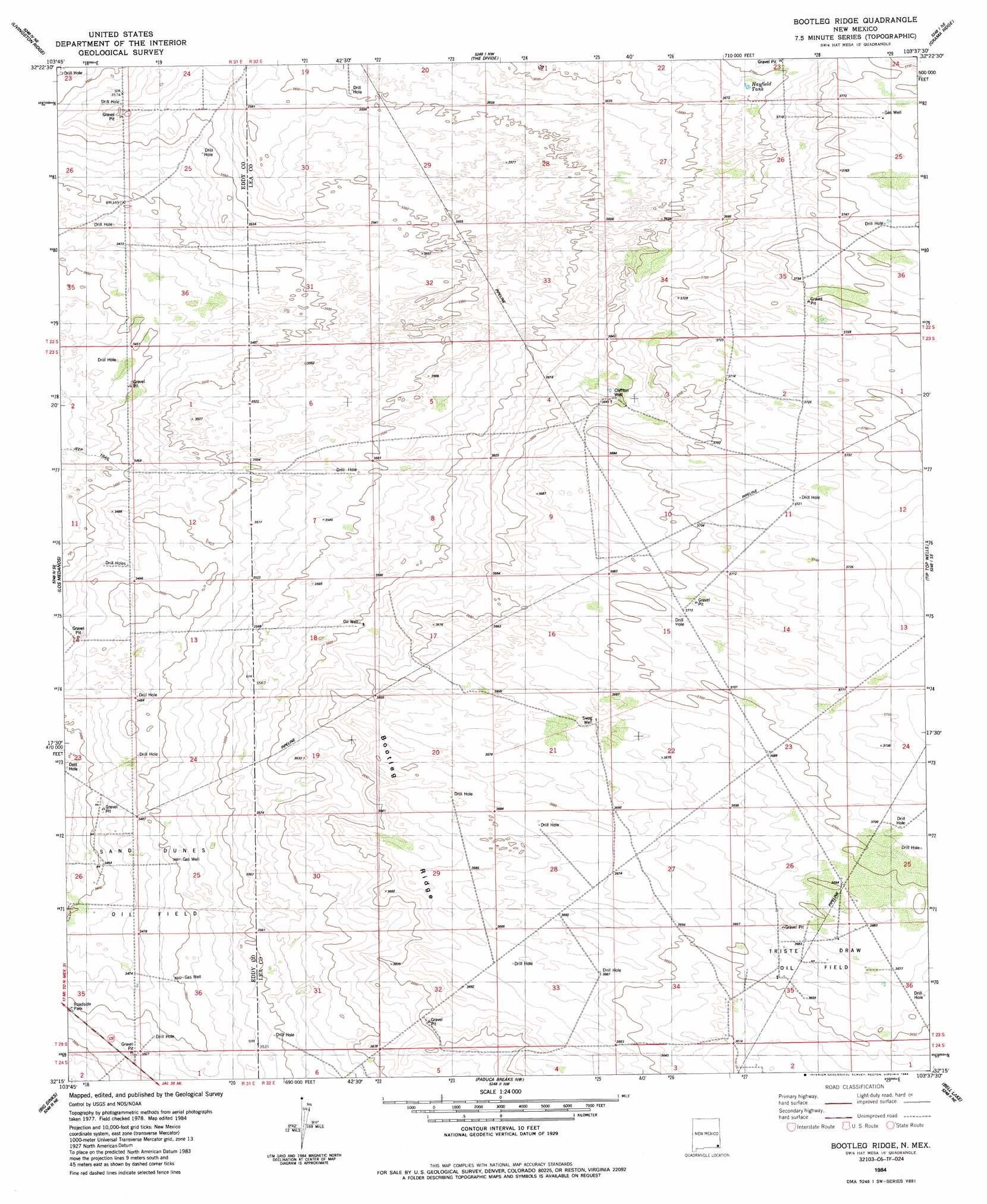
Bootleg Ridge Topo Map New Mexico
To zoom in, hover over the map of Bootleg Ridge
USGS Topo Quad 32103c6 - 1:24,000 scale
| Topo Map Name: | Bootleg Ridge |
| USGS Topo Quad ID: | 32103c6 |
| Print Size: | ca. 21 1/4" wide x 27" high |
| Southeast Coordinates: | 32.25° N latitude / 103.625° W longitude |
| Map Center Coordinates: | 32.3125° N latitude / 103.6875° W longitude |
| U.S. State: | NM |
| Filename: | o32103c6.jpg |
| Download Map JPG Image: | Bootleg Ridge topo map 1:24,000 scale |
| Map Type: | Topographic |
| Topo Series: | 7.5´ |
| Map Scale: | 1:24,000 |
| Source of Map Images: | United States Geological Survey (USGS) |
| Alternate Map Versions: |
Bootleg Ridge NM 1984, updated 1984 Download PDF Buy paper map Bootleg Ridge NM 2010 Download PDF Buy paper map Bootleg Ridge NM 2013 Download PDF Buy paper map Bootleg Ridge NM 2017 Download PDF Buy paper map |
1:24,000 Topo Quads surrounding Bootleg Ridge
Tower Hill North |
Williams Sink |
Laguna Gatuna |
Lea |
Monument Sw |
Tower Hill South |
Livingston Ridge |
The Divide |
Grama Ridge |
San Simon Ranch |
Remuda Basin |
Los Medanos |
Bootleg Ridge |
Tip Top Wells |
San Simon Sink |
Pierce Canyon |
Big Sinks |
Paduca Breaks Nw |
Bell Lake |
Woodley Flat |
Ross Ranch |
Phatom Banks |
Paduca Breaks West |
Paduca Breaks East |
Andrews Place |
> Back to 32103a1 at 1:100,000 scale
> Back to 32102a1 at 1:250,000 scale
> Back to U.S. Topo Maps home
Bootleg Ridge topo map: Gazetteer
Bootleg Ridge: Oilfields
Sand Dunes Oil Field elevation 1063m 3487′Triste Draw Oil Field elevation 1128m 3700′
Bootleg Ridge: Reservoirs
Hayfield Tank elevation 1124m 3687′Bootleg Ridge: Ridges
Bootleg Ridge elevation 1125m 3690′Bootleg Ridge: Wells
13592 Water Well elevation 1118m 3667′13593 Water Well elevation 1116m 3661′
13594 Water Well elevation 1122m 3681′
13595 Water Well elevation 1117m 3664′
Clifton Well elevation 1108m 3635′
Bootleg Ridge digital topo map on disk
Buy this Bootleg Ridge topo map showing relief, roads, GPS coordinates and other geographical features, as a high-resolution digital map file on DVD: