Ironhouse Draw Topo Map New Mexico
To zoom in, hover over the map of Ironhouse Draw
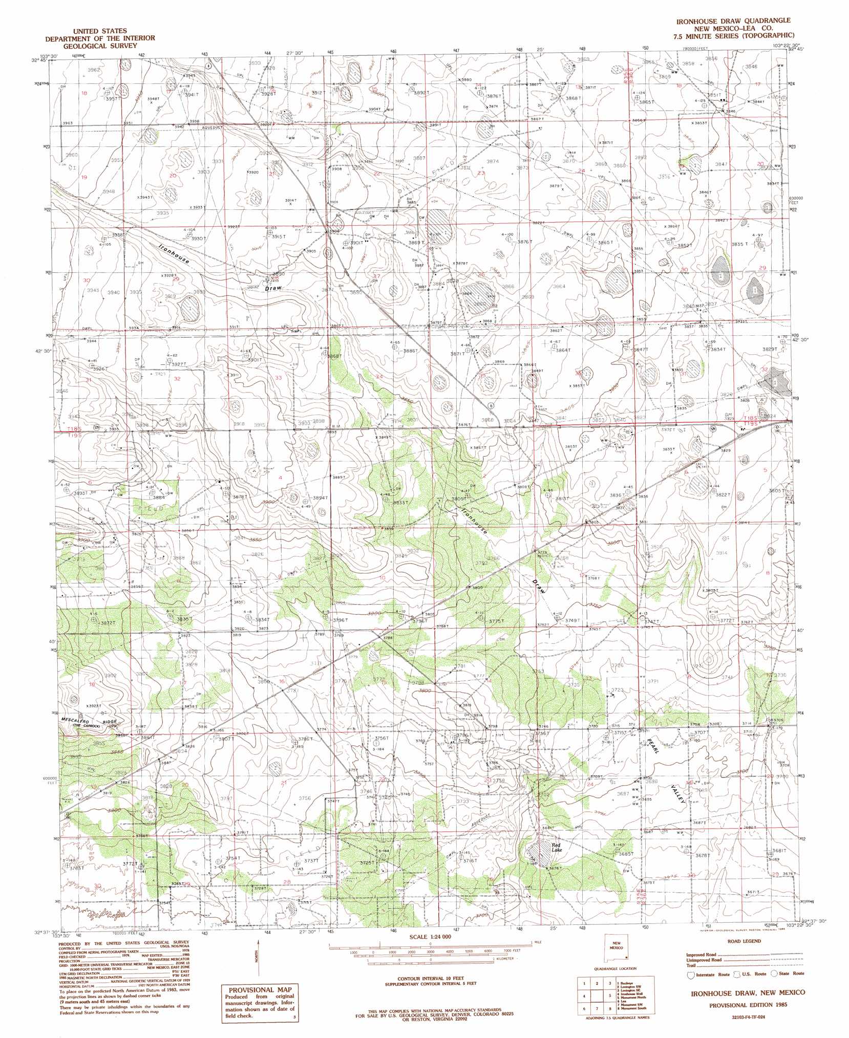
USGS Topo Quad 32103f4 - 1:24,000 scale
| Topo Map Name: | Ironhouse Draw |
| USGS Topo Quad ID: | 32103f4 |
| Print Size: | ca. 21 1/4" wide x 27" high |
| Southeast Coordinates: | 32.625° N latitude / 103.375° W longitude |
| Map Center Coordinates: | 32.6875° N latitude / 103.4375° W longitude |
| U.S. State: | NM |
| Filename: | o32103f4.jpg |
| Download Map JPG Image: | Ironhouse Draw topo map 1:24,000 scale |
| Map Type: | Topographic |
| Topo Series: | 7.5´ |
| Map Scale: | 1:24,000 |
| Source of Map Images: | United States Geological Survey (USGS) |
| Alternate Map Versions: |
Ironhouse Draw NM 1985, updated 1985 Download PDF Buy paper map Ironhouse Draw NM 2010 Download PDF Buy paper map Ironhouse Draw NM 2013 Download PDF Buy paper map Ironhouse Draw NM 2017 Download PDF Buy paper map |
1:24,000 Topo Quads surrounding Ironhouse Draw
Buckeye Nw |
Buckeye Ne |
Lovington Nw |
Lovington |
Humble City Nw |
Dog Lake |
Buckeye |
Lovington Sw |
Lovington Se |
Humble City |
Laguna Gatuna Nw |
Ironhouse Well |
Ironhouse Draw |
Monument North |
Hobbs West |
Laguna Gatuna |
Lea |
Monument Sw |
Monument South |
Hobbs Sw |
The Divide |
Grama Ridge |
San Simon Ranch |
Oil Center |
Eunice |
> Back to 32103e1 at 1:100,000 scale
> Back to 32102a1 at 1:250,000 scale
> Back to U.S. Topo Maps home
Ironhouse Draw topo map: Gazetteer
Ironhouse Draw: Lakes
Red Lake elevation 1119m 3671′Ironhouse Draw: Oilfields
Reeves Oil Field elevation 1186m 3891′Ironhouse Draw: Valleys
Pearl Valley elevation 1116m 3661′Ironhouse Draw digital topo map on disk
Buy this Ironhouse Draw topo map showing relief, roads, GPS coordinates and other geographical features, as a high-resolution digital map file on DVD: