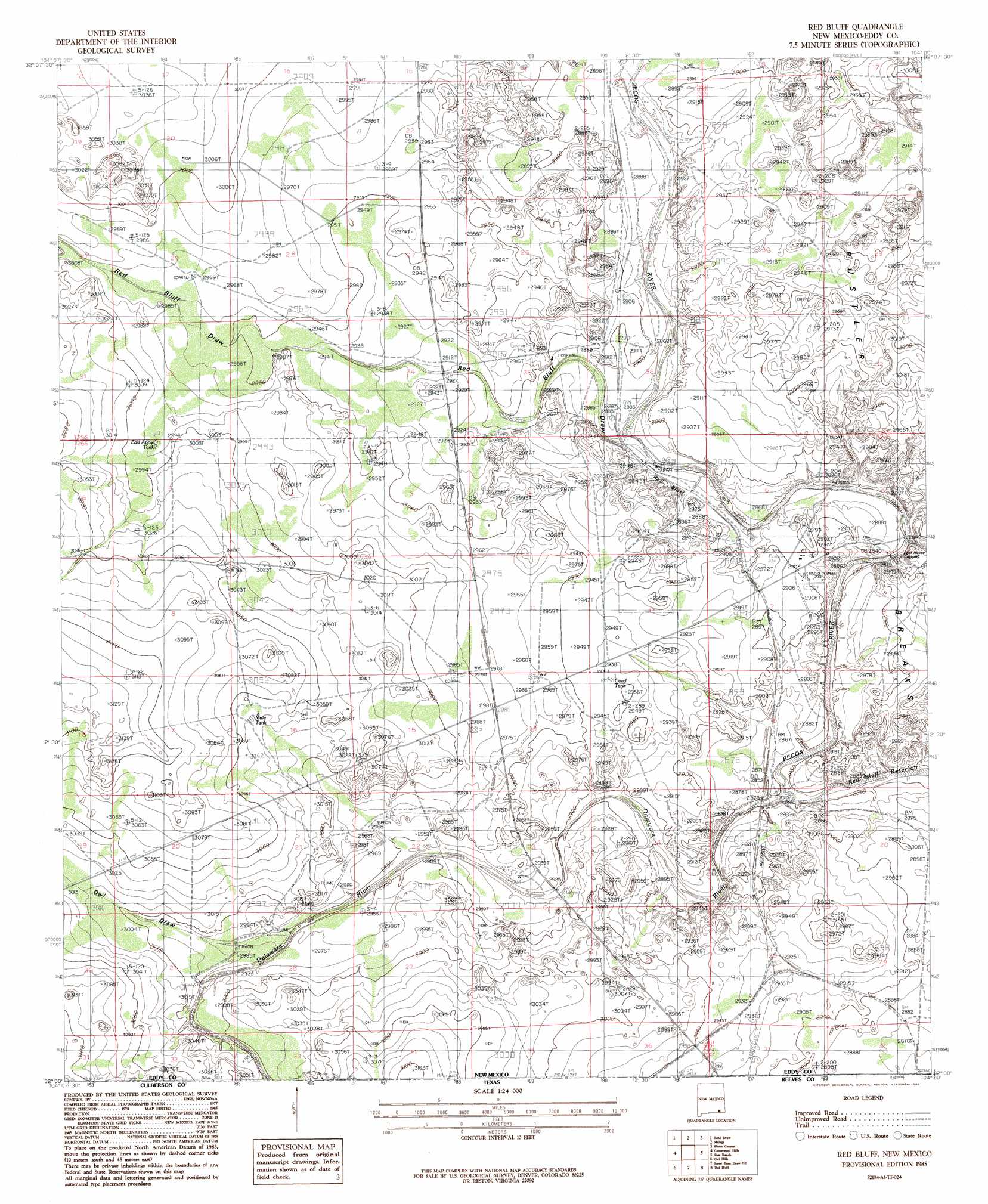
Red Bluff Topo Map New Mexico
To zoom in, hover over the map of Red Bluff
USGS Topo Quad 32104a1 - 1:24,000 scale
| Topo Map Name: | Red Bluff |
| USGS Topo Quad ID: | 32104a1 |
| Print Size: | ca. 21 1/4" wide x 27" high |
| Southeast Coordinates: | 32° N latitude / 104° W longitude |
| Map Center Coordinates: | 32.0625° N latitude / 104.0625° W longitude |
| U.S. State: | NM |
| Filename: | o32104a1.jpg |
| Download Map JPG Image: | Red Bluff topo map 1:24,000 scale |
| Map Type: | Topographic |
| Topo Series: | 7.5´ |
| Map Scale: | 1:24,000 |
| Source of Map Images: | United States Geological Survey (USGS) |
| Alternate Map Versions: |
Red Bluff NM 1985, updated 1985 Download PDF Buy paper map Red Bluff NM 2010 Download PDF Buy paper map Red Bluff NM 2013 Download PDF Buy paper map Red Bluff NM 2017 Download PDF Buy paper map |
1:24,000 Topo Quads surrounding Red Bluff
Kitchen Cove |
Otis |
Loving |
Remuda Basin |
Los Medanos |
Black River Village |
Bond Draw |
Malaga |
Pierce Canyon |
Big Sinks |
Jumping Spring |
Cottonwood Hills |
Red Bluff |
Ross Ranch |
Phatom Banks |
Outlaw Spring |
Owl Hills |
Screw Bean Draw Ne |
Red Bluff |
Orla Ne |
Castile Hill |
Screw Bean Draw West |
Screw Bean Draw East |
Orla |
Orla Se |
> Back to 32104a1 at 1:100,000 scale
> Back to 32104a1 at 1:250,000 scale
> Back to U.S. Topo Maps home
Red Bluff topo map: Gazetteer
Red Bluff: Areas
Rustler Breaks elevation 884m 2900′Red Bluff: Crossings
Rock House Crossing elevation 867m 2844′Red Bluff: Populated Places
Red Bluff elevation 878m 2880′Red Bluff: Reservoirs
Coad Tank elevation 897m 2942′East Apple Tank elevation 911m 2988′
Mule Tank elevation 928m 3044′
Red Bluff: Streams
Delaware River elevation 866m 2841′Delaware River elevation 866m 2841′
Red Bluff: Valleys
Owl Draw elevation 903m 2962′Red Bluff Draw elevation 870m 2854′
Red Bluff: Wells
05121 Water Well elevation 871m 2857′06633 Water Well elevation 916m 3005′
06634 Water Well elevation 905m 2969′
08033 Water Well elevation 888m 2913′
08035 Water Well elevation 936m 3070′
20081 Water Well elevation 905m 2969′
20082 Water Well elevation 911m 2988′
20093 Water Well elevation 897m 2942′
20094 Water Well elevation 885m 2903′
Queen Well elevation 894m 2933′
Yarbro Well elevation 899m 2949′
Red Bluff digital topo map on disk
Buy this Red Bluff topo map showing relief, roads, GPS coordinates and other geographical features, as a high-resolution digital map file on DVD: