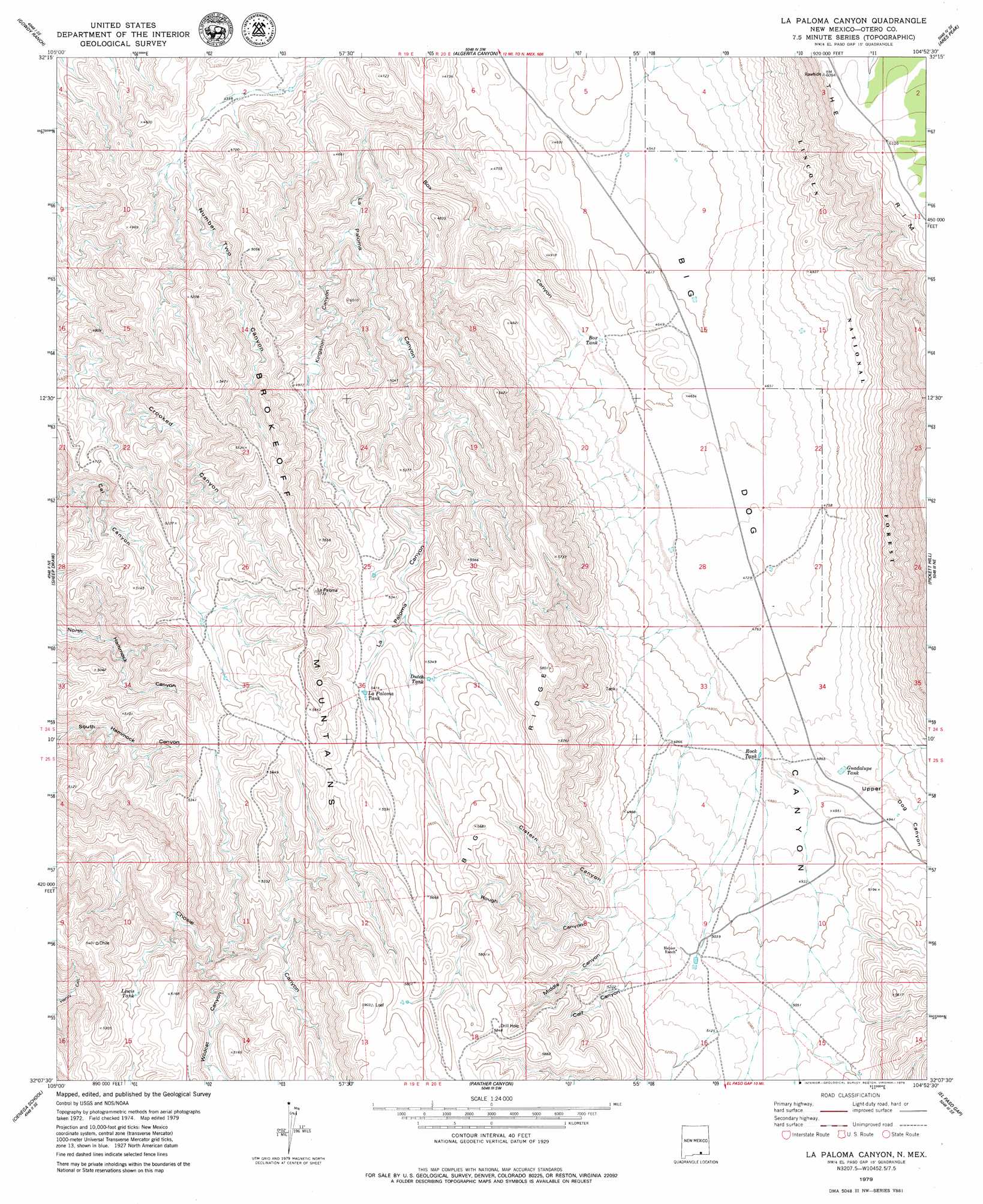
La Paloma Canyon Topo Map New Mexico
To zoom in, hover over the map of La Paloma Canyon
USGS Topo Quad 32104b8 - 1:24,000 scale
| Topo Map Name: | La Paloma Canyon |
| USGS Topo Quad ID: | 32104b8 |
| Print Size: | ca. 21 1/4" wide x 27" high |
| Southeast Coordinates: | 32.125° N latitude / 104.875° W longitude |
| Map Center Coordinates: | 32.1875° N latitude / 104.9375° W longitude |
| U.S. State: | NM |
| Filename: | o32104b8.jpg |
| Download Map JPG Image: | La Paloma Canyon topo map 1:24,000 scale |
| Map Type: | Topographic |
| Topo Series: | 7.5´ |
| Map Scale: | 1:24,000 |
| Source of Map Images: | United States Geological Survey (USGS) |
| Alternate Map Versions: |
La Paloma Canyon NM 2001, updated 2003 Download PDF Buy paper map La Paloma Canyon NM 2011 Download PDF Buy paper map La Paloma Canyon NM 2013 Download PDF Buy paper map La Paloma Canyon NM 2017 Download PDF Buy paper map |
| FStopo: | US Forest Service topo La Paloma Canyon is available: Download FStopo PDF Download FStopo TIF |
1:24,000 Topo Quads surrounding La Paloma Canyon
Tanner Ranch |
Panama Ranch |
Packsaddle Canyon |
Texas Hill |
Cawley Draw |
Hackberry Hill |
Gowdy Ranch |
Algerita Canyon |
Ares Peak |
Red Bluff Draw |
Lewis Canyon |
Sheep Draw |
La Paloma Canyon |
Pickett Hill |
Queen |
Culp Draw |
Cienega School |
Panther Canyon |
El Paso Gap |
Gunsight Canyon |
Dell City |
Linda Lake North |
P X Flat |
Guadalupe Peak |
Independence Spring |
> Back to 32104a1 at 1:100,000 scale
> Back to 32104a1 at 1:250,000 scale
> Back to U.S. Topo Maps home
La Paloma Canyon topo map: Gazetteer
La Paloma Canyon: Reservoirs
Arch Lewis Tank elevation 1601m 5252′Box Tank elevation 1389m 4557′
Dutch Tank elevation 1613m 5291′
Guadalupe Tank elevation 1492m 4895′
La Paloma Tank elevation 1616m 5301′
Lewis Tank elevation 1517m 4977′
Lower Irabane Tank elevation 1447m 4747′
Rock Tank elevation 1475m 4839′
Trick Tank elevation 1477m 4845′
La Paloma Canyon: Valleys
Calf Canyon elevation 1586m 5203′Cistern Canyon elevation 1544m 5065′
Kingston Canyon elevation 1359m 4458′
La Paloma Canyon elevation 1328m 4356′
Middle Canyon elevation 1574m 5164′
Number Two Canyon elevation 1303m 4274′
Rough Canyon elevation 1536m 5039′
Upper Dog Canyon elevation 1488m 4881′
Upper Dog Canyon elevation 1488m 4881′
Wildcat Canyon elevation 1405m 4609′
La Paloma Canyon digital topo map on disk
Buy this La Paloma Canyon topo map showing relief, roads, GPS coordinates and other geographical features, as a high-resolution digital map file on DVD: