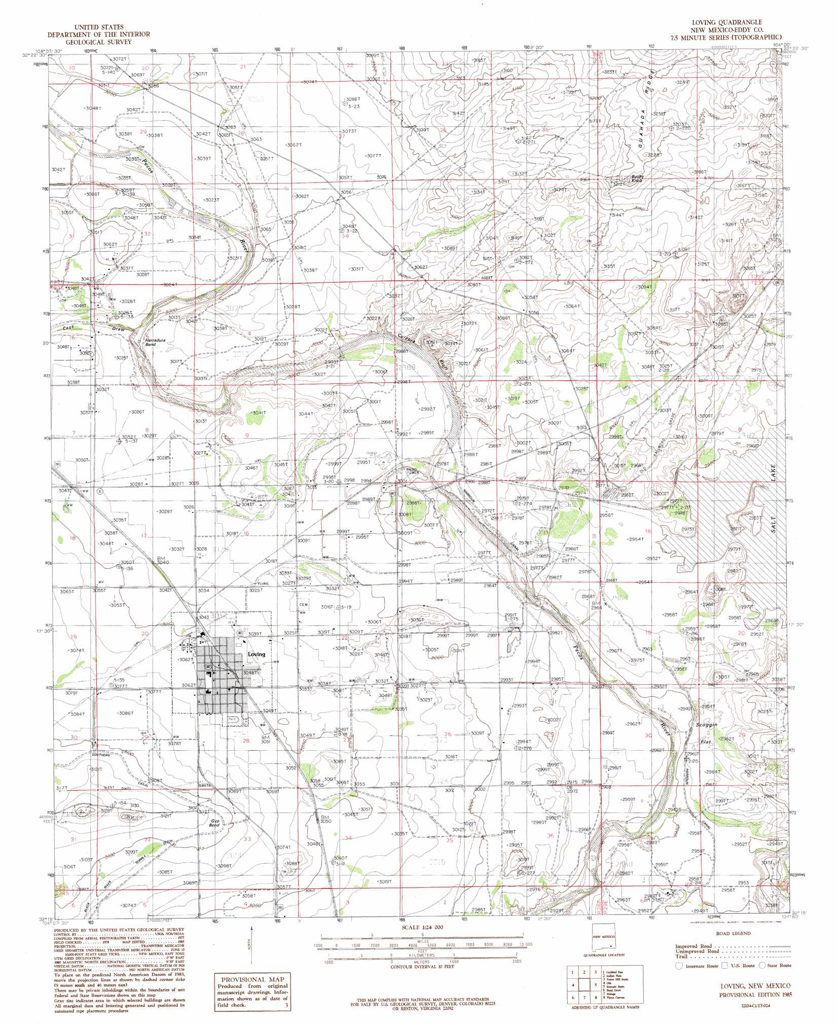
Loving Topo Map New Mexico
To zoom in, hover over the map of Loving
USGS Topo Quad 32104c1 - 1:24,000 scale
| Topo Map Name: | Loving |
| USGS Topo Quad ID: | 32104c1 |
| Print Size: | ca. 21 1/4" wide x 27" high |
| Southeast Coordinates: | 32.25° N latitude / 104° W longitude |
| Map Center Coordinates: | 32.3125° N latitude / 104.0625° W longitude |
| U.S. State: | NM |
| Filename: | o32104c1.jpg |
| Download Map JPG Image: | Loving topo map 1:24,000 scale |
| Map Type: | Topographic |
| Topo Series: | 7.5´ |
| Map Scale: | 1:24,000 |
| Source of Map Images: | United States Geological Survey (USGS) |
| Alternate Map Versions: |
Loving NM 1985, updated 1985 Download PDF Buy paper map Loving NM 2010 Download PDF Buy paper map Loving NM 2013 Download PDF Buy paper map Loving NM 2017 Download PDF Buy paper map |
1:24,000 Topo Quads surrounding Loving
Lake Mcmillan South |
Angel Draw |
Illinois Camp Se |
Tower Hill North |
Williams Sink |
Carlsbad West |
Carlsbad East |
Indian Flats |
Tower Hill South |
Livingston Ridge |
Kitchen Cove |
Otis |
Loving |
Remuda Basin |
Los Medanos |
Black River Village |
Bond Draw |
Malaga |
Pierce Canyon |
Big Sinks |
Jumping Spring |
Cottonwood Hills |
Red Bluff |
Ross Ranch |
Phatom Banks |
> Back to 32104a1 at 1:100,000 scale
> Back to 32104a1 at 1:250,000 scale
> Back to U.S. Topo Maps home
Loving topo map: Gazetteer
Loving: Bends
Gyp Bend elevation 947m 3106′Herradura Bend elevation 909m 2982′
Loving: Canals
Harroun Ditch elevation 903m 2962′Southern Canal elevation 947m 3106′
Loving: Cliffs
Culebra Bluff elevation 924m 3031′Loving: Dams
Harroun Dam elevation 905m 2969′Harroun Diversion Dam elevation 905m 2969′
Loving: Flats
Scoggin Flat elevation 905m 2969′Loving: Mines
Flotation Plant elevation 932m 3057′Loving: Parks
Goodnight-Loving Trail Historical Marker elevation 930m 3051′Lovings Bend Park elevation 930m 3051′
Loving: Populated Places
Loving elevation 930m 3051′Loving: Post Offices
Loving Post Office elevation 930m 3051′Loving: Summits
Bushy Knob elevation 983m 3225′Loving: Valleys
Cass Draw elevation 911m 2988′Loving digital topo map on disk
Buy this Loving topo map showing relief, roads, GPS coordinates and other geographical features, as a high-resolution digital map file on DVD: