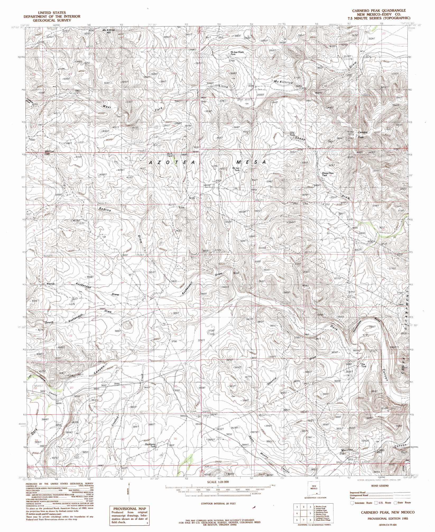
Carnero Peak Topo Map New Mexico
To zoom in, hover over the map of Carnero Peak
USGS Topo Quad 32104c4 - 1:24,000 scale
| Topo Map Name: | Carnero Peak |
| USGS Topo Quad ID: | 32104c4 |
| Print Size: | ca. 21 1/4" wide x 27" high |
| Southeast Coordinates: | 32.25° N latitude / 104.375° W longitude |
| Map Center Coordinates: | 32.3125° N latitude / 104.4375° W longitude |
| U.S. State: | NM |
| Filename: | o32104c4.jpg |
| Download Map JPG Image: | Carnero Peak topo map 1:24,000 scale |
| Map Type: | Topographic |
| Topo Series: | 7.5´ |
| Map Scale: | 1:24,000 |
| Source of Map Images: | United States Geological Survey (USGS) |
| Alternate Map Versions: |
Carnero Peak NM 1985, updated 1985 Download PDF Buy paper map Carnero Peak NM 2010 Download PDF Buy paper map Carnero Peak NM 2013 Download PDF Buy paper map Carnero Peak NM 2017 Download PDF Buy paper map |
1:24,000 Topo Quads surrounding Carnero Peak
Box Canyon Ranch |
Foster Ranch |
Seven Rivers |
Lake Mcmillan South |
Angel Draw |
Cawley Draw |
Martha Creek |
Azotea Peak |
Carlsbad West |
Carlsbad East |
Red Bluff Draw |
Bandanna Point |
Carnero Peak |
Kitchen Cove |
Otis |
Queen |
Serpentine Bends |
Carlsbad Caverns |
Black River Village |
Bond Draw |
Gunsight Canyon |
Grapevine Draw |
Rattlesnake Spring |
Jumping Spring |
Cottonwood Hills |
> Back to 32104a1 at 1:100,000 scale
> Back to 32104a1 at 1:250,000 scale
> Back to U.S. Topo Maps home
Carnero Peak topo map: Gazetteer
Carnero Peak: Arroyos
Kirkendell Draw elevation 1161m 3809′Carnero Peak: Bends
Horseshoe Bend elevation 1156m 3792′Carnero Peak: Reservoirs
CCC Tank elevation 1147m 3763′Flat Tank elevation 1101m 3612′
Hackberry Tank elevation 1189m 3900′
McIver North Tank elevation 1146m 3759′
McIver Tank elevation 1182m 3877′
Rock Tank elevation 1191m 3907′
Sheep Draw Tank elevation 1131m 3710′
Smith Waterhole elevation 1142m 3746′
Wild Cow Tank elevation 1249m 4097′
Carnero Peak: Streams
Crooked Creek elevation 1151m 3776′Carnero Peak: Summits
Carnero Peak elevation 1240m 4068′Carnero Peak: Valleys
Beardon Canyon elevation 1225m 4019′Kuydendall Draw elevation 1215m 3986′
Kuykendall Draw elevation 1124m 3687′
Last Chance Canyon elevation 1164m 3818′
Lookout Draw elevation 1225m 4019′
North Kuykendall Draw elevation 1162m 3812′
Opuntia Draw elevation 1099m 3605′
Robinia Draw elevation 1153m 3782′
South Kuykendall Draw elevation 1162m 3812′
Carnero Peak: Wells
Beardon Well elevation 1180m 3871′Sheep Draw Well elevation 1115m 3658′
Truitt Well elevation 1184m 3884′
Carnero Peak digital topo map on disk
Buy this Carnero Peak topo map showing relief, roads, GPS coordinates and other geographical features, as a high-resolution digital map file on DVD: