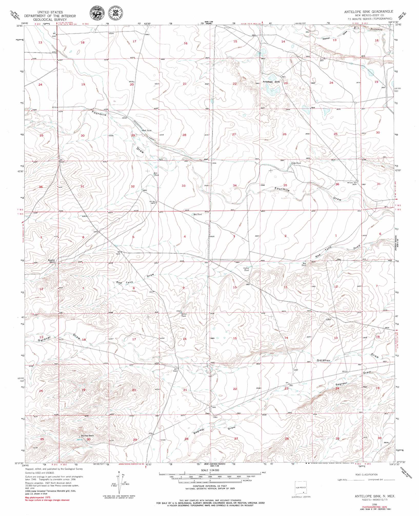
Antelope Sink Topo Map New Mexico
To zoom in, hover over the map of Antelope Sink
USGS Topo Quad 32104f6 - 1:24,000 scale
| Topo Map Name: | Antelope Sink |
| USGS Topo Quad ID: | 32104f6 |
| Print Size: | ca. 21 1/4" wide x 27" high |
| Southeast Coordinates: | 32.625° N latitude / 104.625° W longitude |
| Map Center Coordinates: | 32.6875° N latitude / 104.6875° W longitude |
| U.S. State: | NM |
| Filename: | o32104f6.jpg |
| Download Map JPG Image: | Antelope Sink topo map 1:24,000 scale |
| Map Type: | Topographic |
| Topo Series: | 7.5´ |
| Map Scale: | 1:24,000 |
| Source of Map Images: | United States Geological Survey (USGS) |
| Alternate Map Versions: |
Antelope Sink NM 1956, updated 1957 Download PDF Buy paper map Antelope Sink NM 1956, updated 1979 Download PDF Buy paper map Antelope Sink NM 2010 Download PDF Buy paper map Antelope Sink NM 2013 Download PDF Buy paper map Antelope Sink NM 2017 Download PDF Buy paper map |
1:24,000 Topo Quads surrounding Antelope Sink
Sagebrush Valley W. |
Sagebrush Valley E. |
Hope Nw |
Hope Ne |
Espuela |
Sixteenmile Draw West |
Sixteenmile Draw East |
Hope |
Hope Se |
Artesia |
Encino Draw |
Holt Tank |
Antelope Sink |
Parish Ranch |
Dayton |
South Taylor Tank |
Strychnine Draw |
Box Canyon Ranch |
Foster Ranch |
Seven Rivers |
Packsaddle Canyon |
Texas Hill |
Cawley Draw |
Martha Creek |
Azotea Peak |
> Back to 32104e1 at 1:100,000 scale
> Back to 32104a1 at 1:250,000 scale
> Back to U.S. Topo Maps home
Antelope Sink topo map: Gazetteer
Antelope Sink: Basins
Antelope Sink elevation 1179m 3868′Antelope Sink: Reservoirs
Big Tank elevation 1199m 3933′Coffin Tank elevation 1180m 3871′
Hilt Tank elevation 1214m 3982′
Miller Tank elevation 1209m 3966′
Red Tank elevation 1168m 3832′
Ridge Tank elevation 1181m 3874′
Rock Tank elevation 1220m 4002′
Antelope Sink: Valleys
Catclaw Draw elevation 1185m 3887′Walnut Draw elevation 1164m 3818′
Antelope Sink: Wells
10108 Water Well elevation 1226m 4022′10147 Water Well elevation 1203m 3946′
RA-7804 Water Well elevation 1233m 4045′
Antelope Sink digital topo map on disk
Buy this Antelope Sink topo map showing relief, roads, GPS coordinates and other geographical features, as a high-resolution digital map file on DVD: