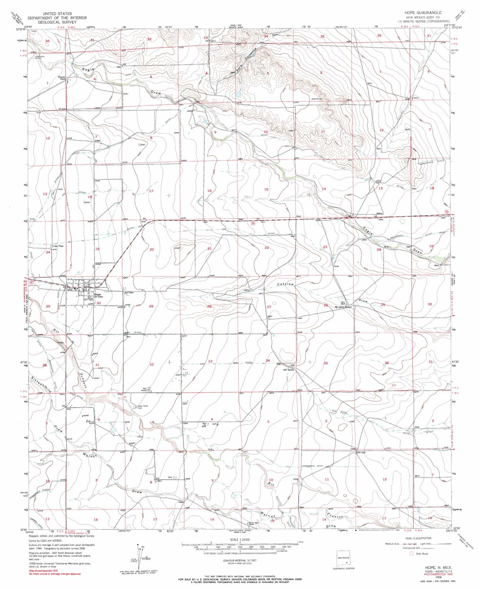
Hope Topo Map New Mexico
To zoom in, hover over the map of Hope
USGS Topo Quad 32104g6 - 1:24,000 scale
| Topo Map Name: | Hope |
| USGS Topo Quad ID: | 32104g6 |
| Print Size: | ca. 21 1/4" wide x 27" high |
| Southeast Coordinates: | 32.75° N latitude / 104.625° W longitude |
| Map Center Coordinates: | 32.8125° N latitude / 104.6875° W longitude |
| U.S. State: | NM |
| Filename: | o32104g6.jpg |
| Download Map JPG Image: | Hope topo map 1:24,000 scale |
| Map Type: | Topographic |
| Topo Series: | 7.5´ |
| Map Scale: | 1:24,000 |
| Source of Map Images: | United States Geological Survey (USGS) |
| Alternate Map Versions: |
Hope NM 1955, updated 1956 Download PDF Buy paper map Hope NM 1956, updated 1957 Download PDF Buy paper map Hope NM 1956, updated 1990 Download PDF Buy paper map Hope NM 2010 Download PDF Buy paper map Hope NM 2013 Download PDF Buy paper map Hope NM 2017 Download PDF Buy paper map |
1:24,000 Topo Quads surrounding Hope
Dark Canyon |
Indian Bluff |
Kincaid Ranch |
Hackberry Ranch |
Hagerman Sw |
Sagebrush Valley W. |
Sagebrush Valley E. |
Hope Nw |
Hope Ne |
Espuela |
Sixteenmile Draw West |
Sixteenmile Draw East |
Hope |
Hope Se |
Artesia |
Encino Draw |
Holt Tank |
Antelope Sink |
Parish Ranch |
Dayton |
South Taylor Tank |
Strychnine Draw |
Box Canyon Ranch |
Foster Ranch |
Seven Rivers |
> Back to 32104e1 at 1:100,000 scale
> Back to 32104a1 at 1:250,000 scale
> Back to U.S. Topo Maps home
Hope topo map: Gazetteer
Hope: Populated Places
Cole Place elevation 1254m 4114′Hope elevation 1245m 4084′
Hunter Place elevation 1242m 4074′
Hope: Post Offices
Hope Post Office elevation 1245m 4084′Hope: Valleys
Sixteenmile Draw elevation 1222m 4009′Hope: Wells
Walnut Well elevation 1199m 3933′Hope digital topo map on disk
Buy this Hope topo map showing relief, roads, GPS coordinates and other geographical features, as a high-resolution digital map file on DVD: