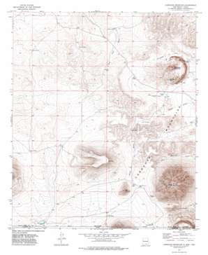
Cornudas Mountain Topo Map New Mexico
To zoom in, hover over the map of Cornudas Mountain
USGS Topo Quad 32105a5 - 1:24,000 scale
| Topo Map Name: | Cornudas Mountain |
| USGS Topo Quad ID: | 32105a5 |
| Print Size: | ca. 21 1/4" wide x 27" high |
| Southeast Coordinates: | 32° N latitude / 105.5° W longitude |
| Map Center Coordinates: | 32.0625° N latitude / 105.5625° W longitude |
| U.S. States: | NM, TX |
| Filename: | o32105a5.jpg |
| Download Map JPG Image: | Cornudas Mountain topo map 1:24,000 scale |
| Map Type: | Topographic |
| Topo Series: | 7.5´ |
| Map Scale: | 1:24,000 |
| Source of Map Images: | United States Geological Survey (USGS) |
| Alternate Map Versions: |
Cornudas Mountain NM 1975, updated 1977 Download PDF Buy paper map Cornudas Mountain NM 2010 Download PDF Buy paper map Cornudas Mountain NM 2013 Download PDF Buy paper map Cornudas Mountain NM 2017 Download PDF Buy paper map |
1:24,000 Topo Quads surrounding Cornudas Mountain
> Back to 32105a1 at 1:100,000 scale
> Back to 32104a1 at 1:250,000 scale
> Back to U.S. Topo Maps home
Cornudas Mountain topo map: Gazetteer
Cornudas Mountain: Dams
Lee Detention Dam elevation 1529m 5016′Cornudas Mountain: Lakes
The Lake elevation 1591m 5219′Cornudas Mountain: Mines
Cornudas Mountain Prospect elevation 1590m 5216′Cornudas Mountain: Ranges
Cornudas Mountains elevation 1521m 4990′Cornudas Mountains elevation 1621m 5318′
Cornudas Mountain: Reservoirs
Cactus Tank elevation 1563m 5127′CCC Tank elevation 1551m 5088′
Chess Tank elevation 1530m 5019′
Cornudas Tank elevation 1508m 4947′
Green Tank elevation 1591m 5219′
Harris Tank elevation 1513m 4963′
J T Tank elevation 1584m 5196′
Rim Tank elevation 1522m 4993′
State Line Tank elevation 1516m 4973′
Two- High Tanks elevation 1460m 4790′
Vince Tank elevation 1526m 5006′
Cornudas Mountain: Summits
Chattfield Mountain elevation 1901m 6236′Cornudas Mountain elevation 1732m 5682′
Deer Mountain elevation 1764m 5787′
Flat Top elevation 1869m 6131′
Wind Mountain elevation 2217m 7273′
Cornudas Mountain digital topo map on disk
Buy this Cornudas Mountain topo map showing relief, roads, GPS coordinates and other geographical features, as a high-resolution digital map file on DVD:


