Sheep Draw Topo Map New Mexico
To zoom in, hover over the map of Sheep Draw
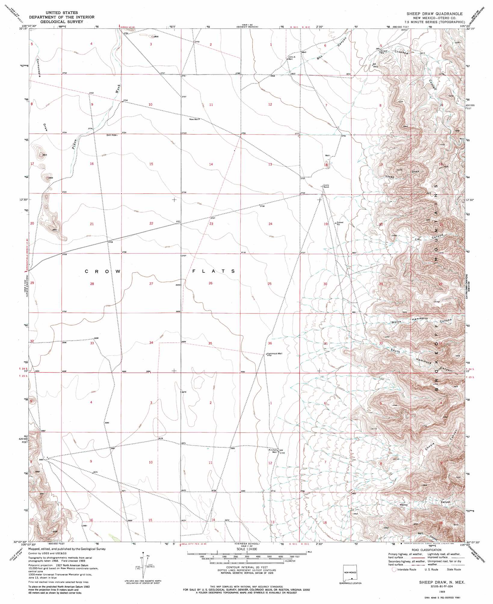
USGS Topo Quad 32105b1 - 1:24,000 scale
| Topo Map Name: | Sheep Draw |
| USGS Topo Quad ID: | 32105b1 |
| Print Size: | ca. 21 1/4" wide x 27" high |
| Southeast Coordinates: | 32.125° N latitude / 105° W longitude |
| Map Center Coordinates: | 32.1875° N latitude / 105.0625° W longitude |
| U.S. State: | NM |
| Filename: | o32105b1.jpg |
| Download Map JPG Image: | Sheep Draw topo map 1:24,000 scale |
| Map Type: | Topographic |
| Topo Series: | 7.5´ |
| Map Scale: | 1:24,000 |
| Source of Map Images: | United States Geological Survey (USGS) |
| Alternate Map Versions: |
Sheep Draw NM 1969, updated 1973 Download PDF Buy paper map Sheep Draw NM 1969, updated 1986 Download PDF Buy paper map Sheep Draw NM 2010 Download PDF Buy paper map Sheep Draw NM 2013 Download PDF Buy paper map Sheep Draw NM 2017 Download PDF Buy paper map |
1:24,000 Topo Quads surrounding Sheep Draw
Cornucopia Ranch |
Tanner Ranch |
Panama Ranch |
Packsaddle Canyon |
Texas Hill |
Cornucopia Ranch Se |
Hackberry Hill |
Gowdy Ranch |
Algerita Canyon |
Ares Peak |
Van Winkle Lake |
Lewis Canyon |
Sheep Draw |
La Paloma Canyon |
Pickett Hill |
Shiloh Hills Se |
Culp Draw |
Cienega School |
Panther Canyon |
El Paso Gap |
C And L Draw |
Dell City |
Linda Lake North |
P X Flat |
Guadalupe Peak |
> Back to 32105a1 at 1:100,000 scale
> Back to 32104a1 at 1:250,000 scale
> Back to U.S. Topo Maps home
Sheep Draw topo map: Gazetteer
Sheep Draw: Flats
Crow Flats elevation 1129m 3704′Sheep Draw: Streams
Piñon Wash elevation 1136m 3727′Sheep Draw: Valleys
Bert Canyon elevation 1223m 4012′Box Canyon elevation 1163m 3815′
Cal Canyon elevation 1191m 3907′
Chosie Canyon elevation 1231m 4038′
Cornucopia Draw elevation 1138m 3733′
Crooked Canyon elevation 1196m 3923′
Henry Canyon elevation 1226m 4022′
North Hammock Canyon elevation 1196m 3923′
Sheep Draw elevation 1173m 3848′
South Hammock Canyon elevation 1191m 3907′
Sheep Draw digital topo map on disk
Buy this Sheep Draw topo map showing relief, roads, GPS coordinates and other geographical features, as a high-resolution digital map file on DVD: