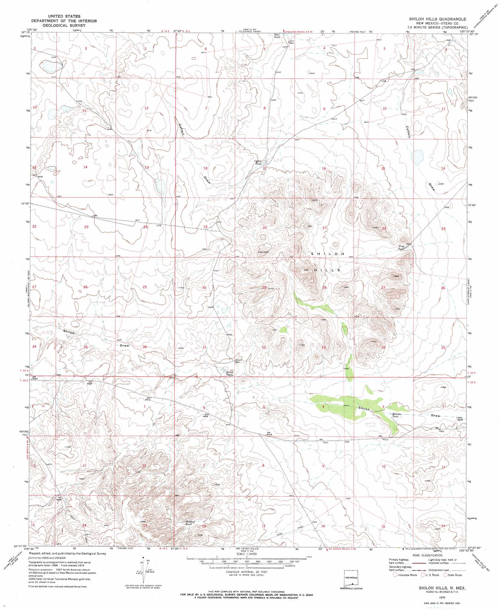
Shiloh Hills Topo Map New Mexico
To zoom in, hover over the map of Shiloh Hills
USGS Topo Quad 32105b4 - 1:24,000 scale
| Topo Map Name: | Shiloh Hills |
| USGS Topo Quad ID: | 32105b4 |
| Print Size: | ca. 21 1/4" wide x 27" high |
| Southeast Coordinates: | 32.125° N latitude / 105.375° W longitude |
| Map Center Coordinates: | 32.1875° N latitude / 105.4375° W longitude |
| U.S. State: | NM |
| Filename: | o32105b4.jpg |
| Download Map JPG Image: | Shiloh Hills topo map 1:24,000 scale |
| Map Type: | Topographic |
| Topo Series: | 7.5´ |
| Map Scale: | 1:24,000 |
| Source of Map Images: | United States Geological Survey (USGS) |
| Alternate Map Versions: |
Shiloh Hills NM 1970, updated 1973 Download PDF Buy paper map Shiloh Hills NM 2010 Download PDF Buy paper map Shiloh Hills NM 2013 Download PDF Buy paper map Shiloh Hills NM 2017 Download PDF Buy paper map |
1:24,000 Topo Quads surrounding Shiloh Hills
El Paso Draw |
Sixteen Canyon |
Indian Draw |
Cornucopia Ranch |
Tanner Ranch |
Stone Well |
Stockard Well |
Cleones Tank |
Cornucopia Ranch Se |
Hackberry Hill |
B T Ranch |
Alamo Mountain Ne |
Shiloh Hills |
Van Winkle Lake |
Lewis Canyon |
Alamo Mountain |
Cornudas Mountain |
Mcveigh Hills |
Shiloh Hills Se |
Culp Draw |
Big Heiser Tank |
Sixteen Mountains |
Cerro Diablo |
C And L Draw |
Dell City |
> Back to 32105a1 at 1:100,000 scale
> Back to 32104a1 at 1:250,000 scale
> Back to U.S. Topo Maps home
Shiloh Hills topo map: Gazetteer
Shiloh Hills: Arroyos
Coffelt Draw elevation 1343m 4406′Shiloh Hills: Ranges
Shiloh Hills elevation 1441m 4727′Shiloh Hills: Reservoirs
Coffelt Tank elevation 1365m 4478′Earl Tank elevation 1357m 4452′
Eskimo Tank elevation 1309m 4294′
Frog Tank elevation 1341m 4399′
Shiloh Tanks elevation 1335m 4379′
Wildcat Tank elevation 1428m 4685′
Shiloh Hills: Wells
Earl Well elevation 1353m 4438′Shiloh Hills digital topo map on disk
Buy this Shiloh Hills topo map showing relief, roads, GPS coordinates and other geographical features, as a high-resolution digital map file on DVD: