B T Ranch Topo Map New Mexico
To zoom in, hover over the map of B T Ranch
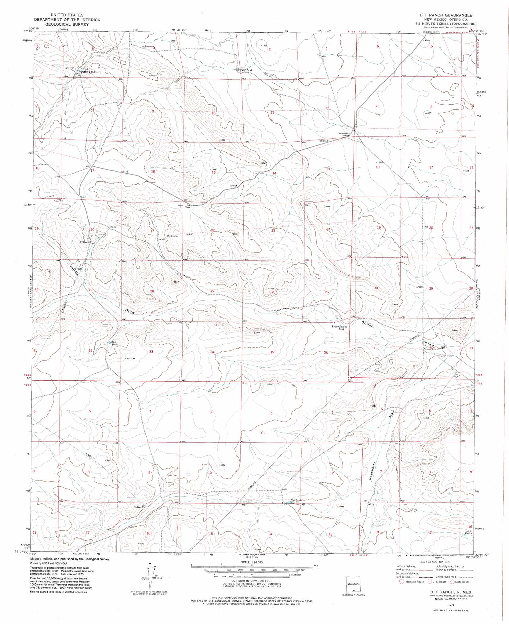
USGS Topo Quad 32105b6 - 1:24,000 scale
| Topo Map Name: | B T Ranch |
| USGS Topo Quad ID: | 32105b6 |
| Print Size: | ca. 21 1/4" wide x 27" high |
| Southeast Coordinates: | 32.125° N latitude / 105.625° W longitude |
| Map Center Coordinates: | 32.1875° N latitude / 105.6875° W longitude |
| U.S. State: | NM |
| Filename: | o32105b6.jpg |
| Download Map JPG Image: | B T Ranch topo map 1:24,000 scale |
| Map Type: | Topographic |
| Topo Series: | 7.5´ |
| Map Scale: | 1:24,000 |
| Source of Map Images: | United States Geological Survey (USGS) |
| Alternate Map Versions: |
B T Ranch NM 1975, updated 1977 Download PDF Buy paper map B T Ranch NM 2010 Download PDF Buy paper map B T Ranch NM 2013 Download PDF Buy paper map B T Ranch NM 2017 Download PDF Buy paper map |
1:24,000 Topo Quads surrounding B T Ranch
Wilde Tank |
Otero Mesa North |
El Paso Draw |
Sixteen Canyon |
Indian Draw |
Mack Tanks |
Otero Mesa South |
Stone Well |
Stockard Well |
Cleones Tank |
Owl Tank Canyon West |
Owl Tank Canyon East |
B T Ranch |
Alamo Mountain Ne |
Shiloh Hills |
Mountain Tank |
Alamo Mountain |
Alamo Mountain |
Cornudas Mountain |
Mcveigh Hills |
Cerro Alto Mountain |
Hobo Tank |
Big Heiser Tank |
Sixteen Mountains |
Cerro Diablo |
> Back to 32105a1 at 1:100,000 scale
> Back to 32104a1 at 1:250,000 scale
> Back to U.S. Topo Maps home
B T Ranch topo map: Gazetteer
B T Ranch: Reservoirs
Big Tank elevation 1464m 4803′Brownfield Tank elevation 1449m 4753′
CCC Tank elevation 1470m 4822′
Jug Tank elevation 1514m 4967′
Potter Tank elevation 1519m 4983′
B T Ranch: Valleys
Hackberry Draw elevation 1429m 4688′B T Ranch digital topo map on disk
Buy this B T Ranch topo map showing relief, roads, GPS coordinates and other geographical features, as a high-resolution digital map file on DVD: