Owl Tank Canyon West Topo Map New Mexico
To zoom in, hover over the map of Owl Tank Canyon West
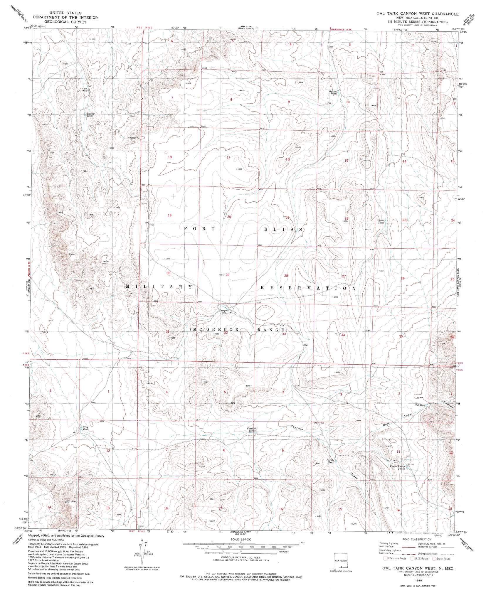
USGS Topo Quad 32105b8 - 1:24,000 scale
| Topo Map Name: | Owl Tank Canyon West |
| USGS Topo Quad ID: | 32105b8 |
| Print Size: | ca. 21 1/4" wide x 27" high |
| Southeast Coordinates: | 32.125° N latitude / 105.875° W longitude |
| Map Center Coordinates: | 32.1875° N latitude / 105.9375° W longitude |
| U.S. State: | NM |
| Filename: | o32105b8.jpg |
| Download Map JPG Image: | Owl Tank Canyon West topo map 1:24,000 scale |
| Map Type: | Topographic |
| Topo Series: | 7.5´ |
| Map Scale: | 1:24,000 |
| Source of Map Images: | United States Geological Survey (USGS) |
| Alternate Map Versions: |
Owl Tank Canyon West NM 1980, updated 1980 Download PDF Buy paper map Owl Tank Canyon West NM 2010 Download PDF Buy paper map Owl Tank Canyon West NM 2013 Download PDF Buy paper map Owl Tank Canyon West NM 2017 Download PDF Buy paper map |
1:24,000 Topo Quads surrounding Owl Tank Canyon West
Elephant Mountain |
Orogrande North |
Wilde Tank |
Otero Mesa North |
El Paso Draw |
Elwood |
Orogrande South |
Mack Tanks |
Otero Mesa South |
Stone Well |
Desert |
Desert Ne |
Owl Tank Canyon West |
Owl Tank Canyon East |
B T Ranch |
Desert Sw |
Desert Se |
Mountain Tank |
Alamo Mountain |
Alamo Mountain |
Nations East Well |
Hueco Tanks |
Cerro Alto Mountain |
Hobo Tank |
Big Heiser Tank |
> Back to 32105a1 at 1:100,000 scale
> Back to 32104a1 at 1:250,000 scale
> Back to U.S. Topo Maps home
Owl Tank Canyon West topo map: Gazetteer
Owl Tank Canyon West: Reservoirs
Broyle Tank elevation 1433m 4701′Campbell Tank elevation 1498m 4914′
Castner Tanks elevation 1481m 4858′
Childs Tank elevation 1526m 5006′
Foster Ranch Tanks elevation 1564m 5131′
Green Tank elevation 1484m 4868′
Grey Tank elevation 1424m 4671′
Owl Tank elevation 1582m 5190′
Tinney Tank elevation 1412m 4632′
Owl Tank Canyon West: Valleys
Castner Draw elevation 1400m 4593′Owl Tank Canyon elevation 1517m 4977′
Owl Tank Canyon West digital topo map on disk
Buy this Owl Tank Canyon West topo map showing relief, roads, GPS coordinates and other geographical features, as a high-resolution digital map file on DVD: