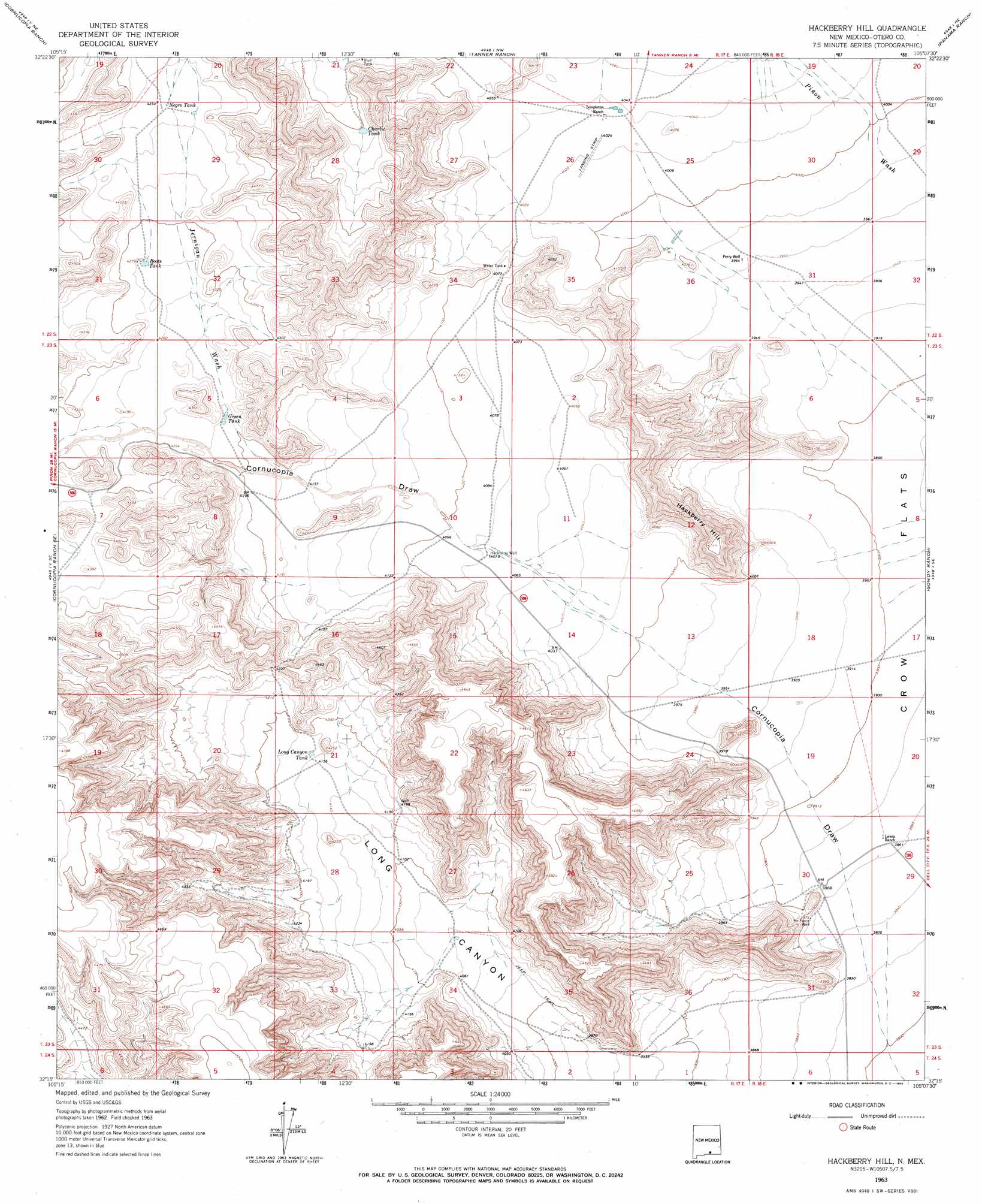
Hackberry Hill Topo Map New Mexico
To zoom in, hover over the map of Hackberry Hill
USGS Topo Quad 32105c2 - 1:24,000 scale
| Topo Map Name: | Hackberry Hill |
| USGS Topo Quad ID: | 32105c2 |
| Print Size: | ca. 21 1/4" wide x 27" high |
| Southeast Coordinates: | 32.25° N latitude / 105.125° W longitude |
| Map Center Coordinates: | 32.3125° N latitude / 105.1875° W longitude |
| U.S. State: | NM |
| Filename: | o32105c2.jpg |
| Download Map JPG Image: | Hackberry Hill topo map 1:24,000 scale |
| Map Type: | Topographic |
| Topo Series: | 7.5´ |
| Map Scale: | 1:24,000 |
| Source of Map Images: | United States Geological Survey (USGS) |
| Alternate Map Versions: |
Hackberry Hill NM 1963, updated 1965 Download PDF Buy paper map Hackberry Hill NM 2010 Download PDF Buy paper map Hackberry Hill NM 2013 Download PDF Buy paper map Hackberry Hill NM 2017 Download PDF Buy paper map |
1:24,000 Topo Quads surrounding Hackberry Hill
Pinon |
Cornucopia Canyon |
Pinon Ranch |
Bullis Spring Ranch |
South Taylor Tank |
Indian Draw |
Cornucopia Ranch |
Tanner Ranch |
Panama Ranch |
Packsaddle Canyon |
Cleones Tank |
Cornucopia Ranch Se |
Hackberry Hill |
Gowdy Ranch |
Algerita Canyon |
Shiloh Hills |
Van Winkle Lake |
Lewis Canyon |
Sheep Draw |
La Paloma Canyon |
Mcveigh Hills |
Shiloh Hills Se |
Culp Draw |
Cienega School |
Panther Canyon |
> Back to 32105a1 at 1:100,000 scale
> Back to 32104a1 at 1:250,000 scale
> Back to U.S. Topo Maps home
Hackberry Hill topo map: Gazetteer
Hackberry Hill: Reservoirs
Boots Tank elevation 1305m 4281′Charlie Tank elevation 1281m 4202′
Green Tank elevation 1285m 4215′
Long Canyon Tank elevation 1269m 4163′
Negro Tank elevation 1326m 4350′
Hackberry Hill: Streams
Jernigan Wash elevation 1275m 4183′Hackberry Hill: Summits
Hackberry Hill elevation 1317m 4320′Hackberry Hill: Valleys
Long Canyon elevation 1189m 3900′Hackberry Hill: Wells
10269 Water Well elevation 1179m 3868′Hackberry Hill digital topo map on disk
Buy this Hackberry Hill topo map showing relief, roads, GPS coordinates and other geographical features, as a high-resolution digital map file on DVD: