Stone Well Topo Map New Mexico
To zoom in, hover over the map of Stone Well
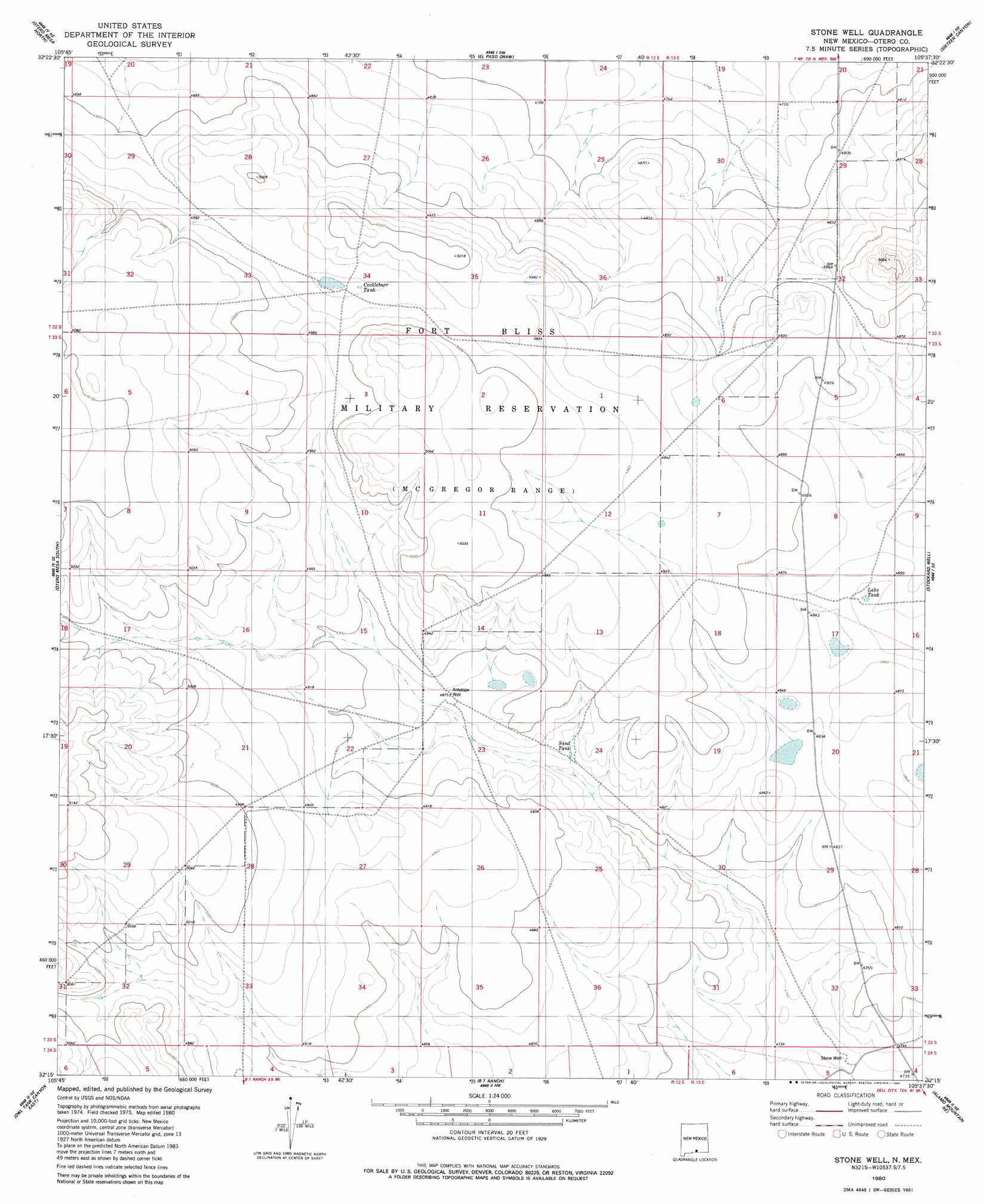
USGS Topo Quad 32105c6 - 1:24,000 scale
| Topo Map Name: | Stone Well |
| USGS Topo Quad ID: | 32105c6 |
| Print Size: | ca. 21 1/4" wide x 27" high |
| Southeast Coordinates: | 32.25° N latitude / 105.625° W longitude |
| Map Center Coordinates: | 32.3125° N latitude / 105.6875° W longitude |
| U.S. State: | NM |
| Filename: | o32105c6.jpg |
| Download Map JPG Image: | Stone Well topo map 1:24,000 scale |
| Map Type: | Topographic |
| Topo Series: | 7.5´ |
| Map Scale: | 1:24,000 |
| Source of Map Images: | United States Geological Survey (USGS) |
| Alternate Map Versions: |
Stone Well NM 1980, updated 1980 Download PDF Buy paper map Stone Well NM 2010 Download PDF Buy paper map Stone Well NM 2013 Download PDF Buy paper map Stone Well NM 2017 Download PDF Buy paper map |
1:24,000 Topo Quads surrounding Stone Well
Pipeline Canyon |
Culp Canyon |
El Paso Canyon |
Surveyors Canyon |
Pinon |
Wilde Tank |
Otero Mesa North |
El Paso Draw |
Sixteen Canyon |
Indian Draw |
Mack Tanks |
Otero Mesa South |
Stone Well |
Stockard Well |
Cleones Tank |
Owl Tank Canyon West |
Owl Tank Canyon East |
B T Ranch |
Alamo Mountain Ne |
Shiloh Hills |
Mountain Tank |
Alamo Mountain |
Alamo Mountain |
Cornudas Mountain |
Mcveigh Hills |
> Back to 32105a1 at 1:100,000 scale
> Back to 32104a1 at 1:250,000 scale
> Back to U.S. Topo Maps home
No gazetteer data is available for the Stone Well topo map sheet.
Stone Well digital topo map on disk
Buy this Stone Well topo map showing relief, roads, GPS coordinates and other geographical features, as a high-resolution digital map file on DVD: