Mack Tanks Topo Map New Mexico
To zoom in, hover over the map of Mack Tanks
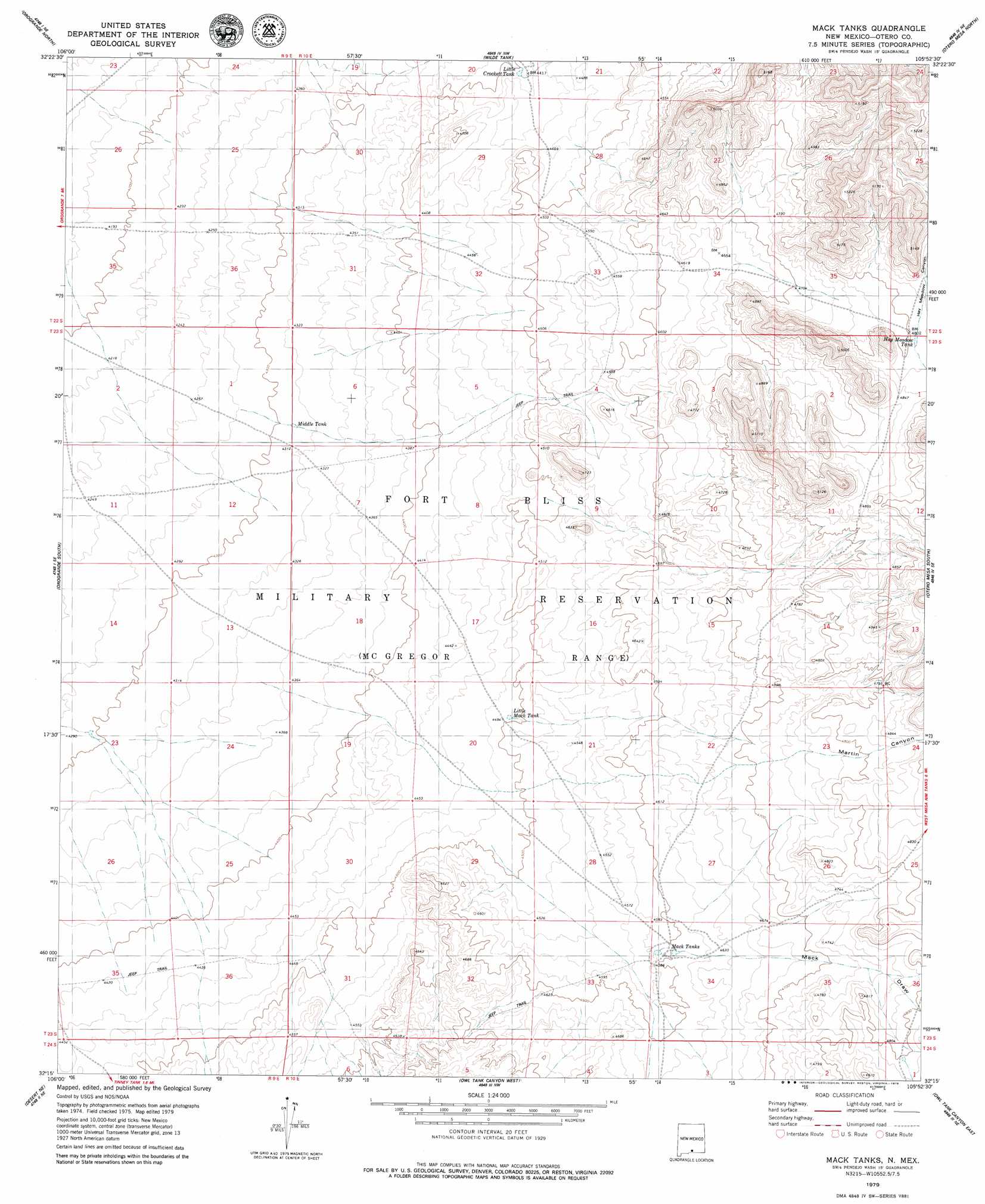
USGS Topo Quad 32105c8 - 1:24,000 scale
| Topo Map Name: | Mack Tanks |
| USGS Topo Quad ID: | 32105c8 |
| Print Size: | ca. 21 1/4" wide x 27" high |
| Southeast Coordinates: | 32.25° N latitude / 105.875° W longitude |
| Map Center Coordinates: | 32.3125° N latitude / 105.9375° W longitude |
| U.S. State: | NM |
| Filename: | o32105c8.jpg |
| Download Map JPG Image: | Mack Tanks topo map 1:24,000 scale |
| Map Type: | Topographic |
| Topo Series: | 7.5´ |
| Map Scale: | 1:24,000 |
| Source of Map Images: | United States Geological Survey (USGS) |
| Alternate Map Versions: |
Mack Tanks NM 1979, updated 1979 Download PDF Buy paper map Mack Tanks NM 2010 Download PDF Buy paper map Mack Tanks NM 2013 Download PDF Buy paper map Mack Tanks NM 2017 Download PDF Buy paper map |
1:24,000 Topo Quads surrounding Mack Tanks
Tres Hermanos Sw |
Tres Hermanos Se |
Pipeline Canyon |
Culp Canyon |
El Paso Canyon |
Elephant Mountain |
Orogrande North |
Wilde Tank |
Otero Mesa North |
El Paso Draw |
Elwood |
Orogrande South |
Mack Tanks |
Otero Mesa South |
Stone Well |
Desert |
Desert Ne |
Owl Tank Canyon West |
Owl Tank Canyon East |
B T Ranch |
Desert Sw |
Desert Se |
Mountain Tank |
Alamo Mountain |
Alamo Mountain |
> Back to 32105a1 at 1:100,000 scale
> Back to 32104a1 at 1:250,000 scale
> Back to U.S. Topo Maps home
Mack Tanks topo map: Gazetteer
Mack Tanks: Reservoirs
Hay Meadow Tank elevation 1466m 4809′Little Crockett Tank elevation 1343m 4406′
Little Mack Tank elevation 1371m 4498′
Mack Tanks elevation 1403m 4603′
Middle Tank elevation 1314m 4311′
Mack Tanks: Valleys
Hay Meadow Canyon elevation 1467m 4812′Mack Draw elevation 1399m 4589′
Martin Canyon elevation 1327m 4353′
Mack Tanks digital topo map on disk
Buy this Mack Tanks topo map showing relief, roads, GPS coordinates and other geographical features, as a high-resolution digital map file on DVD: