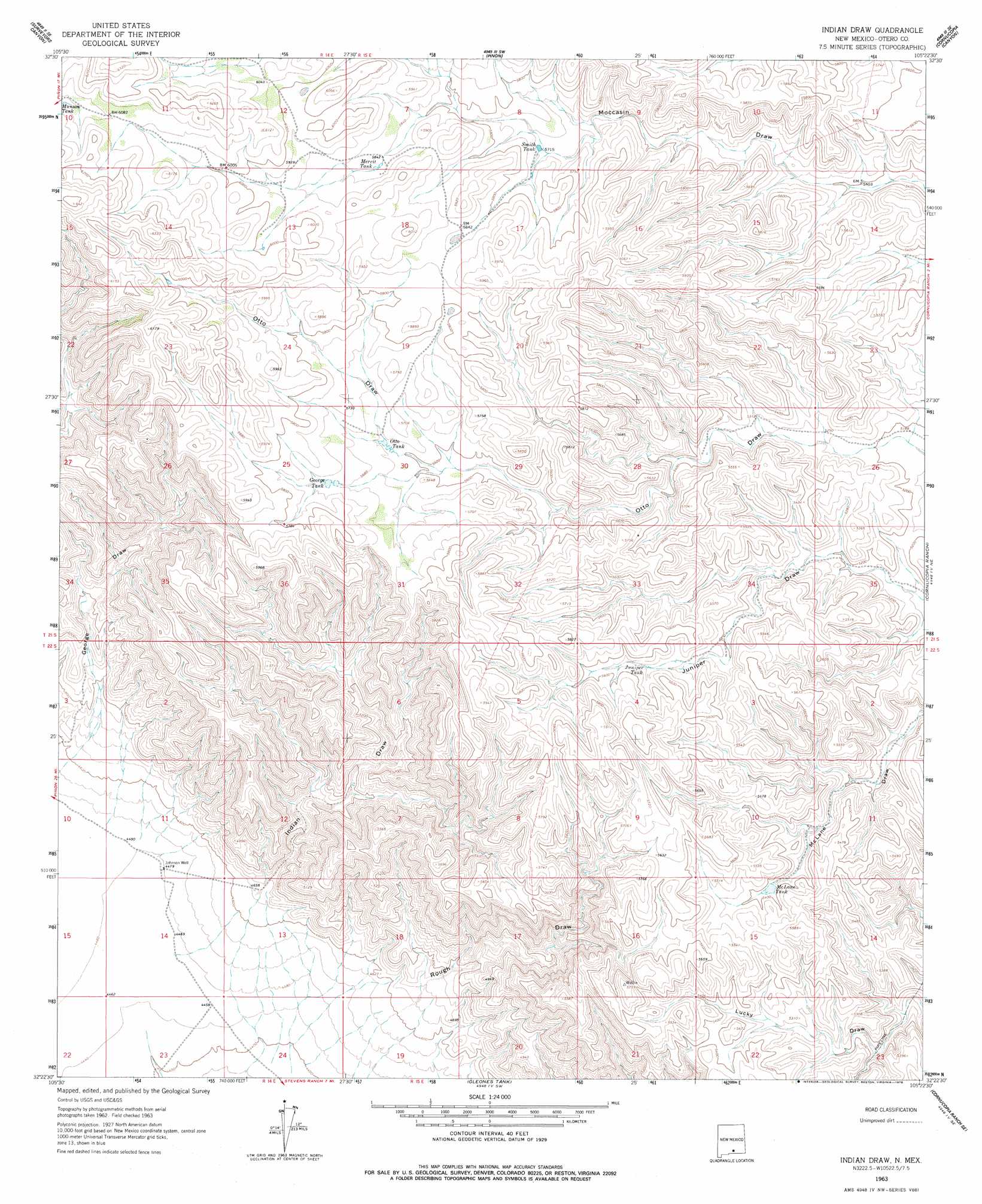
Indian Draw Topo Map New Mexico
To zoom in, hover over the map of Indian Draw
USGS Topo Quad 32105d4 - 1:24,000 scale
| Topo Map Name: | Indian Draw |
| USGS Topo Quad ID: | 32105d4 |
| Print Size: | ca. 21 1/4" wide x 27" high |
| Southeast Coordinates: | 32.375° N latitude / 105.375° W longitude |
| Map Center Coordinates: | 32.4375° N latitude / 105.4375° W longitude |
| U.S. State: | NM |
| Filename: | o32105d4.jpg |
| Download Map JPG Image: | Indian Draw topo map 1:24,000 scale |
| Map Type: | Topographic |
| Topo Series: | 7.5´ |
| Map Scale: | 1:24,000 |
| Source of Map Images: | United States Geological Survey (USGS) |
| Alternate Map Versions: |
Indian Draw NM 1963, updated 1965 Download PDF Buy paper map Indian Draw NM 1963, updated 1978 Download PDF Buy paper map Indian Draw NM 2010 Download PDF Buy paper map Indian Draw NM 2013 Download PDF Buy paper map Indian Draw NM 2017 Download PDF Buy paper map |
1:24,000 Topo Quads surrounding Indian Draw
Rogers Ruins |
Bear Spring |
Avis |
Chimney Lake |
Lewis Peak |
El Paso Canyon |
Surveyors Canyon |
Pinon |
Cornucopia Canyon |
Pinon Ranch |
El Paso Draw |
Sixteen Canyon |
Indian Draw |
Cornucopia Ranch |
Tanner Ranch |
Stone Well |
Stockard Well |
Cleones Tank |
Cornucopia Ranch Se |
Hackberry Hill |
B T Ranch |
Alamo Mountain Ne |
Shiloh Hills |
Van Winkle Lake |
Lewis Canyon |
> Back to 32105a1 at 1:100,000 scale
> Back to 32104a1 at 1:250,000 scale
> Back to U.S. Topo Maps home
Indian Draw topo map: Gazetteer
Indian Draw: Reservoirs
George Tank elevation 1735m 5692′Juniper Tank elevation 1678m 5505′
McLane Tank elevation 1635m 5364′
Merrit Tank elevation 1783m 5849′
Otto Tank elevation 1711m 5613′
Smith Tank elevation 1740m 5708′
Indian Draw: Valleys
George Draw elevation 1424m 4671′Indian Draw elevation 1422m 4665′
Rough Draw elevation 1429m 4688′
Indian Draw: Wells
Johnson Well elevation 1366m 4481′Indian Draw digital topo map on disk
Buy this Indian Draw topo map showing relief, roads, GPS coordinates and other geographical features, as a high-resolution digital map file on DVD: