Lewis Peak Ne Topo Map New Mexico
To zoom in, hover over the map of Lewis Peak Ne
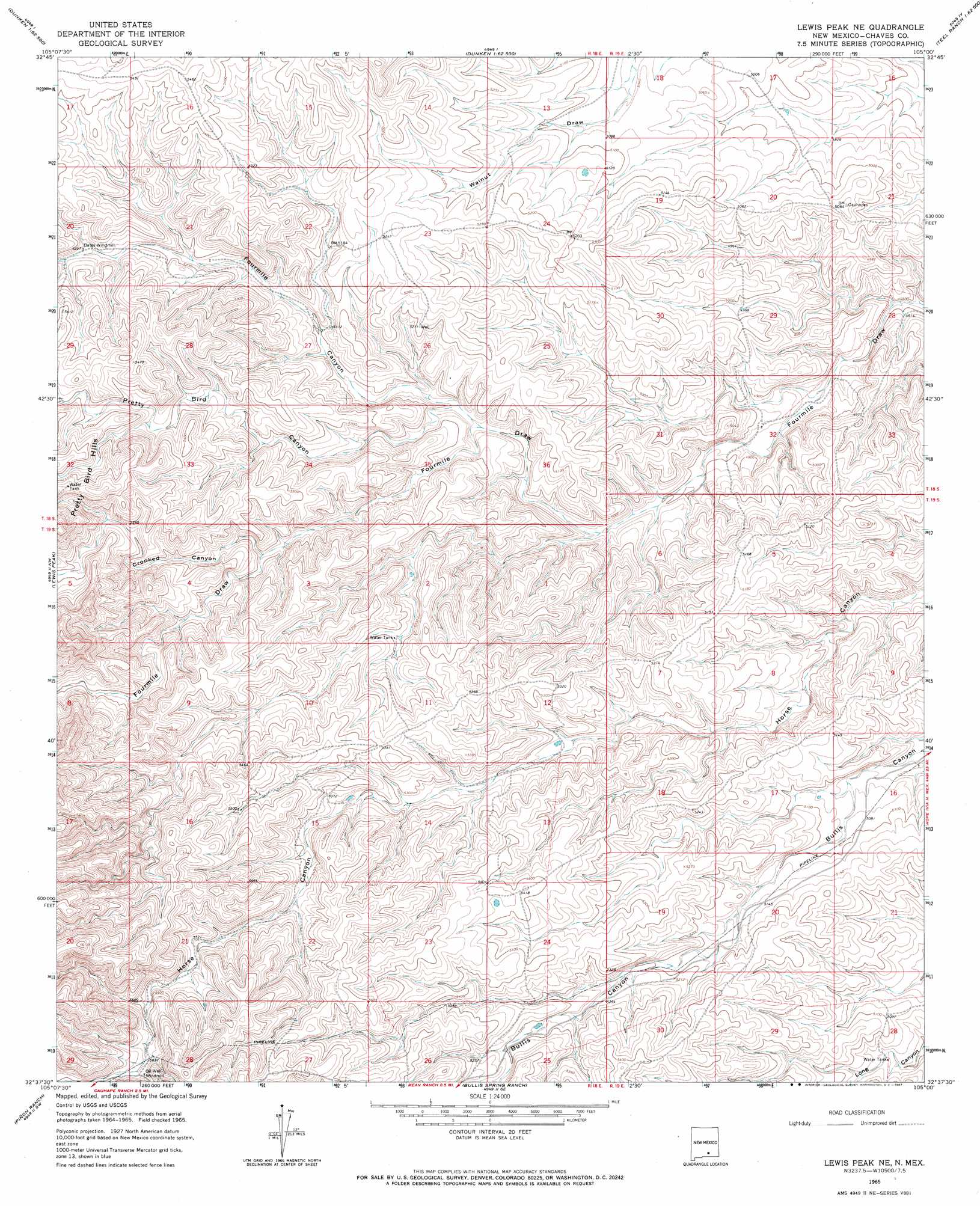
USGS Topo Quad 32105f1 - 1:24,000 scale
| Topo Map Name: | Lewis Peak Ne |
| USGS Topo Quad ID: | 32105f1 |
| Print Size: | ca. 21 1/4" wide x 27" high |
| Southeast Coordinates: | 32.625° N latitude / 105° W longitude |
| Map Center Coordinates: | 32.6875° N latitude / 105.0625° W longitude |
| U.S. State: | NM |
| Filename: | o32105f1.jpg |
| Download Map JPG Image: | Lewis Peak Ne topo map 1:24,000 scale |
| Map Type: | Topographic |
| Topo Series: | 7.5´ |
| Map Scale: | 1:24,000 |
| Source of Map Images: | United States Geological Survey (USGS) |
| Alternate Map Versions: |
Lewis Peak NE NM 1965, updated 1967 Download PDF Buy paper map Lewis Peak NE NM 2010 Download PDF Buy paper map Lewis Peak NE NM 2013 Download PDF Buy paper map Lewis Peak NE NM 2017 Download PDF Buy paper map |
1:24,000 Topo Quads surrounding Lewis Peak Ne
Elk |
Thimble Canyon |
Singer Lake |
Sagebrush Valley W. |
Sagebrush Valley E. |
Robertson Canyon |
Dunken |
Meadow Hill |
Sixteenmile Draw West |
Sixteenmile Draw East |
Chimney Lake |
Lewis Peak |
Lewis Peak Ne |
Encino Draw |
Holt Tank |
Cornucopia Canyon |
Pinon Ranch |
Bullis Spring Ranch |
South Taylor Tank |
Strychnine Draw |
Cornucopia Ranch |
Tanner Ranch |
Panama Ranch |
Packsaddle Canyon |
Texas Hill |
> Back to 32105e1 at 1:100,000 scale
> Back to 32104a1 at 1:250,000 scale
> Back to U.S. Topo Maps home
Lewis Peak Ne topo map: Gazetteer
Lewis Peak Ne: Ranges
Pretty Bird Hills elevation 1705m 5593′Lewis Peak Ne: Valleys
Crooked Canyon elevation 1579m 5180′Fourmile Canyon elevation 1533m 5029′
Pretty Bird Canyon elevation 1536m 5039′
Lewis Peak Ne digital topo map on disk
Buy this Lewis Peak Ne topo map showing relief, roads, GPS coordinates and other geographical features, as a high-resolution digital map file on DVD: