Lewis Peak Topo Map New Mexico
To zoom in, hover over the map of Lewis Peak
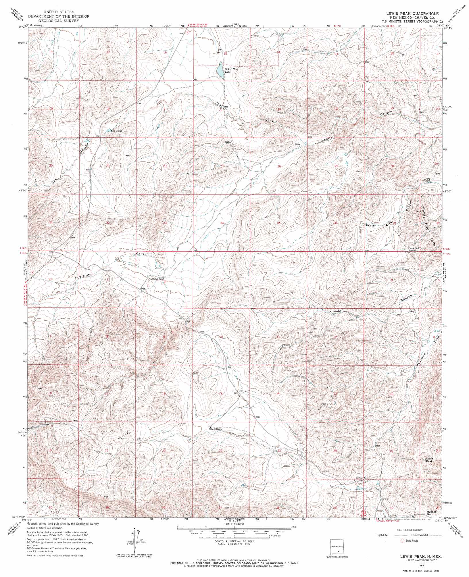
USGS Topo Quad 32105f2 - 1:24,000 scale
| Topo Map Name: | Lewis Peak |
| USGS Topo Quad ID: | 32105f2 |
| Print Size: | ca. 21 1/4" wide x 27" high |
| Southeast Coordinates: | 32.625° N latitude / 105.125° W longitude |
| Map Center Coordinates: | 32.6875° N latitude / 105.1875° W longitude |
| U.S. State: | NM |
| Filename: | o32105f2.jpg |
| Download Map JPG Image: | Lewis Peak topo map 1:24,000 scale |
| Map Type: | Topographic |
| Topo Series: | 7.5´ |
| Map Scale: | 1:24,000 |
| Source of Map Images: | United States Geological Survey (USGS) |
| Alternate Map Versions: |
Lewis Peak NM 1965, updated 1967 Download PDF Buy paper map Lewis Peak NM 2010 Download PDF Buy paper map Lewis Peak NM 2013 Download PDF Buy paper map Lewis Peak NM 2017 Download PDF Buy paper map |
1:24,000 Topo Quads surrounding Lewis Peak
Mayhill |
Elk |
Thimble Canyon |
Singer Lake |
Sagebrush Valley W. |
Woodson Canyon |
Robertson Canyon |
Dunken |
Meadow Hill |
Sixteenmile Draw West |
Avis |
Chimney Lake |
Lewis Peak |
Lewis Peak Ne |
Encino Draw |
Pinon |
Cornucopia Canyon |
Pinon Ranch |
Bullis Spring Ranch |
South Taylor Tank |
Indian Draw |
Cornucopia Ranch |
Tanner Ranch |
Panama Ranch |
Packsaddle Canyon |
> Back to 32105e1 at 1:100,000 scale
> Back to 32104a1 at 1:250,000 scale
> Back to U.S. Topo Maps home
Lewis Peak topo map: Gazetteer
Lewis Peak: Gaps
Russell Gap elevation 1747m 5731′Lewis Peak: Lakes
Cedar Hill Lake elevation 1704m 5590′Lewis Peak: Reservoirs
Cox Tank elevation 1770m 5807′Lee Tank elevation 1660m 5446′
Lewis Peak: Summits
Lewis Peak elevation 1881m 6171′Lewis Peak: Valleys
Cox Canyon elevation 1653m 5423′Lewis Peak digital topo map on disk
Buy this Lewis Peak topo map showing relief, roads, GPS coordinates and other geographical features, as a high-resolution digital map file on DVD: