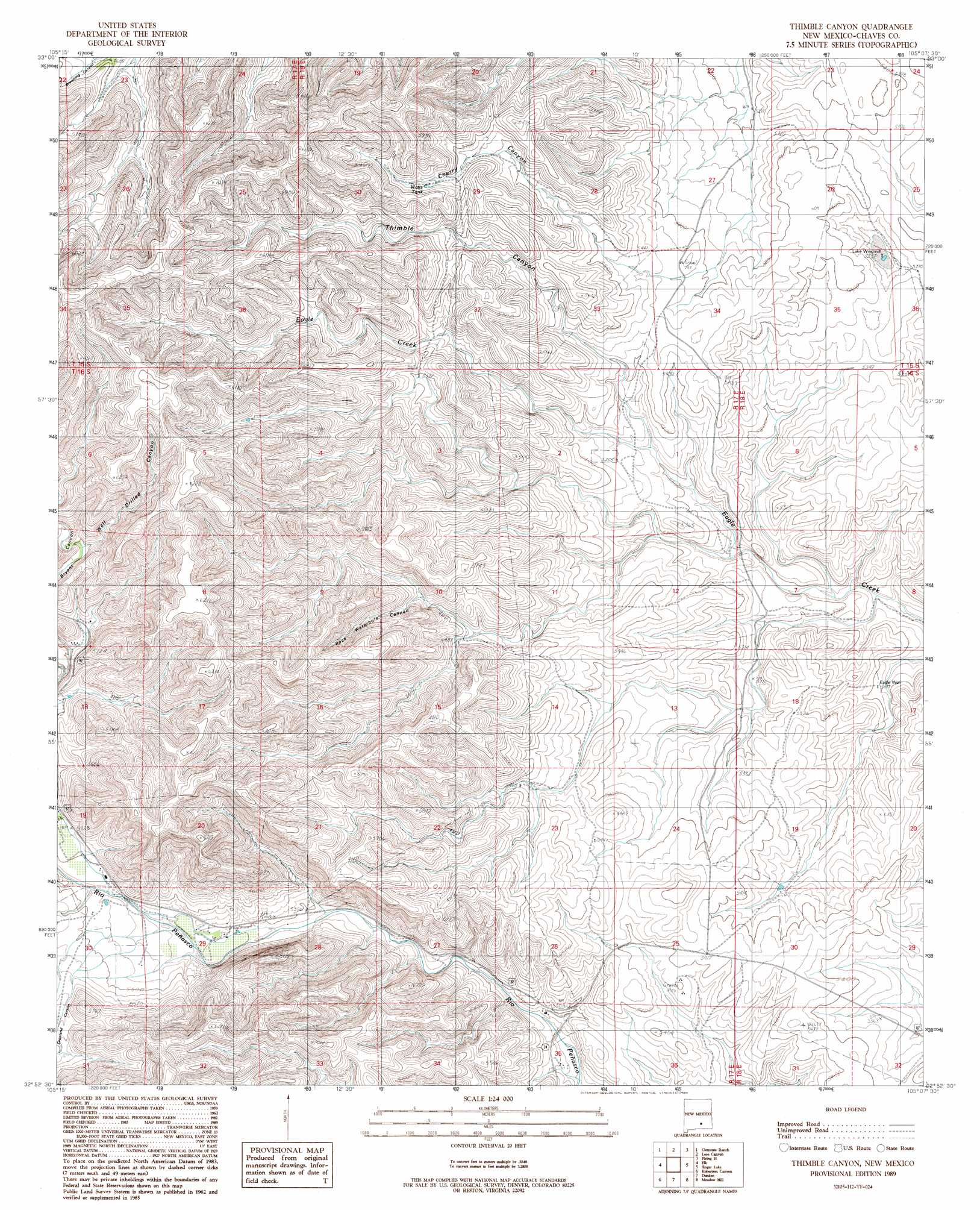
Thimble Canyon Topo Map New Mexico
To zoom in, hover over the map of Thimble Canyon
USGS Topo Quad 32105h2 - 1:24,000 scale
| Topo Map Name: | Thimble Canyon |
| USGS Topo Quad ID: | 32105h2 |
| Print Size: | ca. 21 1/4" wide x 27" high |
| Southeast Coordinates: | 32.875° N latitude / 105.125° W longitude |
| Map Center Coordinates: | 32.9375° N latitude / 105.1875° W longitude |
| U.S. State: | NM |
| Filename: | o32105h2.jpg |
| Download Map JPG Image: | Thimble Canyon topo map 1:24,000 scale |
| Map Type: | Topographic |
| Topo Series: | 7.5´ |
| Map Scale: | 1:24,000 |
| Source of Map Images: | United States Geological Survey (USGS) |
| Alternate Map Versions: |
Thimble Canyon NM 1989, updated 1989 Download PDF Buy paper map Thimble Canyon NM 2010 Download PDF Buy paper map Thimble Canyon NM 2013 Download PDF Buy paper map Thimble Canyon NM 2017 Download PDF Buy paper map |
1:24,000 Topo Quads surrounding Thimble Canyon
Pajarita Mountain |
Deadman Lake |
Flying H Nw |
Flying H Ne |
Skunk Canyon |
Turkey Peak |
Clements Ranch |
Loco Canyon |
Flying H |
Dark Canyon |
Mayhill |
Elk |
Thimble Canyon |
Singer Lake |
Sagebrush Valley W. |
Woodson Canyon |
Robertson Canyon |
Dunken |
Meadow Hill |
Sixteenmile Draw West |
Avis |
Chimney Lake |
Lewis Peak |
Lewis Peak Ne |
Encino Draw |
> Back to 32105e1 at 1:100,000 scale
> Back to 32104a1 at 1:250,000 scale
> Back to U.S. Topo Maps home
Thimble Canyon topo map: Gazetteer
Thimble Canyon: Populated Places
Old Longbotbam Place elevation 1631m 5351′Thimble Canyon: Reservoirs
Watts Tank elevation 1745m 5725′Thimble Canyon: Valleys
Buck Spring Canyon elevation 1671m 5482′Cherry Canyon elevation 1672m 5485′
Copeland Canyon elevation 1685m 5528′
Cottonwood Canyon elevation 1669m 5475′
Rock Waterhole Canyon elevation 1699m 5574′
Thimble Canyon elevation 1633m 5357′
Well Drilled Canyon elevation 1749m 5738′
Thimble Canyon: Wells
06287 Water Well elevation 1600m 5249′10634 Water Well elevation 1730m 5675′
10646 Water Well elevation 1714m 5623′
10647 Water Well elevation 1655m 5429′
10648 Water Well elevation 1667m 5469′
Thimble Canyon digital topo map on disk
Buy this Thimble Canyon topo map showing relief, roads, GPS coordinates and other geographical features, as a high-resolution digital map file on DVD: