Desert Topo Map New Mexico
To zoom in, hover over the map of Desert
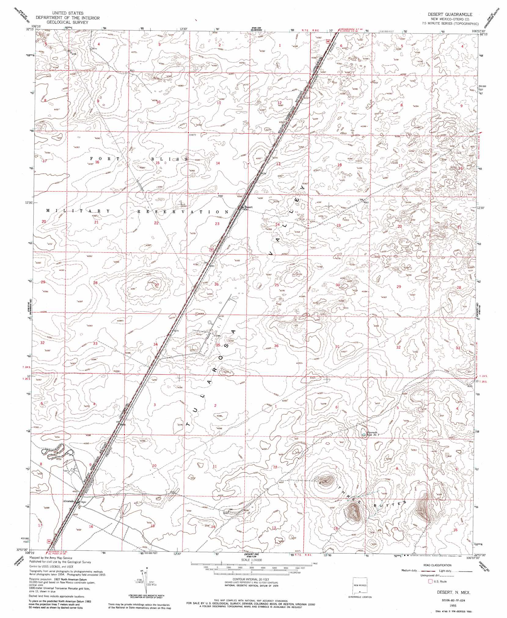
USGS Topo Quad 32106b2 - 1:24,000 scale
| Topo Map Name: | Desert |
| USGS Topo Quad ID: | 32106b2 |
| Print Size: | ca. 21 1/4" wide x 27" high |
| Southeast Coordinates: | 32.125° N latitude / 106.125° W longitude |
| Map Center Coordinates: | 32.1875° N latitude / 106.1875° W longitude |
| U.S. State: | NM |
| Filename: | o32106b2.jpg |
| Download Map JPG Image: | Desert topo map 1:24,000 scale |
| Map Type: | Topographic |
| Topo Series: | 7.5´ |
| Map Scale: | 1:24,000 |
| Source of Map Images: | United States Geological Survey (USGS) |
| Alternate Map Versions: |
Desert NM 1948 Download PDF Buy paper map Desert NM 1955, updated 1962 Download PDF Buy paper map Desert NM 1955, updated 1985 Download PDF Buy paper map Desert NM 2010 Download PDF Buy paper map Desert NM 2013 Download PDF Buy paper map Desert NM 2017 Download PDF Buy paper map |
1:24,000 Topo Quads surrounding Desert
White Sands |
White Sands Ne |
Elephant Mountain |
Orogrande North |
Wilde Tank |
Davies Tank |
White Sands Se |
Elwood |
Orogrande South |
Mack Tanks |
Newman Nw |
Newman Ne |
Desert |
Desert Ne |
Owl Tank Canyon West |
Newman Sw |
Newman |
Desert Sw |
Desert Se |
Mountain Tank |
North Franklin Mountain |
Fort Bliss Ne |
Nations East Well |
Hueco Tanks |
Cerro Alto Mountain |
> Back to 32106a1 at 1:100,000 scale
> Back to 32106a1 at 1:250,000 scale
> Back to U.S. Topo Maps home
Desert topo map: Gazetteer
Desert: Populated Places
Alvarado elevation 1251m 4104′Desert: Reservoirs
Alvarado Tank Number One elevation 1242m 4074′Desert: Summits
Three Buttes elevation 1331m 4366′Desert: Wells
Alavarado Water Well elevation 1250m 4101′Alvarado Water Well elevation 1250m 4101′
T-31 N-1 Water Well elevation 1249m 4097′
Desert digital topo map on disk
Buy this Desert topo map showing relief, roads, GPS coordinates and other geographical features, as a high-resolution digital map file on DVD: