Afton Nw Topo Map New Mexico
To zoom in, hover over the map of Afton Nw
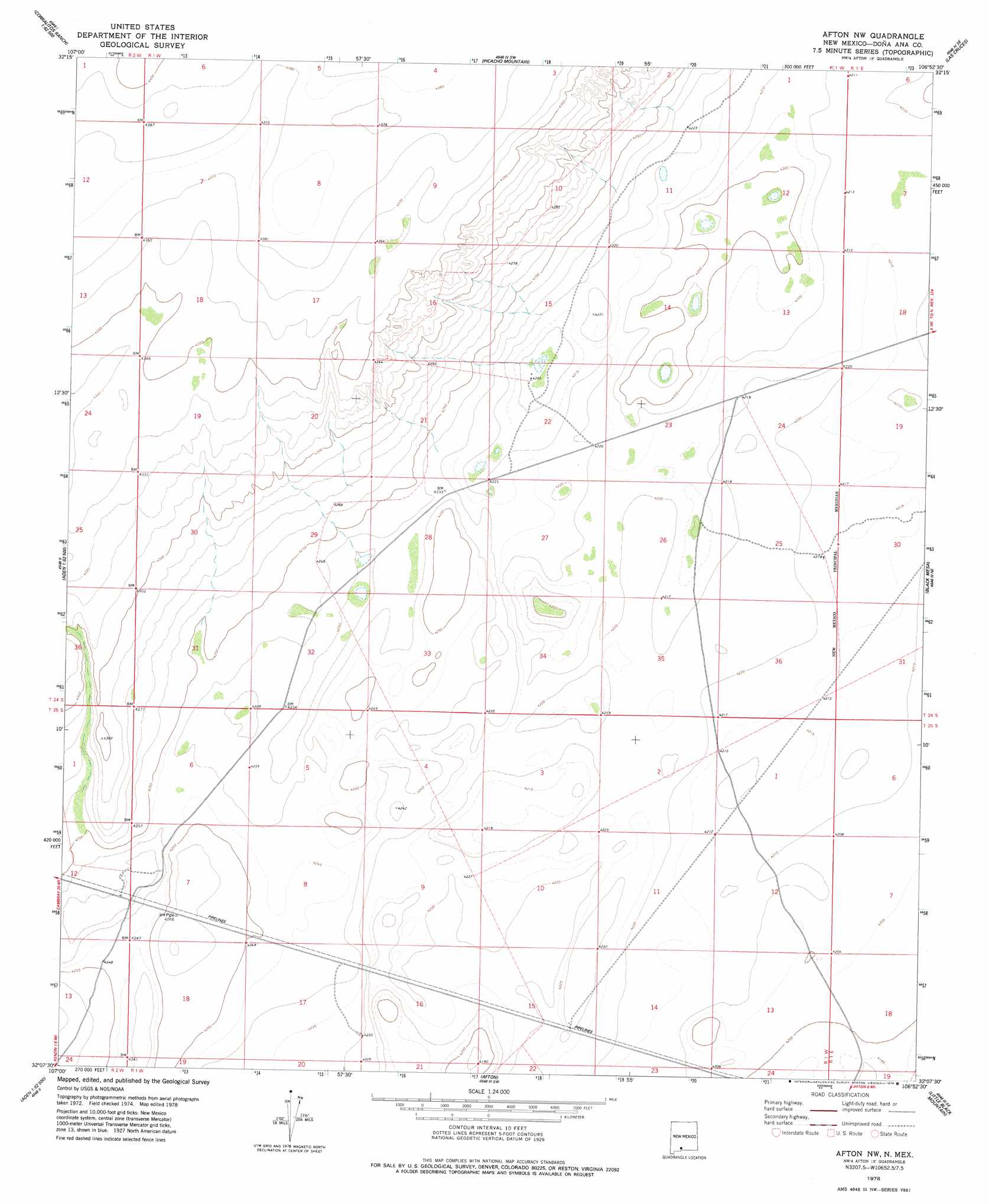
USGS Topo Quad 32106b8 - 1:24,000 scale
| Topo Map Name: | Afton Nw |
| USGS Topo Quad ID: | 32106b8 |
| Print Size: | ca. 21 1/4" wide x 27" high |
| Southeast Coordinates: | 32.125° N latitude / 106.875° W longitude |
| Map Center Coordinates: | 32.1875° N latitude / 106.9375° W longitude |
| U.S. State: | NM |
| Filename: | o32106b8.jpg |
| Download Map JPG Image: | Afton Nw topo map 1:24,000 scale |
| Map Type: | Topographic |
| Topo Series: | 7.5´ |
| Map Scale: | 1:24,000 |
| Source of Map Images: | United States Geological Survey (USGS) |
| Alternate Map Versions: |
Afton NW NM 1996, updated 2001 Download PDF Buy paper map Afton NW NM 2010 Download PDF Buy paper map Afton NW NM 2013 Download PDF Buy paper map Afton NW NM 2017 Download PDF Buy paper map |
1:24,000 Topo Quads surrounding Afton Nw
Magdalena Peak |
Rough And Ready Hills |
Leasburg |
Dona Ana |
Organ Peak Nw |
Magdalena Gap |
Sleeping Lady Hills |
Picacho Mountain |
Las Cruces |
Tortugas Mountain |
Mount Aden |
Aden Hills |
Afton Nw |
Black Mesa |
San Miguel |
Mount Aden Sw |
Aden Crater |
Afton |
Little Black Mountain |
La Mesa |
Potrillo Peak |
Mount Riley |
Kilbourne Hole |
Lanark |
La Union |
> Back to 32106a1 at 1:100,000 scale
> Back to 32106a1 at 1:250,000 scale
> Back to U.S. Topo Maps home
No gazetteer data is available for the Afton Nw topo map sheet.
Afton Nw digital topo map on disk
Buy this Afton Nw topo map showing relief, roads, GPS coordinates and other geographical features, as a high-resolution digital map file on DVD: