Tres Hermanos Topo Map New Mexico
To zoom in, hover over the map of Tres Hermanos
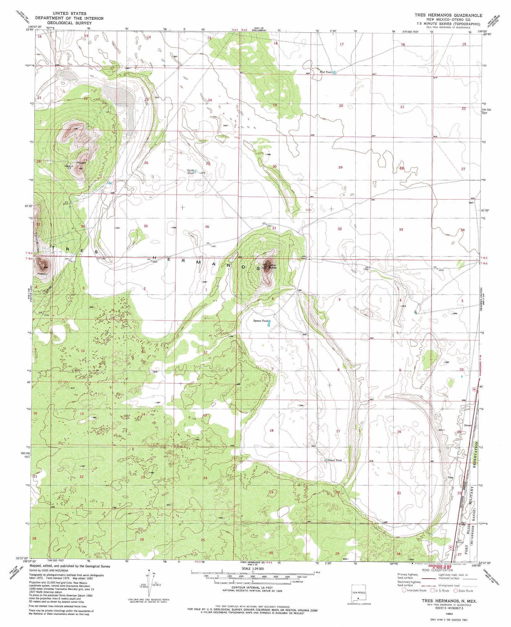
USGS Topo Quad 32106f1 - 1:24,000 scale
| Topo Map Name: | Tres Hermanos |
| USGS Topo Quad ID: | 32106f1 |
| Print Size: | ca. 21 1/4" wide x 27" high |
| Southeast Coordinates: | 32.625° N latitude / 106° W longitude |
| Map Center Coordinates: | 32.6875° N latitude / 106.0625° W longitude |
| U.S. State: | NM |
| Filename: | o32106f1.jpg |
| Download Map JPG Image: | Tres Hermanos topo map 1:24,000 scale |
| Map Type: | Topographic |
| Topo Series: | 7.5´ |
| Map Scale: | 1:24,000 |
| Source of Map Images: | United States Geological Survey (USGS) |
| Alternate Map Versions: |
Tres Hermanos NM 1982, updated 1982 Download PDF Buy paper map Tres Hermanos NM 2010 Download PDF Buy paper map Tres Hermanos NM 2013 Download PDF Buy paper map Tres Hermanos NM 2017 Download PDF Buy paper map |
1:24,000 Topo Quads surrounding Tres Hermanos
Heart Of The Sands Ne |
Lost River |
Malone Draw |
Alamogordo North |
High Rolls |
Heart Of The Sands |
Garton Lake |
Holloman |
Alamogordo South |
Sacramento Peak |
Lake Lucero Ne |
Foster Lake |
Tres Hermanos |
Deadman Canyon |
Bug Scuffle Canyon |
Lake Lucero Se |
Tres Hermanos Sw |
Tres Hermanos Se |
Pipeline Canyon |
Culp Canyon |
White Sands Ne |
Elephant Mountain |
Orogrande North |
Wilde Tank |
Otero Mesa North |
> Back to 32106e1 at 1:100,000 scale
> Back to 32106a1 at 1:250,000 scale
> Back to U.S. Topo Maps home
Tres Hermanos topo map: Gazetteer
Tres Hermanos: Flats
Tres Hermanos elevation 1214m 3982′Tres Hermanos: Reservoirs
Desert Tank elevation 1211m 3973′Flat Tank elevation 1221m 4005′
North Tank elevation 1213m 3979′
Squaw Tank elevation 1210m 3969′
Tres Hermanos: Summits
Lone Butte elevation 1292m 4238′Tres Hermanos digital topo map on disk
Buy this Tres Hermanos topo map showing relief, roads, GPS coordinates and other geographical features, as a high-resolution digital map file on DVD: