Fleck Draw Topo Map New Mexico
To zoom in, hover over the map of Fleck Draw
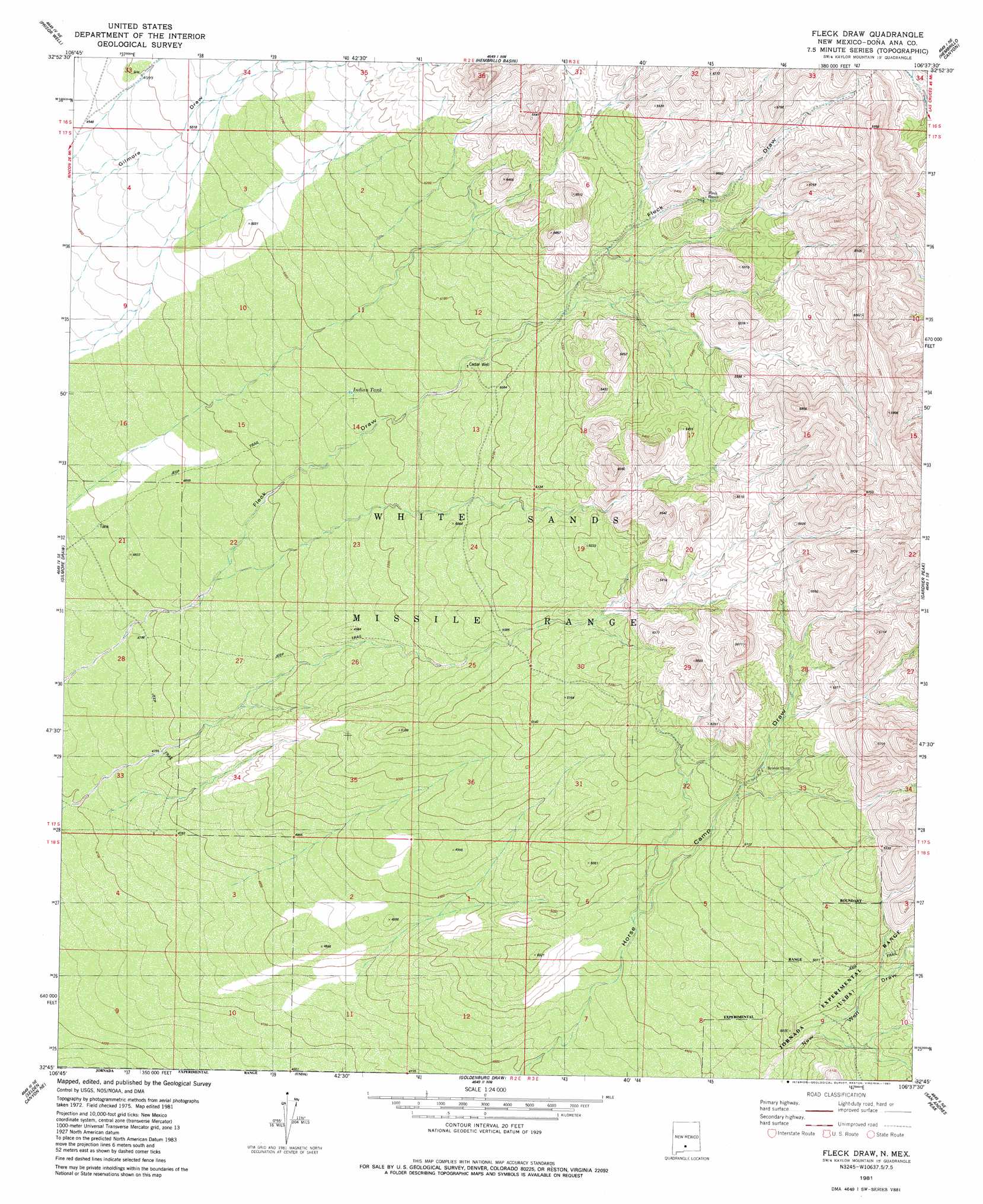
USGS Topo Quad 32106g6 - 1:24,000 scale
| Topo Map Name: | Fleck Draw |
| USGS Topo Quad ID: | 32106g6 |
| Print Size: | ca. 21 1/4" wide x 27" high |
| Southeast Coordinates: | 32.75° N latitude / 106.625° W longitude |
| Map Center Coordinates: | 32.8125° N latitude / 106.6875° W longitude |
| U.S. State: | NM |
| Filename: | o32106g6.jpg |
| Download Map JPG Image: | Fleck Draw topo map 1:24,000 scale |
| Map Type: | Topographic |
| Topo Series: | 7.5´ |
| Map Scale: | 1:24,000 |
| Source of Map Images: | United States Geological Survey (USGS) |
| Alternate Map Versions: |
Fleck Draw NM 1981, updated 1981 Download PDF Buy paper map Fleck Draw NM 1996, updated 2002 Download PDF Buy paper map Fleck Draw NM 2010 Download PDF Buy paper map Fleck Draw NM 2013 Download PDF Buy paper map Fleck Draw NM 2017 Download PDF Buy paper map |
1:24,000 Topo Quads surrounding Fleck Draw
Polecat Tank |
Dugout Canyon |
Sulphur Pass |
Strawberry Peak |
Lumley Lake |
Prisor Hill |
Prisor Well |
Hembrillo Basin |
Hembrillo Canyon |
Heart Of The Sands Nw |
Upham Hills |
Gilmore Draw |
Fleck Draw |
Gardner Peak |
Heart Of The Sands Sw |
Thorn Well |
Seldon Canyon Ne |
Goldenburg Draw |
San Andres Peak |
Lake Lucero |
Seldon Canyon |
Summerford Mountain |
Taylor Well |
Bear Peak |
Bennett Mountain |
> Back to 32106e1 at 1:100,000 scale
> Back to 32106a1 at 1:250,000 scale
> Back to U.S. Topo Maps home
Fleck Draw topo map: Gazetteer
Fleck Draw: Reservoirs
Indian Tank elevation 1522m 4993′Fleck Draw: Wells
Cedar Well elevation 1545m 5068′Fleck Draw digital topo map on disk
Buy this Fleck Draw topo map showing relief, roads, GPS coordinates and other geographical features, as a high-resolution digital map file on DVD: