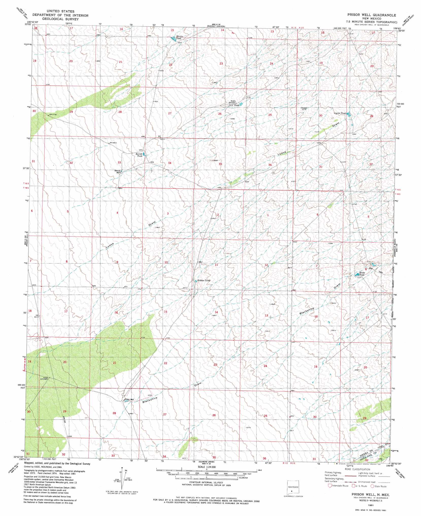
Prisor Well Topo Map New Mexico
To zoom in, hover over the map of Prisor Well
USGS Topo Quad 32106h7 - 1:24,000 scale
| Topo Map Name: | Prisor Well |
| USGS Topo Quad ID: | 32106h7 |
| Print Size: | ca. 21 1/4" wide x 27" high |
| Southeast Coordinates: | 32.875° N latitude / 106.75° W longitude |
| Map Center Coordinates: | 32.9375° N latitude / 106.8125° W longitude |
| U.S. State: | NM |
| Filename: | o32106h7.jpg |
| Download Map JPG Image: | Prisor Well topo map 1:24,000 scale |
| Map Type: | Topographic |
| Topo Series: | 7.5´ |
| Map Scale: | 1:24,000 |
| Source of Map Images: | United States Geological Survey (USGS) |
| Alternate Map Versions: |
Prisor Well NM 1981, updated 1981 Download PDF Buy paper map Prisor Well NM 1996, updated 2001 Download PDF Buy paper map Prisor Well NM 2010 Download PDF Buy paper map Prisor Well NM 2013 Download PDF Buy paper map Prisor Well NM 2017 Download PDF Buy paper map |
1:24,000 Topo Quads surrounding Prisor Well
Engle |
Shannon Canyon Nw |
Shannon Canyon |
Hardscrabble Mountains |
Tip Top Canyon |
Cutter |
Polecat Tank |
Dugout Canyon |
Sulphur Pass |
Strawberry Peak |
Upham |
Prisor Hill |
Prisor Well |
Hembrillo Basin |
Hembrillo Canyon |
Alivio |
Upham Hills |
Gilmore Draw |
Fleck Draw |
Gardner Peak |
Rincon |
Thorn Well |
Seldon Canyon Ne |
Goldenburg Draw |
San Andres Peak |
> Back to 32106e1 at 1:100,000 scale
> Back to 32106a1 at 1:250,000 scale
> Back to U.S. Topo Maps home
Prisor Well topo map: Gazetteer
Prisor Well: Reservoirs
Broke Tank elevation 1561m 5121′CCC Tank elevation 1551m 5088′
Hidden Tank elevation 1470m 4822′
Lyons Tank elevation 1604m 5262′
Martin Tank elevation 1532m 5026′
Renick Tank elevation 1486m 4875′
Prisor Well: Wells
Prisor Well elevation 1417m 4648′Renick Well elevation 1470m 4822′
Prisor Well digital topo map on disk
Buy this Prisor Well topo map showing relief, roads, GPS coordinates and other geographical features, as a high-resolution digital map file on DVD: