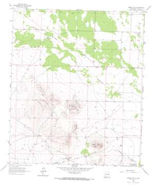
Bisbee Hills Topo Map New Mexico
To zoom in, hover over the map of Bisbee Hills
USGS Topo Quad 32107a8 - 1:24,000 scale
| Topo Map Name: | Bisbee Hills |
| USGS Topo Quad ID: | 32107a8 |
| Print Size: | ca. 21 1/4" wide x 27" high |
| Southeast Coordinates: | 32° N latitude / 107.875° W longitude |
| Map Center Coordinates: | 32.0625° N latitude / 107.9375° W longitude |
| U.S. State: | NM |
| Filename: | o32107a8.jpg |
| Download Map JPG Image: | Bisbee Hills topo map 1:24,000 scale |
| Map Type: | Topographic |
| Topo Series: | 7.5´ |
| Map Scale: | 1:24,000 |
| Source of Map Images: | United States Geological Survey (USGS) |
| Alternate Map Versions: |
Bisbee Hills NM 1965, updated 1967 Download PDF Buy paper map Bisbee Hills NM 2010 Download PDF Buy paper map Bisbee Hills NM 2013 Download PDF Buy paper map Bisbee Hills NM 2017 Download PDF Buy paper map |
1:24,000 Topo Quads surrounding Bisbee Hills
> Back to 32107a1 at 1:100,000 scale
> Back to 32106a1 at 1:250,000 scale
> Back to U.S. Topo Maps home
Bisbee Hills topo map: Gazetteer
Bisbee Hills: Dams
Miller-Gibson Detention Dam Number 1 elevation 1327m 4353′Miller-Gibson Detention Dam Number 2 elevation 1291m 4235′
Bisbee Hills: Mines
Big Digging Mines elevation 1356m 4448′Bisbee Hills: Populated Places
Eller Place elevation 1349m 4425′Bisbee Hills: Ranges
Burdick Hills elevation 1367m 4484′Bisbee Hills: Summits
Bisbee Hills elevation 1361m 4465′Bisbee Hills: Valleys
Gap Draw elevation 1327m 4353′Bisbee Hills: Wells
00774 Water Well elevation 1298m 4258′00849 Water Well elevation 1290m 4232′
00858 Water Well elevation 1297m 4255′
00865 Water Well elevation 1294m 4245′
00866 Water Well elevation 1302m 4271′
01415 Water Well elevation 1304m 4278′
01418 Water Well elevation 1317m 4320′
01419 Water Well elevation 1296m 4251′
01477 Water Well elevation 1301m 4268′
01478 Water Well elevation 1296m 4251′
06019 Water Well elevation 1298m 4258′
06082 Water Well elevation 1304m 4278′
Farm Well elevation 1295m 4248′
Seventysix Well elevation 1297m 4255′
Bisbee Hills digital topo map on disk
Buy this Bisbee Hills topo map showing relief, roads, GPS coordinates and other geographical features, as a high-resolution digital map file on DVD:


