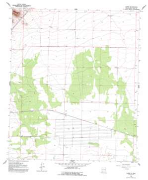
Carne Topo Map New Mexico
To zoom in, hover over the map of Carne
USGS Topo Quad 32107c5 - 1:24,000 scale
| Topo Map Name: | Carne |
| USGS Topo Quad ID: | 32107c5 |
| Print Size: | ca. 21 1/4" wide x 27" high |
| Southeast Coordinates: | 32.25° N latitude / 107.5° W longitude |
| Map Center Coordinates: | 32.3125° N latitude / 107.5625° W longitude |
| U.S. State: | NM |
| Filename: | o32107c5.jpg |
| Download Map JPG Image: | Carne topo map 1:24,000 scale |
| Map Type: | Topographic |
| Topo Series: | 7.5´ |
| Map Scale: | 1:24,000 |
| Source of Map Images: | United States Geological Survey (USGS) |
| Alternate Map Versions: |
Carne NM 1965, updated 1967 Download PDF Buy paper map Carne NM 1965, updated 1993 Download PDF Buy paper map Carne NM 1996, updated 2003 Download PDF Buy paper map Carne NM 2010 Download PDF Buy paper map Carne NM 2013 Download PDF Buy paper map Carne NM 2017 Download PDF Buy paper map |
1:24,000 Topo Quads surrounding Carne
> Back to 32107a1 at 1:100,000 scale
> Back to 32106a1 at 1:250,000 scale
> Back to U.S. Topo Maps home
Carne topo map: Gazetteer
Carne: Mines
Carne Well elevation 1277m 4189′Carne: Populated Places
Carne elevation 1278m 4192′Carne: Post Offices
Carne Post Office (historical) elevation 1278m 4192′Carne: Wells
00001 Water Well elevation 1298m 4258′00002 Water Well elevation 1296m 4251′
00005 Water Well elevation 1286m 4219′
00008 Water Well elevation 1280m 4199′
00009 Water Well elevation 1277m 4189′
00012 Water Well elevation 1272m 4173′
00013 Water Well elevation 1284m 4212′
00015 Water Well elevation 1279m 4196′
00016 Water Well elevation 1280m 4199′
00018 Water Well elevation 1278m 4192′
00264 Water Well elevation 1278m 4192′
00265 Water Well elevation 1276m 4186′
01220 Water Well elevation 1321m 4333′
01221 Water Well elevation 1324m 4343′
01222 Water Well elevation 1331m 4366′
01224 Water Well elevation 1315m 4314′
01376 Water Well elevation 1285m 4215′
01598 Water Well elevation 1276m 4186′
06077 Water Well elevation 1280m 4199′
06109 Water Well elevation 1304m 4278′
06110 Water Well elevation 1284m 4212′
06111 Water Well elevation 1304m 4278′
06133 Water Well elevation 1276m 4186′
10046 Water Well elevation 1287m 4222′
10047 Water Well elevation 1278m 4192′
10048 Water Well elevation 1271m 4169′
10049 Water Well elevation 1281m 4202′
10050 Water Well elevation 1279m 4196′
10051 Water Well elevation 1279m 4196′
10052 Water Well elevation 1284m 4212′
10053 Water Well elevation 1281m 4202′
10054 Water Well elevation 1281m 4202′
10055 Water Well elevation 1279m 4196′
10056 Water Well elevation 1276m 4186′
10057 Water Well elevation 1272m 4173′
10060 Water Well elevation 1302m 4271′
10106 Water Well elevation 1276m 4186′
10469 Water Well elevation 1326m 4350′
10470 Water Well elevation 1317m 4320′
10471 Water Well elevation 1316m 4317′
10473 Water Well elevation 1311m 4301′
10474 Water Well elevation 1326m 4350′
Hannigan Well elevation 1276m 4186′
Number 1219 Water Well elevation 1329m 4360′
Carne digital topo map on disk
Buy this Carne topo map showing relief, roads, GPS coordinates and other geographical features, as a high-resolution digital map file on DVD:


