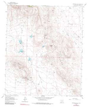
Massacre Peak Topo Map New Mexico
To zoom in, hover over the map of Massacre Peak
USGS Topo Quad 32107d6 - 1:24,000 scale
| Topo Map Name: | Massacre Peak |
| USGS Topo Quad ID: | 32107d6 |
| Print Size: | ca. 21 1/4" wide x 27" high |
| Southeast Coordinates: | 32.375° N latitude / 107.625° W longitude |
| Map Center Coordinates: | 32.4375° N latitude / 107.6875° W longitude |
| U.S. State: | NM |
| Filename: | o32107d6.jpg |
| Download Map JPG Image: | Massacre Peak topo map 1:24,000 scale |
| Map Type: | Topographic |
| Topo Series: | 7.5´ |
| Map Scale: | 1:24,000 |
| Source of Map Images: | United States Geological Survey (USGS) |
| Alternate Map Versions: |
Massacre Peak NM 1964, updated 1967 Download PDF Buy paper map Massacre Peak NM 1964, updated 1984 Download PDF Buy paper map Massacre Peak NM 2010 Download PDF Buy paper map Massacre Peak NM 2013 Download PDF Buy paper map Massacre Peak NM 2017 Download PDF Buy paper map |
1:24,000 Topo Quads surrounding Massacre Peak
> Back to 32107a1 at 1:100,000 scale
> Back to 32106a1 at 1:250,000 scale
> Back to U.S. Topo Maps home
Massacre Peak topo map: Gazetteer
Massacre Peak: Dams
Detention Dam Number 1 elevation 1452m 4763′Detention Dam Number 2 elevation 1476m 4842′
Detention Dam Number 5 elevation 1427m 4681′
Starvation Draw Detention Dam Number 1 elevation 1459m 4786′
Starvation Draw Detention Dam Number 2 elevation 1478m 4849′
Starvation Draw Detention Dam Number 3 elevation 1480m 4855′
Starvation Draw Detention Dam Number 4 elevation 1479m 4852′
Starvation Draw Detention Dam Number 5 elevation 1434m 4704′
Massacre Peak: Mines
Doubtful Group elevation 1398m 4586′Grattan Mine elevation 1598m 5242′
Gratten Mine elevation 1602m 5255′
Green Spar Mine elevation 1586m 5203′
Greenleaf Mine elevation 1426m 4678′
Hill Top Mine elevation 1516m 4973′
Hilltop Prospect elevation 1516m 4973′
Lucky Mine elevation 1441m 4727′
Sadler Mine elevation 1461m 4793′
San Juan Mine elevation 1440m 4724′
Tip Top Prospect elevation 1593m 5226′
Valley Mine elevation 1404m 4606′
White Bluff elevation 1468m 4816′
Whitehill Prospect elevation 1559m 5114′
Massacre Peak: Parks
Fort Cummings 1836-1886 Historical Marker elevation 1477m 4845′Massacre Peak: Post Offices
Fort Cummings Post Office (historical) elevation 1477m 4845′Massacre Peak: Ranges
Pony Hills elevation 1502m 4927′Massacre Peak: Ridges
Fluorite Ridge elevation 1722m 5649′Rattlesnake Ridge elevation 1916m 6286′
Massacre Peak: Springs
Cookes Spring elevation 1475m 4839′Fryingpan Spring elevation 1529m 5016′
Puma Spring elevation 1468m 4816′
Massacre Peak: Summits
Massacre Peak elevation 1690m 5544′Massacre Peak: Valleys
Clark Draw elevation 1509m 4950′Fryingpan Canyon elevation 1437m 4714′
Rattlesnake Canyon elevation 1511m 4957′
Massacre Peak: Wells
01216 Water Well elevation 1423m 4668′01226 Water Well elevation 1428m 4685′
01277 Water Well elevation 1567m 5141′
01278 Water Well elevation 1511m 4957′
01282 Water Well elevation 1510m 4954′
01579 Water Well elevation 1484m 4868′
01580 Water Well elevation 1482m 4862′
Number 1228 Water Well elevation 1419m 4655′
Massacre Peak digital topo map on disk
Buy this Massacre Peak topo map showing relief, roads, GPS coordinates and other geographical features, as a high-resolution digital map file on DVD:


