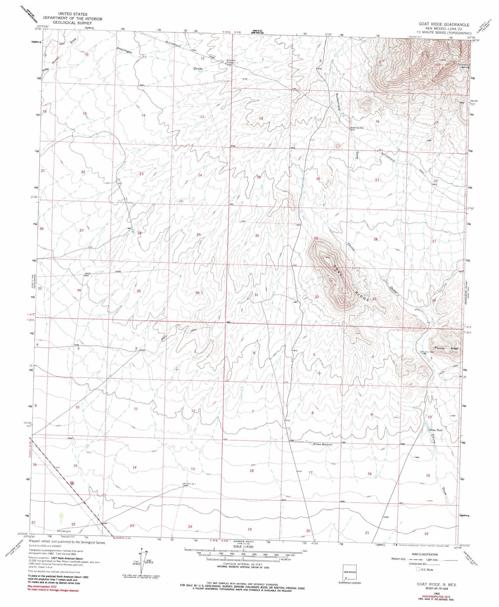
Goat Ridge Topo Map New Mexico
To zoom in, hover over the map of Goat Ridge
USGS Topo Quad 32107d7 - 1:24,000 scale
| Topo Map Name: | Goat Ridge |
| USGS Topo Quad ID: | 32107d7 |
| Print Size: | ca. 21 1/4" wide x 27" high |
| Southeast Coordinates: | 32.375° N latitude / 107.75° W longitude |
| Map Center Coordinates: | 32.4375° N latitude / 107.8125° W longitude |
| U.S. State: | NM |
| Filename: | o32107d7.jpg |
| Download Map JPG Image: | Goat Ridge topo map 1:24,000 scale |
| Map Type: | Topographic |
| Topo Series: | 7.5´ |
| Map Scale: | 1:24,000 |
| Source of Map Images: | United States Geological Survey (USGS) |
| Alternate Map Versions: |
Goat Ridge NM 1964, updated 1967 Download PDF Buy paper map Goat Ridge NM 1964, updated 1986 Download PDF Buy paper map Goat Ridge NM 2010 Download PDF Buy paper map Goat Ridge NM 2013 Download PDF Buy paper map Goat Ridge NM 2017 Download PDF Buy paper map |
1:24,000 Topo Quads surrounding Goat Ridge
Hurley East |
Whitehorse Mountain |
Dwyer |
Whiterock Mountain |
Lake Valley |
Faywood Station |
Taylor Mountain |
Faywood Se |
Ok Canyon |
Greg Hills |
Antelope Hill |
Spalding |
Goat Ridge |
Massacre Peak |
Florida |
Grandmother Mountain East |
Williams Ranch |
Deming West |
Deming East |
Carne |
Gage |
Red Mountain |
Bowlin Ranch |
Capitol Dome |
Florida Gap |
> Back to 32107a1 at 1:100,000 scale
> Back to 32106a1 at 1:250,000 scale
> Back to U.S. Topo Maps home
Goat Ridge topo map: Gazetteer
Goat Ridge: Mines
Goat Ridge elevation 1530m 5019′Goat Ridge: Reservoirs
China Tank elevation 1424m 4671′Wilson Reservoir elevation 1429m 4688′
Goat Ridge: Ridges
Goat Ridge elevation 1646m 5400′Goat Ridge: Valleys
Butterfield Draw elevation 1486m 4875′Goat Ridge: Wells
01237 Water Well elevation 1410m 4625′01239 Water Well elevation 1397m 4583′
01244 Water Well elevation 1450m 4757′
01285 Water Well elevation 1502m 4927′
01286 Water Well elevation 1562m 5124′
06137 Water Well elevation 1558m 5111′
06138 Water Well elevation 1451m 4760′
06140 Water Well elevation 1533m 5029′
Butterfield Well elevation 1543m 5062′
Goat Ridge digital topo map on disk
Buy this Goat Ridge topo map showing relief, roads, GPS coordinates and other geographical features, as a high-resolution digital map file on DVD: