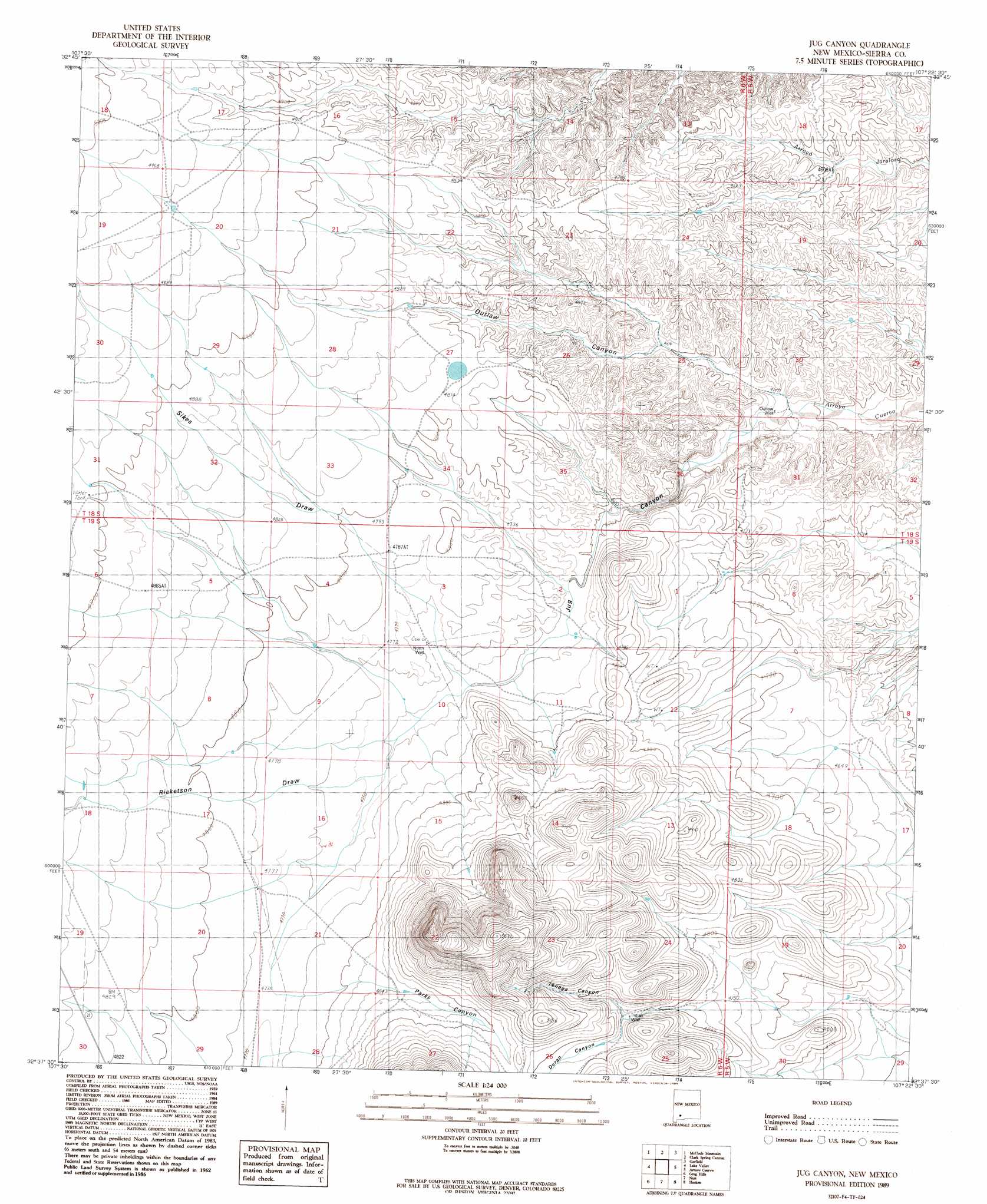
Jug Canyon Topo Map New Mexico
To zoom in, hover over the map of Jug Canyon
USGS Topo Quad 32107f4 - 1:24,000 scale
| Topo Map Name: | Jug Canyon |
| USGS Topo Quad ID: | 32107f4 |
| Print Size: | ca. 21 1/4" wide x 27" high |
| Southeast Coordinates: | 32.625° N latitude / 107.375° W longitude |
| Map Center Coordinates: | 32.6875° N latitude / 107.4375° W longitude |
| U.S. State: | NM |
| Filename: | o32107f4.jpg |
| Download Map JPG Image: | Jug Canyon topo map 1:24,000 scale |
| Map Type: | Topographic |
| Topo Series: | 7.5´ |
| Map Scale: | 1:24,000 |
| Source of Map Images: | United States Geological Survey (USGS) |
| Alternate Map Versions: |
Jug Canyon NM 1989, updated 1989 Download PDF Buy paper map Jug Canyon NM 1996, updated 2002 Download PDF Buy paper map Jug Canyon NM 2010 Download PDF Buy paper map Jug Canyon NM 2013 Download PDF Buy paper map Jug Canyon NM 2017 Download PDF Buy paper map |
1:24,000 Topo Quads surrounding Jug Canyon
Kingston |
Hillsboro |
Skute Stone Arroyo |
Caballo |
Apache Gap |
Pa Mountain |
Mcclede Mountain |
Clark Spring Canyon |
Garfield |
Mcleod Tank |
Whiterock Mountain |
Lake Valley |
Jug Canyon |
Arroyo Cuervo |
Hatch |
Ok Canyon |
Greg Hills |
Nutt |
Hockett |
Souse Springs |
Massacre Peak |
Florida |
Good Sight Peak |
Good Sight Peak Ne |
Magdalena Peak |
> Back to 32107e1 at 1:100,000 scale
> Back to 32106a1 at 1:250,000 scale
> Back to U.S. Topo Maps home
Jug Canyon topo map: Gazetteer
Jug Canyon: Mines
Nunn Lease elevation 1448m 4750′Nunn S State Lease elevation 1446m 4744′
Jug Canyon: Valleys
Duran Canyon elevation 1476m 4842′Jug Canyon elevation 1375m 4511′
Outlaw Canyon elevation 1375m 4511′
Parks Canyon elevation 1462m 4796′
Ricketson Draw elevation 1445m 4740′
Sikes Draw elevation 1443m 4734′
Tenaga Canyon elevation 1476m 4842′
Jug Canyon digital topo map on disk
Buy this Jug Canyon topo map showing relief, roads, GPS coordinates and other geographical features, as a high-resolution digital map file on DVD: