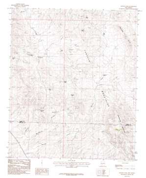
Mcleod Tank Topo Map New Mexico
To zoom in, hover over the map of Mcleod Tank
USGS Topo Quad 32107g2 - 1:24,000 scale
| Topo Map Name: | Mcleod Tank |
| USGS Topo Quad ID: | 32107g2 |
| Print Size: | ca. 21 1/4" wide x 27" high |
| Southeast Coordinates: | 32.75° N latitude / 107.125° W longitude |
| Map Center Coordinates: | 32.8125° N latitude / 107.1875° W longitude |
| U.S. State: | NM |
| Filename: | o32107g2.jpg |
| Download Map JPG Image: | Mcleod Tank topo map 1:24,000 scale |
| Map Type: | Topographic |
| Topo Series: | 7.5´ |
| Map Scale: | 1:24,000 |
| Source of Map Images: | United States Geological Survey (USGS) |
| Alternate Map Versions: |
McLeod Tank NM 1985, updated 1985 Download PDF Buy paper map McLeod Tank NM 1996, updated 2002 Download PDF Buy paper map McLeod Tank NM 2010 Download PDF Buy paper map McLeod Tank NM 2013 Download PDF Buy paper map McLeod Tank NM 2017 Download PDF Buy paper map |
1:24,000 Topo Quads surrounding Mcleod Tank
> Back to 32107e1 at 1:100,000 scale
> Back to 32106a1 at 1:250,000 scale
> Back to U.S. Topo Maps home
Mcleod Tank topo map: Gazetteer
Mcleod Tank: Dams
Hatch Valley Arroyos Site Six Dam elevation 1293m 4242′Mcleod Tank: Mines
Alamo elevation 1477m 4845′Black Darling elevation 1450m 4757′
Black Darling Group elevation 1548m 5078′
Blackie Mine elevation 1565m 5134′
Blackie Mine elevation 1480m 4855′
Gar Spar Claims elevation 1439m 4721′
Gar-Spar elevation 1451m 4760′
Lorraine elevation 1508m 4947′
Luchini Manganese Prospect elevation 1462m 4796′
Nakaye Group elevation 1539m 5049′
Palm Park Mine elevation 1507m 4944′
Velarde elevation 1534m 5032′
Velarde Manganese Prospect elevation 1462m 4796′
Mcleod Tank: Ranges
Hogue Hills elevation 1549m 5082′Mcleod Tank: Reservoirs
Broken House Tank elevation 1397m 4583′East Tank elevation 1523m 4996′
Flat Tank elevation 1411m 4629′
Hidden Tank elevation 1495m 4904′
Horse Tank elevation 1445m 4740′
McLeod Tank elevation 1496m 4908′
Mine Tank elevation 1526m 5006′
Mountain Tank elevation 1396m 4580′
Mountain Tank elevation 1500m 4921′
Pass Tank elevation 1426m 4678′
Red Hill Tank elevation 1378m 4520′
Red Tank elevation 1414m 4639′
Tripple Tank elevation 1468m 4816′
Twin Tanks elevation 1448m 4750′
Mcleod Tank: Ridges
McLeod Hills elevation 1558m 5111′Mcleod Tank: Summits
Red House Mountain elevation 1873m 6145′Redhouse Mountain elevation 1773m 5816′
Mcleod Tank: Valleys
McLeod Draw elevation 1390m 4560′Mcleod Tank digital topo map on disk
Buy this Mcleod Tank topo map showing relief, roads, GPS coordinates and other geographical features, as a high-resolution digital map file on DVD:


