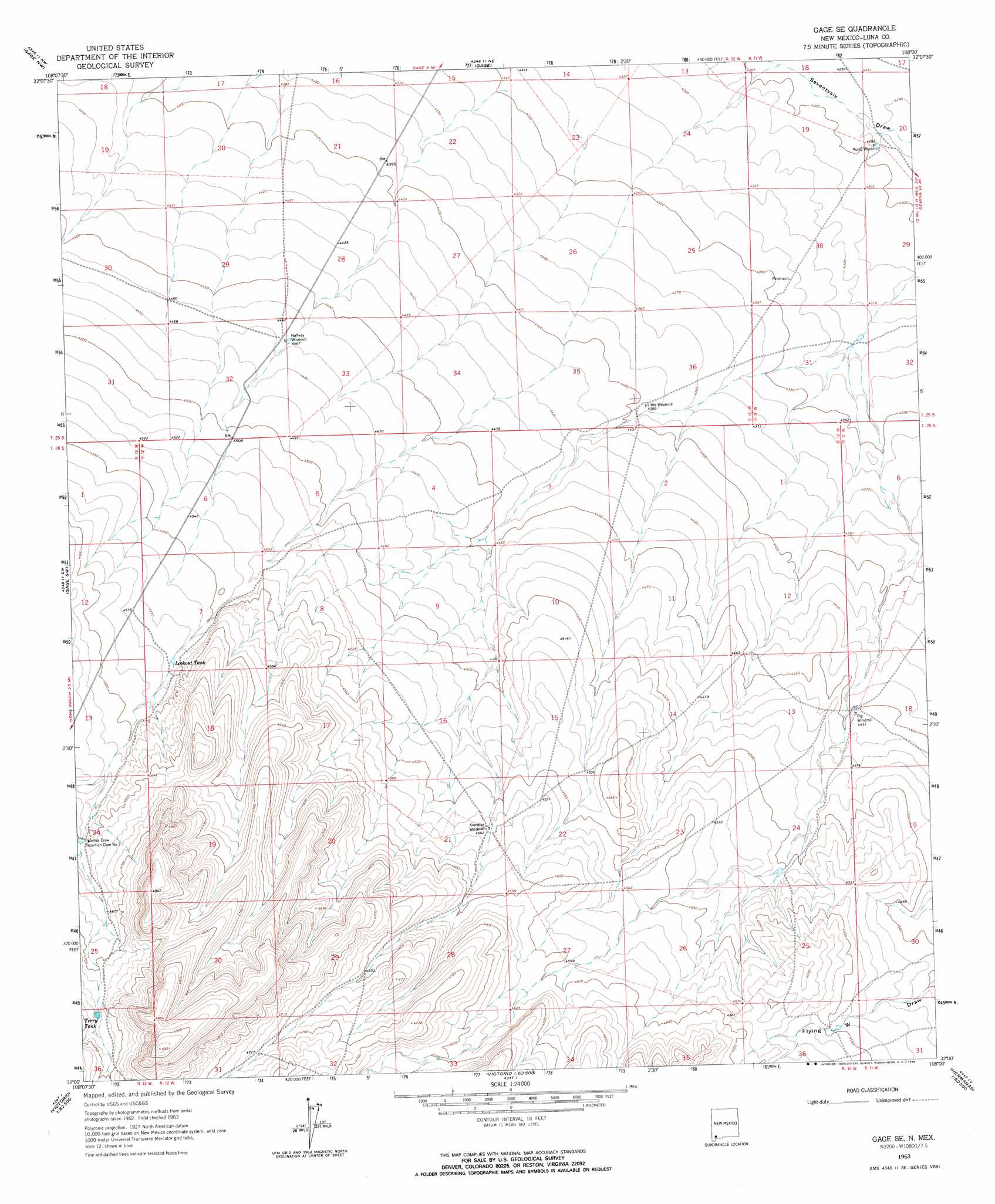
Gage Se Topo Map New Mexico
To zoom in, hover over the map of Gage Se
USGS Topo Quad 32108a1 - 1:24,000 scale
| Topo Map Name: | Gage Se |
| USGS Topo Quad ID: | 32108a1 |
| Print Size: | ca. 21 1/4" wide x 27" high |
| Southeast Coordinates: | 32° N latitude / 108° W longitude |
| Map Center Coordinates: | 32.0625° N latitude / 108.0625° W longitude |
| U.S. State: | NM |
| Filename: | o32108a1.jpg |
| Download Map JPG Image: | Gage Se topo map 1:24,000 scale |
| Map Type: | Topographic |
| Topo Series: | 7.5´ |
| Map Scale: | 1:24,000 |
| Source of Map Images: | United States Geological Survey (USGS) |
| Alternate Map Versions: |
Gage SE NM 1963, updated 1966 Download PDF Buy paper map Gage SE NM 1963, updated 1966 Download PDF Buy paper map Gage SE NM 2010 Download PDF Buy paper map Gage SE NM 2013 Download PDF Buy paper map Gage SE NM 2017 Download PDF Buy paper map |
1:24,000 Topo Quads surrounding Gage Se
Soldiers Farewell Hill |
Grandmother Mountain West |
Grandmother Mountain East |
Williams Ranch |
Deming West |
Separ Ne |
Gage Nw |
Gage |
Red Mountain |
Bowlin Ranch |
The Saltys |
Gage Sw |
Gage Se |
Bisbee Hills |
Midway Butte |
Hachita |
Hat Top Mountain |
Flying W Mountain |
Hermanas Nw |
West Lime Hills |
Doyle Peak |
Victorio Ranch |
Victorio Ranch Se |
Hermanas |
Malpais Hill |
> Back to 32108a1 at 1:100,000 scale
> Back to 32108a1 at 1:250,000 scale
> Back to U.S. Topo Maps home
Gage Se topo map: Gazetteer
Gage Se: Reservoirs
Lookout Tank elevation 1394m 4573′Terry Tank elevation 1442m 4730′
Gage Se: Valleys
Flying W Draw elevation 1372m 4501′Gage Se: Wells
00867 Water Well elevation 1358m 4455′01413 Water Well elevation 1309m 4294′
01428 Water Well elevation 1362m 4468′
01480 Water Well elevation 1392m 4566′
06081 Water Well elevation 1404m 4606′
Gage Se digital topo map on disk
Buy this Gage Se topo map showing relief, roads, GPS coordinates and other geographical features, as a high-resolution digital map file on DVD: