Coyote Peak Topo Map New Mexico
To zoom in, hover over the map of Coyote Peak
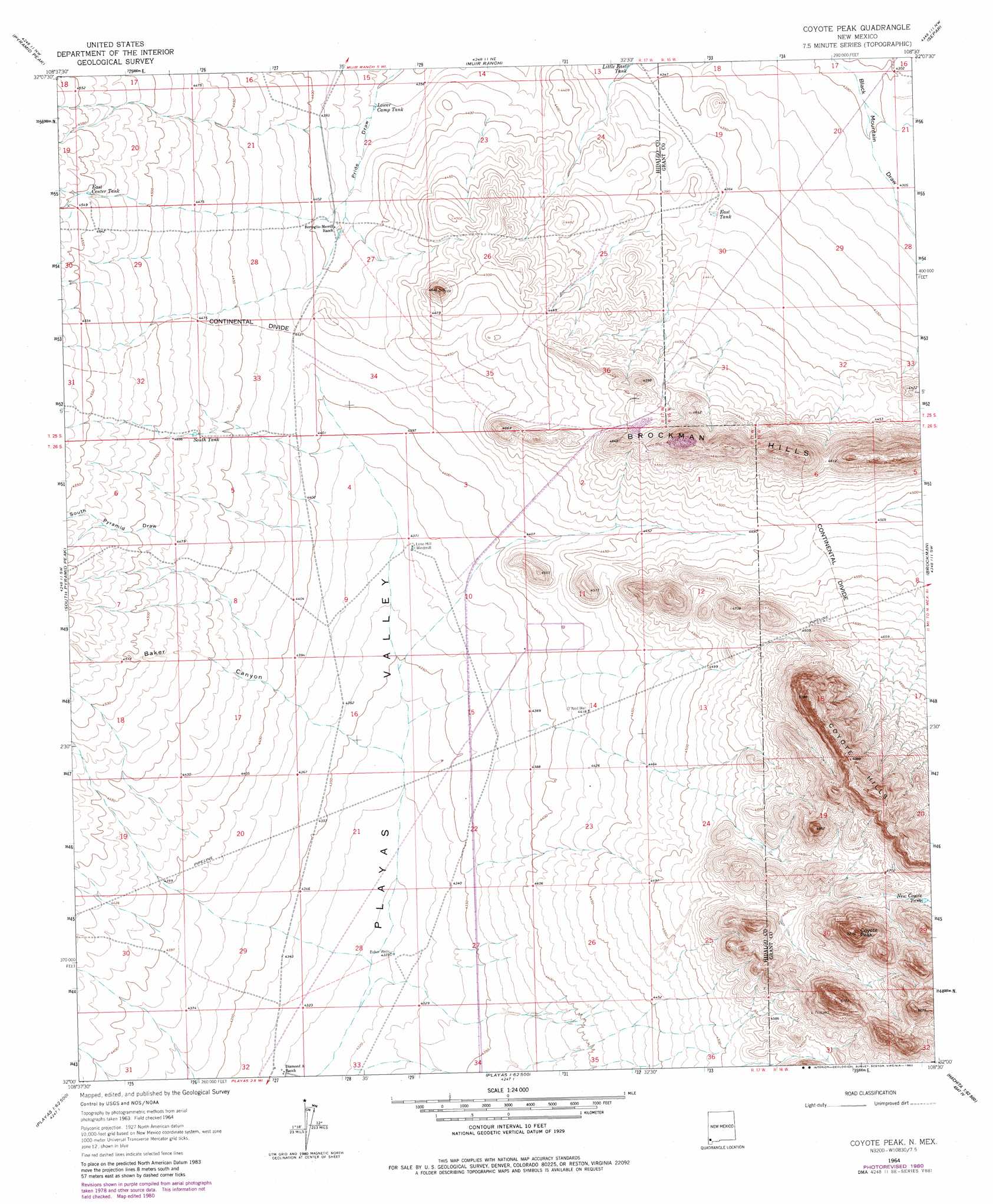
USGS Topo Quad 32108a5 - 1:24,000 scale
| Topo Map Name: | Coyote Peak |
| USGS Topo Quad ID: | 32108a5 |
| Print Size: | ca. 21 1/4" wide x 27" high |
| Southeast Coordinates: | 32° N latitude / 108.5° W longitude |
| Map Center Coordinates: | 32.0625° N latitude / 108.5625° W longitude |
| U.S. State: | NM |
| Filename: | o32108a5.jpg |
| Download Map JPG Image: | Coyote Peak topo map 1:24,000 scale |
| Map Type: | Topographic |
| Topo Series: | 7.5´ |
| Map Scale: | 1:24,000 |
| Source of Map Images: | United States Geological Survey (USGS) |
| Alternate Map Versions: |
Coyote Peak NM 1964, updated 1966 Download PDF Buy paper map Coyote Peak NM 1964, updated 1980 Download PDF Buy paper map Coyote Peak NM 2010 Download PDF Buy paper map Coyote Peak NM 2013 Download PDF Buy paper map Coyote Peak NM 2017 Download PDF Buy paper map |
1:24,000 Topo Quads surrounding Coyote Peak
Gary |
Lordsburg |
Lisbon |
Ninetysix Ranch |
Soldiers Farewell Hill |
Swallow Fork Peak |
Pyramid Peak |
Muir Ranch |
Separ |
Separ Ne |
Table Top Mountain |
South Pyramid Peak |
Coyote Peak |
Brockman |
The Saltys |
Animas |
Beacon Hill |
Playas Lake North |
Playas Peak |
Hachita |
Tank Mountain |
Whitmire Pass |
Playas Lake South |
Hachita Peak |
Doyle Peak |
> Back to 32108a1 at 1:100,000 scale
> Back to 32108a1 at 1:250,000 scale
> Back to U.S. Topo Maps home
Coyote Peak topo map: Gazetteer
Coyote Peak: Mines
Brockman Mine elevation 1423m 4668′Cherrys Mines elevation 1434m 4704′
Forced Issue Mine elevation 1434m 4704′
Hawkins, Kelly, and Butterworth Mine elevation 1434m 4704′
Waldo Mine elevation 1423m 4668′
Coyote Peak: Ranges
Brockman Hills elevation 1467m 4812′Coyote Peak: Reservoirs
East Center Tank elevation 1385m 4543′East Tank elevation 1331m 4366′
Little East Tank elevation 1326m 4350′
Lower Camp Tank elevation 1330m 4363′
New Coyote Tank elevation 1436m 4711′
South Tank elevation 1364m 4475′
Coyote Peak: Summits
Coyote Peak elevation 1580m 5183′Coyote Peak: Valleys
Baker Canyon elevation 1324m 4343′South Pyramid Draw elevation 1330m 4363′
Coyote Peak: Wells
Baker Wells elevation 1318m 4324′Oneil Water Well elevation 1348m 4422′
O'Neil Well elevation 1348m 4422′
Coyote Peak digital topo map on disk
Buy this Coyote Peak topo map showing relief, roads, GPS coordinates and other geographical features, as a high-resolution digital map file on DVD: