Separ Ne Topo Map New Mexico
To zoom in, hover over the map of Separ Ne
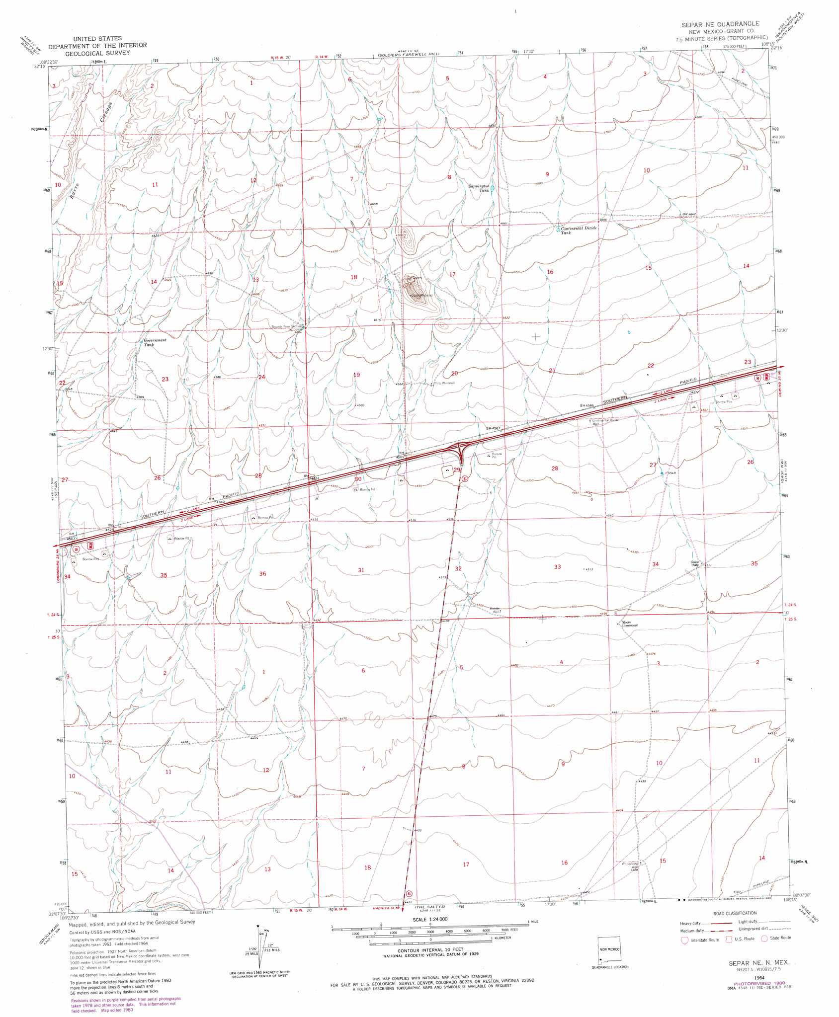
USGS Topo Quad 32108b3 - 1:24,000 scale
| Topo Map Name: | Separ Ne |
| USGS Topo Quad ID: | 32108b3 |
| Print Size: | ca. 21 1/4" wide x 27" high |
| Southeast Coordinates: | 32.125° N latitude / 108.25° W longitude |
| Map Center Coordinates: | 32.1875° N latitude / 108.3125° W longitude |
| U.S. State: | NM |
| Filename: | o32108b3.jpg |
| Download Map JPG Image: | Separ Ne topo map 1:24,000 scale |
| Map Type: | Topographic |
| Topo Series: | 7.5´ |
| Map Scale: | 1:24,000 |
| Source of Map Images: | United States Geological Survey (USGS) |
| Alternate Map Versions: |
Separ NE NM 1964, updated 1966 Download PDF Buy paper map Separ NE NM 1964, updated 1980 Download PDF Buy paper map Separ NE NM 2010 Download PDF Buy paper map Separ NE NM 2013 Download PDF Buy paper map Separ NE NM 2017 Download PDF Buy paper map |
1:24,000 Topo Quads surrounding Separ Ne
Gold Hill |
C Bar Ranch |
Werney Hill |
Cow Springs Mountain |
Antelope Hill |
Lisbon |
Ninetysix Ranch |
Soldiers Farewell Hill |
Grandmother Mountain West |
Grandmother Mountain East |
Muir Ranch |
Separ |
Separ Ne |
Gage Nw |
Gage |
Coyote Peak |
Brockman |
The Saltys |
Gage Sw |
Gage Se |
Playas Lake North |
Playas Peak |
Hachita |
Hat Top Mountain |
Flying W Mountain |
> Back to 32108a1 at 1:100,000 scale
> Back to 32108a1 at 1:250,000 scale
> Back to U.S. Topo Maps home
Separ Ne topo map: Gazetteer
Separ Ne: Parks
Basin and Range Country Historical Marker elevation 1391m 4563′Cookes Wagon Road Historical Marker elevation 1391m 4563′
Yucca Plains Historical Marker elevation 1391m 4563′
Separ Ne: Populated Places
Guess Place elevation 1376m 4514′Separ Ne: Reservoirs
Continental Divide Tank elevation 1421m 4662′Government Tank elevation 1400m 4593′
Sappington Tank elevation 1424m 4671′
Separ Ne: Wells
Continental Divide Well elevation 1397m 4583′Highway Water Well elevation 1383m 4537′
Middle Well elevation 1372m 4501′
Whitteburg Well elevation 1350m 4429′
Separ Ne digital topo map on disk
Buy this Separ Ne topo map showing relief, roads, GPS coordinates and other geographical features, as a high-resolution digital map file on DVD: