Ninetysix Ranch Topo Map New Mexico
To zoom in, hover over the map of Ninetysix Ranch
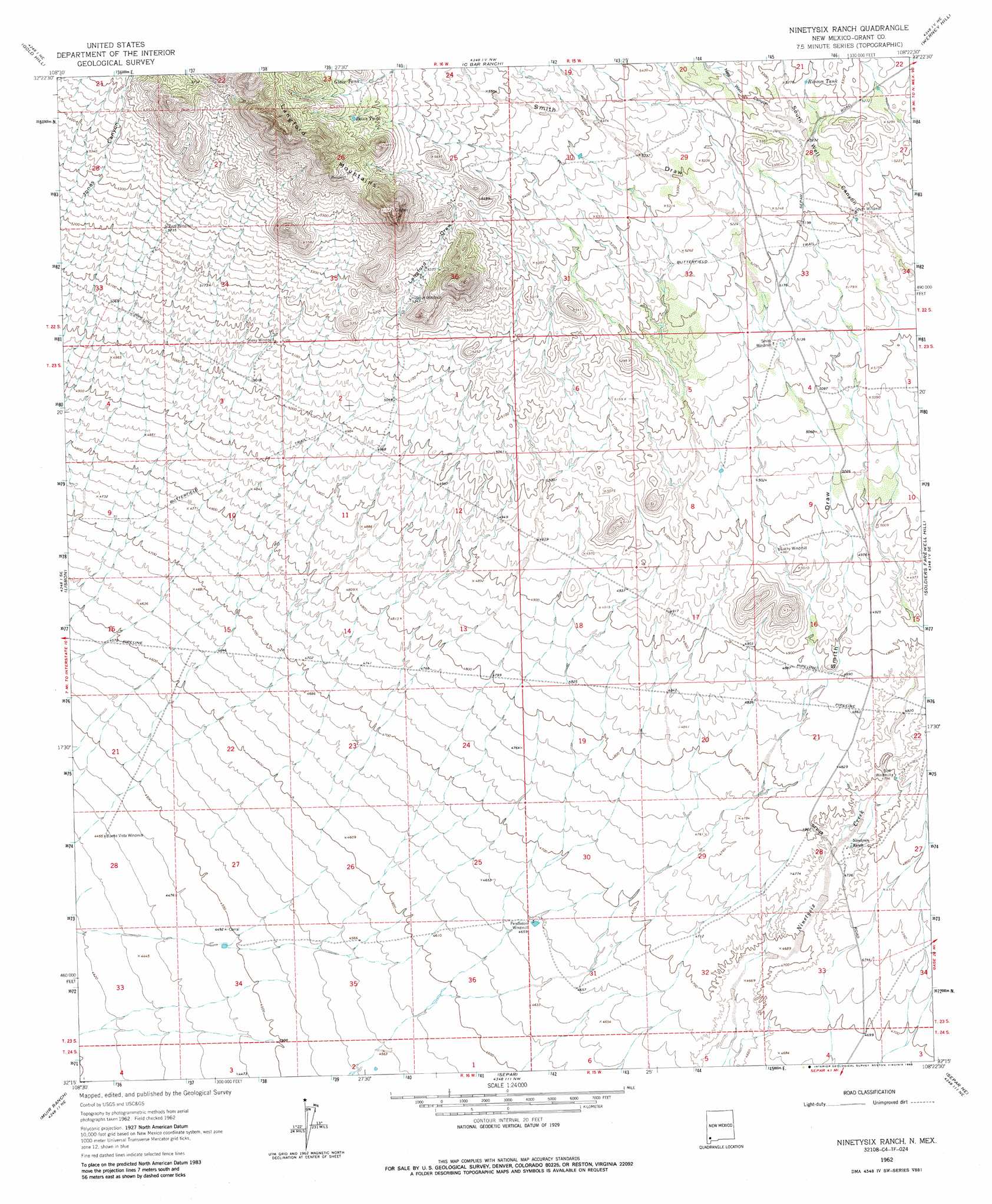
USGS Topo Quad 32108c4 - 1:24,000 scale
| Topo Map Name: | Ninetysix Ranch |
| USGS Topo Quad ID: | 32108c4 |
| Print Size: | ca. 21 1/4" wide x 27" high |
| Southeast Coordinates: | 32.25° N latitude / 108.375° W longitude |
| Map Center Coordinates: | 32.3125° N latitude / 108.4375° W longitude |
| U.S. State: | NM |
| Filename: | o32108c4.jpg |
| Download Map JPG Image: | Ninetysix Ranch topo map 1:24,000 scale |
| Map Type: | Topographic |
| Topo Series: | 7.5´ |
| Map Scale: | 1:24,000 |
| Source of Map Images: | United States Geological Survey (USGS) |
| Alternate Map Versions: |
Ninetysix Ranch NM 1962, updated 1965 Download PDF Buy paper map Ninetysix Ranch NM 1962, updated 1986 Download PDF Buy paper map Ninetysix Ranch NM 2010 Download PDF Buy paper map Ninetysix Ranch NM 2013 Download PDF Buy paper map Ninetysix Ranch NM 2017 Download PDF Buy paper map |
1:24,000 Topo Quads surrounding Ninetysix Ranch
Willow Draw |
Eagle Eye Peak |
Burro Peak |
White Signal |
Whitewater |
Culberson Ranch |
Gold Hill |
C Bar Ranch |
Werney Hill |
Cow Springs Mountain |
Lordsburg |
Lisbon |
Ninetysix Ranch |
Soldiers Farewell Hill |
Grandmother Mountain West |
Pyramid Peak |
Muir Ranch |
Separ |
Separ Ne |
Gage Nw |
South Pyramid Peak |
Coyote Peak |
Brockman |
The Saltys |
Gage Sw |
> Back to 32108a1 at 1:100,000 scale
> Back to 32108a1 at 1:250,000 scale
> Back to U.S. Topo Maps home
Ninetysix Ranch topo map: Gazetteer
Ninetysix Ranch: Ranges
Langford Mountains elevation 1879m 6164′Ninetysix Ranch: Reservoirs
Dons Tank elevation 1753m 5751′Glaze Tank elevation 1747m 5731′
Little Tank elevation 1582m 5190′
Rincon Tank elevation 1614m 5295′
Ninetysix Ranch: Valleys
Langford Draw elevation 1587m 5206′New Well Canyon elevation 1604m 5262′
Smith Draw elevation 1457m 4780′
Ninetysix Ranch: Wells
10180 Water Well elevation 1457m 4780′10181 Water Well elevation 1420m 4658′
10182 Water Well elevation 1359m 4458′
Ninetysix Ranch digital topo map on disk
Buy this Ninetysix Ranch topo map showing relief, roads, GPS coordinates and other geographical features, as a high-resolution digital map file on DVD: