Summit Topo Map New Mexico
To zoom in, hover over the map of Summit
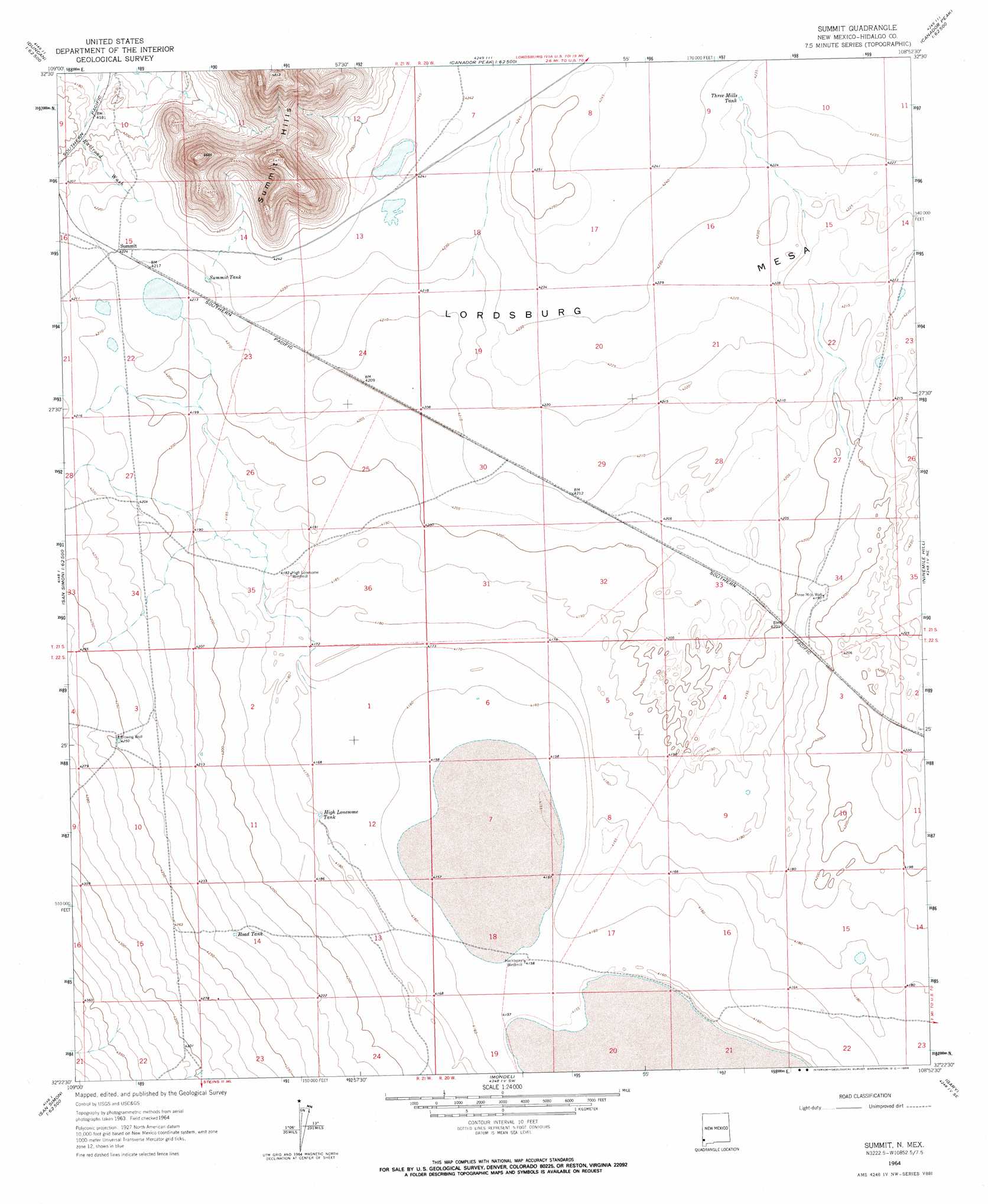
USGS Topo Quad 32108d8 - 1:24,000 scale
| Topo Map Name: | Summit |
| USGS Topo Quad ID: | 32108d8 |
| Print Size: | ca. 21 1/4" wide x 27" high |
| Southeast Coordinates: | 32.375° N latitude / 108.875° W longitude |
| Map Center Coordinates: | 32.4375° N latitude / 108.9375° W longitude |
| U.S. State: | NM |
| Filename: | o32108d8.jpg |
| Download Map JPG Image: | Summit topo map 1:24,000 scale |
| Map Type: | Topographic |
| Topo Series: | 7.5´ |
| Map Scale: | 1:24,000 |
| Source of Map Images: | United States Geological Survey (USGS) |
| Alternate Map Versions: |
Summit NM 1964, updated 1966 Download PDF Buy paper map Summit NM 2010 Download PDF Buy paper map Summit NM 2013 Download PDF Buy paper map Summit NM 2017 Download PDF Buy paper map |
1:24,000 Topo Quads surrounding Summit
Hot Well |
Duncan |
Canador Peak |
Nichols Canyon |
Redrock |
Whitlock Peak |
Round Mountain |
Rock Tank Draw |
Caprock Mountain |
Willow Draw |
Orange Butte |
Engine Mountain |
Summit |
Ninemile Hill |
Culberson Ranch |
San Simon |
Doubtful Mountain |
Mondel |
Gary |
Lordsburg |
Vanar Nw |
Vanar |
Steins |
Swallow Fork Peak |
Pyramid Peak |
> Back to 32108a1 at 1:100,000 scale
> Back to 32108a1 at 1:250,000 scale
> Back to U.S. Topo Maps home
Summit topo map: Gazetteer
Summit: Reservoirs
High Lonesome Tank elevation 1272m 4173′Road Tank elevation 1290m 4232′
Summit Tank elevation 1287m 4222′
Three Mills Tank elevation 1290m 4232′
Summit: Valleys
Animas Valley elevation 1288m 4225′Summit: Wells
3 Mills Water Well elevation 1284m 4212′Blowing Well elevation 1296m 4251′
Three Mills Well elevation 1278m 4192′
Summit digital topo map on disk
Buy this Summit topo map showing relief, roads, GPS coordinates and other geographical features, as a high-resolution digital map file on DVD: