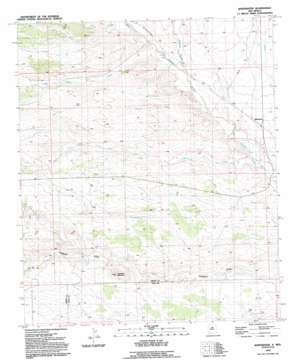
Whitewater Topo Map New Mexico
To zoom in, hover over the map of Whitewater
USGS Topo Quad 32108e2 - 1:24,000 scale
| Topo Map Name: | Whitewater |
| USGS Topo Quad ID: | 32108e2 |
| Print Size: | ca. 21 1/4" wide x 27" high |
| Southeast Coordinates: | 32.5° N latitude / 108.125° W longitude |
| Map Center Coordinates: | 32.5625° N latitude / 108.1875° W longitude |
| U.S. State: | NM |
| Filename: | o32108e2.jpg |
| Download Map JPG Image: | Whitewater topo map 1:24,000 scale |
| Map Type: | Topographic |
| Topo Series: | 7.5´ |
| Map Scale: | 1:24,000 |
| Source of Map Images: | United States Geological Survey (USGS) |
| Alternate Map Versions: |
Whitewater NM 1949 Download PDF Buy paper map Whitewater NM 1949, updated 1976 Download PDF Buy paper map Whitewater NM 1992, updated 1992 Download PDF Buy paper map Whitewater NM 2010 Download PDF Buy paper map Whitewater NM 2013 Download PDF Buy paper map Whitewater NM 2017 Download PDF Buy paper map |
1:24,000 Topo Quads surrounding Whitewater
> Back to 32108e1 at 1:100,000 scale
> Back to 32108a1 at 1:250,000 scale
> Back to U.S. Topo Maps home
Whitewater topo map: Gazetteer
Whitewater: Populated Places
Whitewater elevation 1572m 5157′Whitewater: Post Offices
Whitewater Post Office (historical) elevation 1572m 5157′Whitewater: Streams
Cameron Creek elevation 1576m 5170′Cherry Creek elevation 1545m 5068′
Oak Grove Creek elevation 1592m 5223′
Whitewater: Summits
Hogback Mountain elevation 1697m 5567′Whitewater: Wells
00781 Water Well elevation 1598m 5242′00942 Water Well elevation 1575m 5167′
00945 Water Well elevation 1623m 5324′
00947 Water Well elevation 1592m 5223′
00949 Water Well elevation 1566m 5137′
08898 Water Well elevation 1542m 5059′
Cherry Creek Water Well elevation 1654m 5426′
G 940 Water Well elevation 1669m 5475′
G 943 Water Well elevation 1619m 5311′
Whitewater digital topo map on disk
Buy this Whitewater topo map showing relief, roads, GPS coordinates and other geographical features, as a high-resolution digital map file on DVD:


