Cochise Topo Map Arizona
To zoom in, hover over the map of Cochise
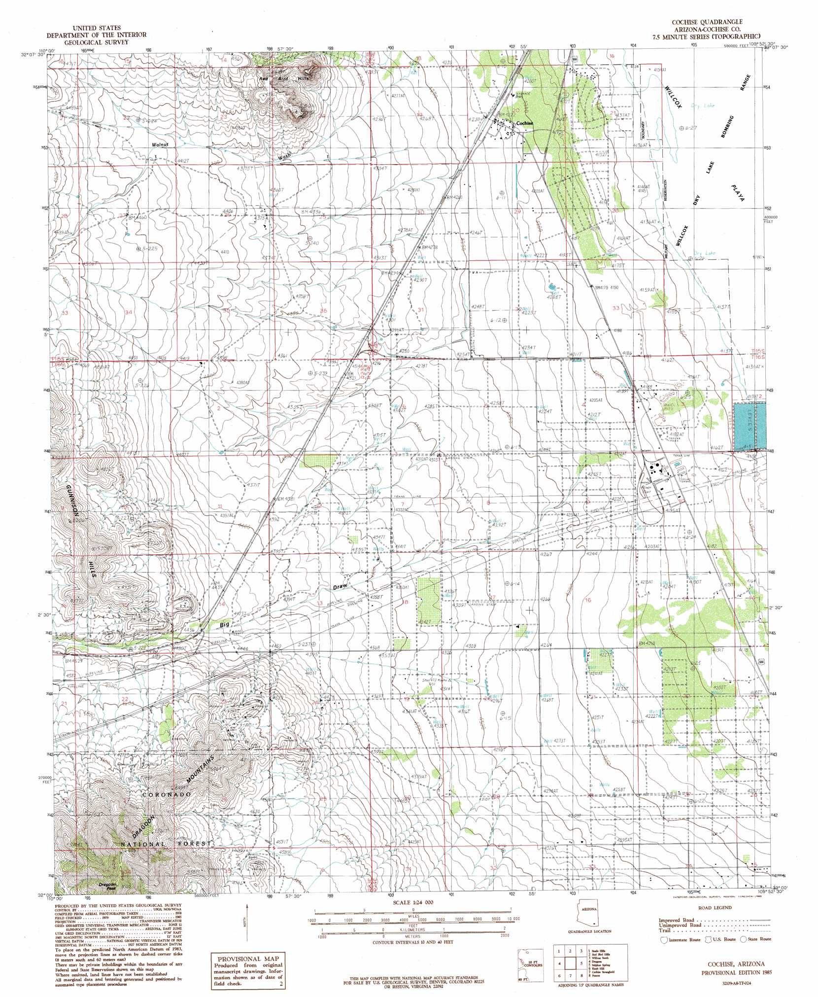
USGS Topo Quad 32109a8 - 1:24,000 scale
| Topo Map Name: | Cochise |
| USGS Topo Quad ID: | 32109a8 |
| Print Size: | ca. 21 1/4" wide x 27" high |
| Southeast Coordinates: | 32° N latitude / 109.875° W longitude |
| Map Center Coordinates: | 32.0625° N latitude / 109.9375° W longitude |
| U.S. State: | AZ |
| Filename: | o32109a8.jpg |
| Download Map JPG Image: | Cochise topo map 1:24,000 scale |
| Map Type: | Topographic |
| Topo Series: | 7.5´ |
| Map Scale: | 1:24,000 |
| Source of Map Images: | United States Geological Survey (USGS) |
| Alternate Map Versions: |
Cochise AZ 1985, updated 1985 Download PDF Buy paper map Cochise AZ 1985, updated 1985 Download PDF Buy paper map Cochise AZ 2012 Download PDF Buy paper map Cochise AZ 2014 Download PDF Buy paper map |
| FStopo: | US Forest Service topo Cochise is available: Download FStopo PDF Download FStopo TIF |
1:24,000 Topo Quads surrounding Cochise
Hookers Hot Springs |
Muskhog Mountain |
Square Mountain |
Willcox North |
Railroad Pass |
Deepwell Ranch |
Steele Hills |
Red Bird Hills |
Willcox South |
Simmons Peak |
San Pedro Ranch |
Dragoon |
Cochise |
Sulphur Spring |
Dos Cabezas Sw |
Saint David |
Knob Hill |
Cochise Stronghold |
Pearce |
Sulphur Hills |
Land |
Haberstock Hill |
Black Diamond Peak |
Turquoise Mountain |
Squaretop Hills West |
> Back to 32109a1 at 1:100,000 scale
> Back to 32108a1 at 1:250,000 scale
> Back to U.S. Topo Maps home
Cochise topo map: Gazetteer
Cochise: Airports
Ammon Airport elevation 1371m 4498′Cochise: Mines
Golden Rule Mine elevation 1401m 4596′Cochise: Populated Places
Cochise elevation 1287m 4222′Manzoro elevation 1353m 4438′
Cochise: Post Offices
Cochise Post Office elevation 1286m 4219′Cochise: Streams
Walnut Wash elevation 1306m 4284′Cochise: Summits
Dragoon Peak elevation 1963m 6440′Cochise: Valleys
Big Draw elevation 1299m 4261′Cochise digital topo map on disk
Buy this Cochise topo map showing relief, roads, GPS coordinates and other geographical features, as a high-resolution digital map file on DVD: