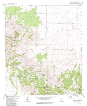
Bowie Mountain North Topo Map Arizona
To zoom in, hover over the map of Bowie Mountain North
USGS Topo Quad 32109b4 - 1:24,000 scale
| Topo Map Name: | Bowie Mountain North |
| USGS Topo Quad ID: | 32109b4 |
| Print Size: | ca. 21 1/4" wide x 27" high |
| Southeast Coordinates: | 32.125° N latitude / 109.375° W longitude |
| Map Center Coordinates: | 32.1875° N latitude / 109.4375° W longitude |
| U.S. State: | AZ |
| Filename: | o32109b4.jpg |
| Download Map JPG Image: | Bowie Mountain North topo map 1:24,000 scale |
| Map Type: | Topographic |
| Topo Series: | 7.5´ |
| Map Scale: | 1:24,000 |
| Source of Map Images: | United States Geological Survey (USGS) |
| Alternate Map Versions: |
Bowie Mtn North AZ 1979, updated 1979 Download PDF Buy paper map Bowie Mtn North AZ 1979, updated 1981 Download PDF Buy paper map Bowie Mountain North AZ 1996, updated 2002 Download PDF Buy paper map Bowie Mountain North AZ 2012 Download PDF Buy paper map Bowie Mountain North AZ 2014 Download PDF Buy paper map |
| FStopo: | US Forest Service topo Bowie Mountain North is available: Download FStopo PDF Download FStopo TIF |
1:24,000 Topo Quads surrounding Bowie Mountain North
> Back to 32109a1 at 1:100,000 scale
> Back to 32108a1 at 1:250,000 scale
> Back to U.S. Topo Maps home
Bowie Mountain North topo map: Gazetteer
Bowie Mountain North: Gaps
Apache Pass elevation 1558m 5111′Bowie Mountain North: Mines
Silverstrike Mine elevation 1627m 5337′Bowie Mountain North: Parks
Fort Bowie National Historic Site elevation 1463m 4799′Bowie Mountain North: Pillars
Tevs Rocks elevation 1409m 4622′Bowie Mountain North: Reservoirs
Dickson Tank elevation 1201m 3940′Maggie Tank elevation 1222m 4009′
Pass Tank elevation 1533m 5029′
Red Tank elevation 1333m 4373′
Bowie Mountain North: Ridges
Overlook Ridge elevation 1564m 5131′Bowie Mountain North: Springs
Apache Spring elevation 1491m 4891′Bear Spring elevation 1535m 5036′
Goodwin Spring elevation 1365m 4478′
Sheep Canyon Spring elevation 0m 0′
Silverstrike Spring elevation 1549m 5082′
Bowie Mountain North: Streams
Ninemile Creek elevation 1218m 3996′Bowie Mountain North: Summits
Emigrant Hills elevation 1355m 4445′Helens Dome elevation 1940m 6364′
Bowie Mountain North: Valleys
Bear Gulch elevation 1391m 4563′Cutoff Canyon elevation 1386m 4547′
Emigrant Canyon elevation 1329m 4360′
Goodwin Canyon elevation 1328m 4356′
Little Emigrant Canyon elevation 1324m 4343′
Long Canyon elevation 1341m 4399′
Sheep Canyon elevation 0m 0′
Siphon Canyon elevation 1359m 4458′
Willow Gulch Canyon elevation 1389m 4557′
Wood Canyon elevation 1509m 4950′
Bowie Mountain North: Wells
Quillian Well elevation 1538m 5045′Whitehouse Well elevation 1230m 4035′
Bowie Mountain North digital topo map on disk
Buy this Bowie Mountain North topo map showing relief, roads, GPS coordinates and other geographical features, as a high-resolution digital map file on DVD:


