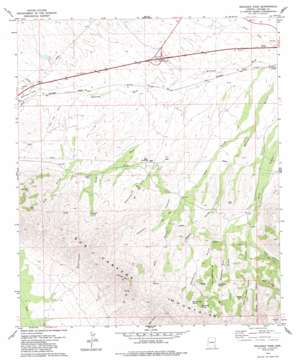
Railroad Pass Topo Map Arizona
To zoom in, hover over the map of Railroad Pass
USGS Topo Quad 32109c6 - 1:24,000 scale
| Topo Map Name: | Railroad Pass |
| USGS Topo Quad ID: | 32109c6 |
| Print Size: | ca. 21 1/4" wide x 27" high |
| Southeast Coordinates: | 32.25° N latitude / 109.625° W longitude |
| Map Center Coordinates: | 32.3125° N latitude / 109.6875° W longitude |
| U.S. State: | AZ |
| Filename: | o32109c6.jpg |
| Download Map JPG Image: | Railroad Pass topo map 1:24,000 scale |
| Map Type: | Topographic |
| Topo Series: | 7.5´ |
| Map Scale: | 1:24,000 |
| Source of Map Images: | United States Geological Survey (USGS) |
| Alternate Map Versions: |
Railroad Pass AZ 1979, updated 1979 Download PDF Buy paper map Railroad Pass AZ 1979, updated 1985 Download PDF Buy paper map Railroad Pass AZ 2011 Download PDF Buy paper map Railroad Pass AZ 2014 Download PDF Buy paper map |
1:24,000 Topo Quads surrounding Railroad Pass
> Back to 32109a1 at 1:100,000 scale
> Back to 32108a1 at 1:250,000 scale
> Back to U.S. Topo Maps home
Railroad Pass topo map: Gazetteer
Railroad Pass: Arroyos
Seventysix Gulch elevation 1415m 4642′Railroad Pass: Crossings
Safford Interchange elevation 0m 0′Railroad Pass: Gaps
Railroad Pass elevation 1342m 4402′Railroad Pass: Populated Places
Bowie Junction (historical) elevation 1232m 4041′Luzena elevation 1225m 4019′
Railroad Pass: Springs
Blue Ledge Spring elevation 1548m 5078′Minnie Nash Spring elevation 1541m 5055′
Seventysix Spring elevation 0m 0′
Railroad Pass: Streams
Smith Wash elevation 1272m 4173′Railroad Pass: Summits
Camels Back elevation 1917m 6289′Railroad Pass: Valleys
Ash Gulch elevation 1268m 4160′California Gulch elevation 1361m 4465′
California Gulch elevation 1361m 4465′
Cowboy Canyon elevation 1265m 4150′
East Canyon elevation 1366m 4481′
East Polecat Canyon elevation 1418m 4652′
Hay Flat Draw elevation 1318m 4324′
Little California Gulch elevation 1410m 4625′
Middle Polecat Canyon elevation 1403m 4603′
Misenhimer Draw elevation 1322m 4337′
Polecat Canyon elevation 1341m 4399′
Smith Canyon elevation 1293m 4242′
West Polecat Canyon elevation 1403m 4603′
Zeits Canyon elevation 1402m 4599′
Railroad Pass digital topo map on disk
Buy this Railroad Pass topo map showing relief, roads, GPS coordinates and other geographical features, as a high-resolution digital map file on DVD:


