Square Mountain Topo Map Arizona
To zoom in, hover over the map of Square Mountain
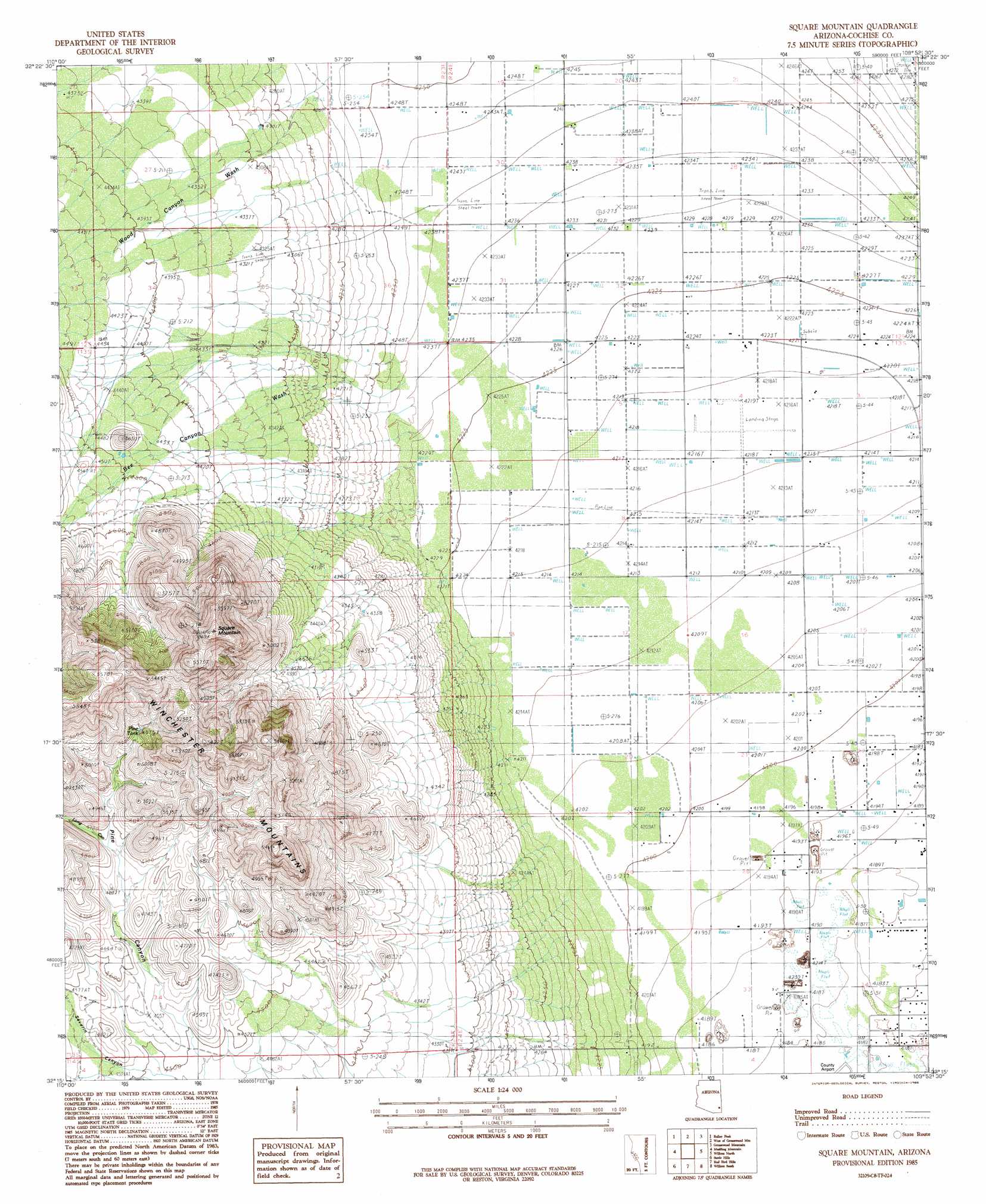
USGS Topo Quad 32109c8 - 1:24,000 scale
| Topo Map Name: | Square Mountain |
| USGS Topo Quad ID: | 32109c8 |
| Print Size: | ca. 21 1/4" wide x 27" high |
| Southeast Coordinates: | 32.25° N latitude / 109.875° W longitude |
| Map Center Coordinates: | 32.3125° N latitude / 109.9375° W longitude |
| U.S. State: | AZ |
| Filename: | o32109c8.jpg |
| Download Map JPG Image: | Square Mountain topo map 1:24,000 scale |
| Map Type: | Topographic |
| Topo Series: | 7.5´ |
| Map Scale: | 1:24,000 |
| Source of Map Images: | United States Geological Survey (USGS) |
| Alternate Map Versions: |
Square Mountain AZ 1985, updated 1985 Download PDF Buy paper map Square Mountain AZ 1996, updated 2002 Download PDF Buy paper map Square Mountain AZ 2011 Download PDF Buy paper map Square Mountain AZ 2014 Download PDF Buy paper map |
1:24,000 Topo Quads surrounding Square Mountain
Harrison Canyon |
Sierra Bonita Ranch |
Fort Grant |
Stockton Pass |
Gillespie Mountain |
The Mesas |
Reiley Peak |
West Of Greasewood Mountain |
Greasewood Mountain |
Monk Draw |
Hookers Hot Springs |
Muskhog Mountain |
Square Mountain |
Willcox North |
Railroad Pass |
Deepwell Ranch |
Steele Hills |
Red Bird Hills |
Willcox South |
Simmons Peak |
San Pedro Ranch |
Dragoon |
Cochise |
Sulphur Spring |
Dos Cabezas Sw |
> Back to 32109a1 at 1:100,000 scale
> Back to 32108a1 at 1:250,000 scale
> Back to U.S. Topo Maps home
Square Mountain topo map: Gazetteer
Square Mountain: Reservoirs
Pine Tank elevation 1501m 4924′Square Mountain: Streams
Bee Canyon Wash elevation 1296m 4251′Wood Canyon Wash elevation 1308m 4291′
Square Mountain: Summits
Square Mountain elevation 1723m 5652′Square Mountain: Valleys
Bee Canyon elevation 1296m 4251′Long Canyon elevation 1426m 4678′
Pine Canyon elevation 1369m 4491′
Severin Canyon elevation 0m 0′
Square Mountain digital topo map on disk
Buy this Square Mountain topo map showing relief, roads, GPS coordinates and other geographical features, as a high-resolution digital map file on DVD: