Ryan Draw Topo Map Arizona
To zoom in, hover over the map of Ryan Draw
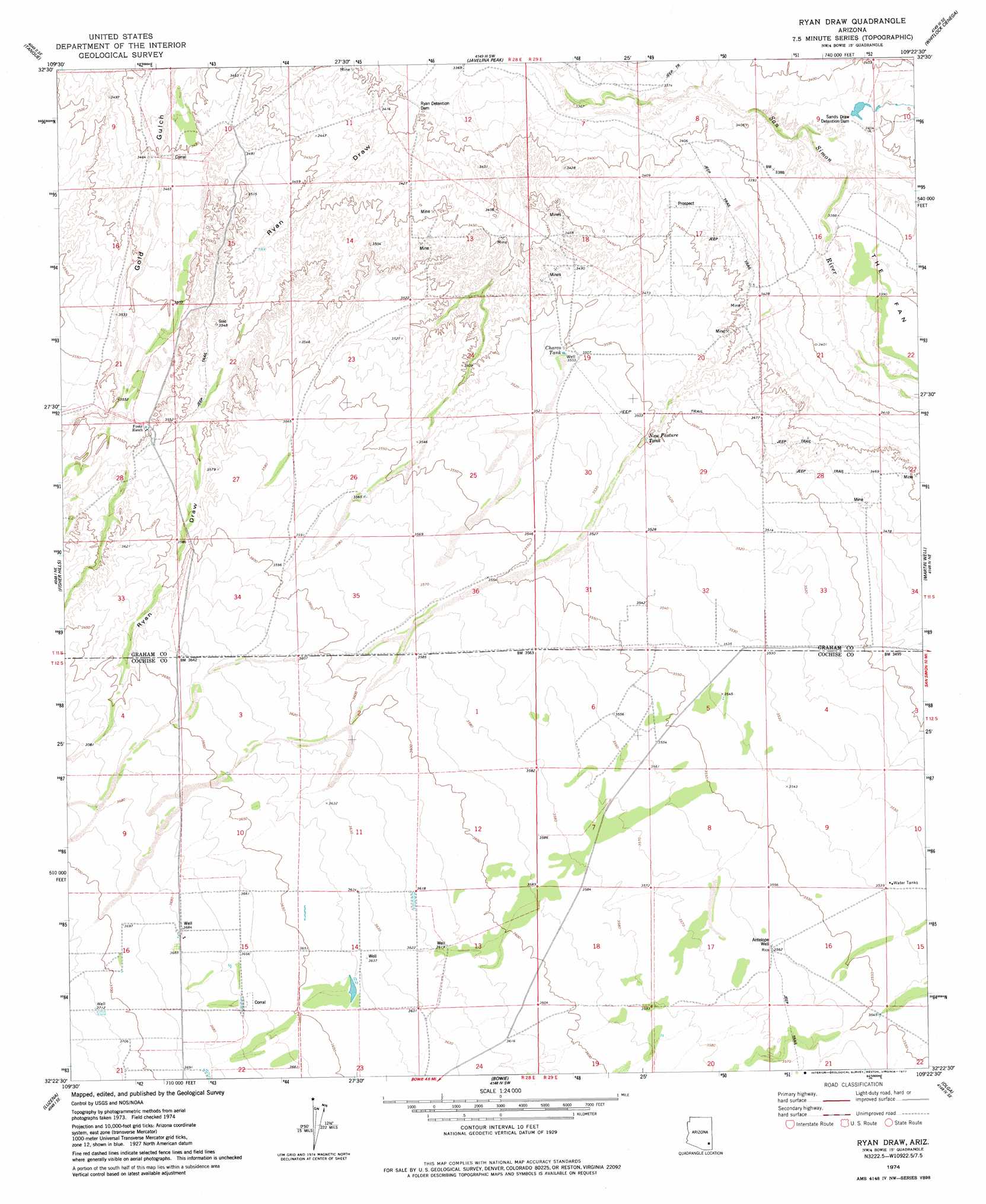
USGS Topo Quad 32109d4 - 1:24,000 scale
| Topo Map Name: | Ryan Draw |
| USGS Topo Quad ID: | 32109d4 |
| Print Size: | ca. 21 1/4" wide x 27" high |
| Southeast Coordinates: | 32.375° N latitude / 109.375° W longitude |
| Map Center Coordinates: | 32.4375° N latitude / 109.4375° W longitude |
| U.S. State: | AZ |
| Filename: | o32109d4.jpg |
| Download Map JPG Image: | Ryan Draw topo map 1:24,000 scale |
| Map Type: | Topographic |
| Topo Series: | 7.5´ |
| Map Scale: | 1:24,000 |
| Source of Map Images: | United States Geological Survey (USGS) |
| Alternate Map Versions: |
Ryan Draw AZ 1974, updated 1977 Download PDF Buy paper map Ryan Draw AZ 2011 Download PDF Buy paper map Ryan Draw AZ 2014 Download PDF Buy paper map |
1:24,000 Topo Quads surrounding Ryan Draw
Artesia |
Artesia Ne |
Dry Mountain |
Whitlock Mountains Ne |
Hot Well |
Gillespie Mountain |
Tanque |
Javelina Peak |
Whitlock Cienega |
Whitlock Peak |
Monk Draw |
Fisher Hills |
Ryan Draw |
Martin Well |
Orange Butte |
Railroad Pass |
Luzena |
Bowie |
Olga |
San Simon |
Simmons Peak |
Dos Cabezas |
Bowie Mountain North |
Little Wood Canyon |
Vanar Nw |
> Back to 32109a1 at 1:100,000 scale
> Back to 32108a1 at 1:250,000 scale
> Back to U.S. Topo Maps home
Ryan Draw topo map: Gazetteer
Ryan Draw: Dams
Ryan Detention Dam elevation 0m 0′Sands Draw Detention Dam elevation 0m 0′
Ryan Draw: Reservoirs
Charco Tank elevation 1068m 3503′New Pasture Tank elevation 1067m 3500′
Ryan Draw: Wells
Antelope Well elevation 1086m 3562′New Pasture Well elevation 1081m 3546′
Ryan Draw digital topo map on disk
Buy this Ryan Draw topo map showing relief, roads, GPS coordinates and other geographical features, as a high-resolution digital map file on DVD: