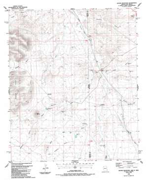
Round Mountain Topo Map Arizona
To zoom in, hover over the map of Round Mountain
USGS Topo Quad 32109e1 - 1:24,000 scale
| Topo Map Name: | Round Mountain |
| USGS Topo Quad ID: | 32109e1 |
| Print Size: | ca. 21 1/4" wide x 27" high |
| Southeast Coordinates: | 32.5° N latitude / 109° W longitude |
| Map Center Coordinates: | 32.5625° N latitude / 109.0625° W longitude |
| U.S. States: | AZ, NM |
| Filename: | o32109e1.jpg |
| Download Map JPG Image: | Round Mountain topo map 1:24,000 scale |
| Map Type: | Topographic |
| Topo Series: | 7.5´ |
| Map Scale: | 1:24,000 |
| Source of Map Images: | United States Geological Survey (USGS) |
| Alternate Map Versions: |
Round Mountain AZ 1986, updated 1987 Download PDF Buy paper map Round Mountain AZ 2010 Download PDF Buy paper map Round Mountain AZ 2011 Download PDF Buy paper map Round Mountain AZ 2014 Download PDF Buy paper map |
1:24,000 Topo Quads surrounding Round Mountain
> Back to 32109e1 at 1:100,000 scale
> Back to 32108a1 at 1:250,000 scale
> Back to U.S. Topo Maps home
Round Mountain topo map: Gazetteer
Round Mountain: Airports
Lazy B Ranch Airstrip elevation 1261m 4137′Round Mountain: Dams
Antelope Dam elevation 1250m 4101′Antelope Draw Dention Dam elevation 1249m 4097′
Dagger Dam Number 1 elevation 1214m 3982′
Dagger Dam Number 2 elevation 1234m 4048′
Dagger Dam Number 3 elevation 1234m 4048′
Dagger Draw Detention Dam elevation 1218m 3996′
Dagger Draw Detention Number Two Dam elevation 1234m 4048′
Grayhorse Dam elevation 1249m 4097′
Horseshoe Terrace Dam elevation 1225m 4019′
Horseshoe Terrace Detention Dam elevation 1227m 4025′
Olney Dam elevation 1262m 4140′
Round Mountain Dam Number 3 elevation 1207m 3959′
Round Mountain Dam Number Two elevation 0m 0′
Stanford Dam Number 1 elevation 1237m 4058′
Stateline Dam elevation 1244m 4081′
Twin Dam elevation 1256m 4120′
Round Mountain: Streams
Horseshoe Wash elevation 1215m 3986′Round Mountain: Summits
Round Mountain elevation 0m 0′Round Mountain: Valleys
Antelope Canyon elevation 1254m 4114′Antelope Canyon elevation 1254m 4114′
Dagger Draw elevation 1208m 3963′
Gillispie Canyon elevation 1301m 4268′
Grayhorse Canyon elevation 1272m 4173′
Little Grayhorse Canyon elevation 1255m 4117′
Olney Well Draw elevation 1231m 4038′
Olney Well Draw elevation 1230m 4035′
Round Mountain Draw elevation 0m 0′
Stanford Draw elevation 1216m 3989′
Thompson Draw elevation 1179m 3868′
Thompson Draw elevation 1178m 3864′
Round Mountain: Wells
Railroad Well elevation 1211m 3973′Round Mountain digital topo map on disk
Buy this Round Mountain topo map showing relief, roads, GPS coordinates and other geographical features, as a high-resolution digital map file on DVD:


