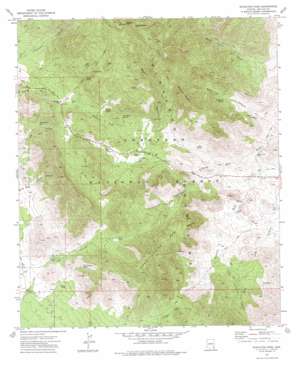
Stockton Pass Topo Map Arizona
To zoom in, hover over the map of Stockton Pass
USGS Topo Quad 32109e7 - 1:24,000 scale
| Topo Map Name: | Stockton Pass |
| USGS Topo Quad ID: | 32109e7 |
| Print Size: | ca. 21 1/4" wide x 27" high |
| Southeast Coordinates: | 32.5° N latitude / 109.75° W longitude |
| Map Center Coordinates: | 32.5625° N latitude / 109.8125° W longitude |
| U.S. State: | AZ |
| Filename: | o32109e7.jpg |
| Download Map JPG Image: | Stockton Pass topo map 1:24,000 scale |
| Map Type: | Topographic |
| Topo Series: | 7.5´ |
| Map Scale: | 1:24,000 |
| Source of Map Images: | United States Geological Survey (USGS) |
| Alternate Map Versions: |
Stockton Pass AZ 1972, updated 1975 Download PDF Buy paper map Stockton Pass AZ 1996, updated 2002 Download PDF Buy paper map Stockton Pass AZ 2011 Download PDF Buy paper map Stockton Pass AZ 2014 Download PDF Buy paper map |
| FStopo: | US Forest Service topo Stockton Pass is available: Download FStopo PDF Download FStopo TIF |
1:24,000 Topo Quads surrounding Stockton Pass
> Back to 32109e1 at 1:100,000 scale
> Back to 32108a1 at 1:250,000 scale
> Back to U.S. Topo Maps home
Stockton Pass topo map: Gazetteer
Stockton Pass: Arroyos
C N Wash elevation 1477m 4845′Stockton Pass: Dams
Righthand Dam elevation 1354m 4442′Stockton Pass: Gaps
Ladybug Saddle elevation 2606m 8549′Stockton Pass elevation 1725m 5659′
Stockton Pass: Reservoirs
Bar X Tank elevation 1676m 5498′Bar X Trick Tank elevation 1696m 5564′
Corner Tank elevation 1517m 4977′
Hog Canyon Tank elevation 1612m 5288′
Jernigan Trick Tank elevation 1577m 5173′
O Bar O Tank elevation 1609m 5278′
Stockton Pass: Springs
Alder Spring elevation 2071m 6794′Bootlegger Spring elevation 1971m 6466′
C N Seep elevation 1620m 5314′
Cove Spring elevation 1667m 5469′
Half Moon Spring elevation 1618m 5308′
Hidden Spring elevation 1664m 5459′
Hog Spring elevation 1582m 5190′
Kane Spring elevation 1712m 5616′
Mash Barrel Spring elevation 1587m 5206′
Righthand Spring elevation 1536m 5039′
Rock Spring elevation 1497m 4911′
Shake Spring elevation 0m 0′
Trap Spring elevation 2021m 6630′
Stockton Pass: Streams
Gillespie Wash elevation 1303m 4274′Stockton Pass: Summits
Kane Spring Mountain elevation 2099m 6886′Ladybug Peak elevation 2656m 8713′
Maverick Mountain elevation 2161m 7089′
Stockton Pass: Trails
Bear Canyon Two hundred ninety-nine Trail elevation 2139m 7017′Dutch Henry Two hundred ninety seven Trail elevation 1629m 5344′
Stockton Pass: Valleys
Bar X Canyon elevation 1499m 4917′Bear Canyon elevation 1621m 5318′
Cove Canyon elevation 1425m 4675′
Hog Canyon elevation 1335m 4379′
Little Cottonwood Canyon elevation 1428m 4685′
Martin Canyon elevation 1584m 5196′
Stockton Pass: Wells
Gillespie Well elevation 1300m 4265′Stockton Pass digital topo map on disk
Buy this Stockton Pass topo map showing relief, roads, GPS coordinates and other geographical features, as a high-resolution digital map file on DVD:


