Artesia Ne Topo Map Arizona
To zoom in, hover over the map of Artesia Ne
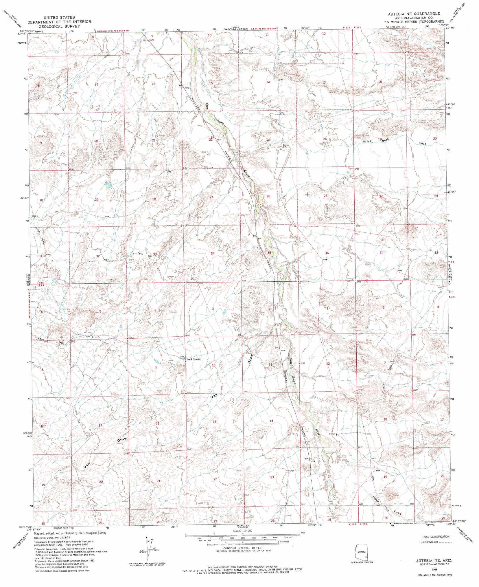
USGS Topo Quad 32109f5 - 1:24,000 scale
| Topo Map Name: | Artesia Ne |
| USGS Topo Quad ID: | 32109f5 |
| Print Size: | ca. 21 1/4" wide x 27" high |
| Southeast Coordinates: | 32.625° N latitude / 109.5° W longitude |
| Map Center Coordinates: | 32.6875° N latitude / 109.5625° W longitude |
| U.S. State: | AZ |
| Filename: | o32109f5.jpg |
| Download Map JPG Image: | Artesia Ne topo map 1:24,000 scale |
| Map Type: | Topographic |
| Topo Series: | 7.5´ |
| Map Scale: | 1:24,000 |
| Source of Map Images: | United States Geological Survey (USGS) |
| Alternate Map Versions: |
Artesia NE AZ 1966, updated 1967 Download PDF Buy paper map Artesia NE AZ 2011 Download PDF Buy paper map Artesia NE AZ 2014 Download PDF Buy paper map |
1:24,000 Topo Quads surrounding Artesia Ne
Pima |
Weber Peak |
Lone Star Mountain |
Gila Box |
Guthrie |
Thatcher |
Safford |
San Jose |
Tollgate Tank |
Ash Peak |
Mount Graham |
Artesia |
Artesia Ne |
Dry Mountain |
Whitlock Mountains Ne |
Stockton Pass |
Gillespie Mountain |
Tanque |
Javelina Peak |
Whitlock Cienega |
Greasewood Mountain |
Monk Draw |
Fisher Hills |
Ryan Draw |
Martin Well |
> Back to 32109e1 at 1:100,000 scale
> Back to 32108a1 at 1:250,000 scale
> Back to U.S. Topo Maps home
Artesia Ne topo map: Gazetteer
Artesia Ne: Dams
Cove Detention Dam elevation 1006m 3300′Goat Well Drop Structure Dam elevation 958m 3143′
Halfway Detention Dam elevation 955m 3133′
Artesia Ne: Streams
Slick Rock Wash elevation 967m 3172′Artesia Ne: Valleys
Cove Draw elevation 985m 3231′Oak Draw elevation 960m 3149′
Artesia Ne: Wells
Olson Well elevation 967m 3172′Artesia Ne digital topo map on disk
Buy this Artesia Ne topo map showing relief, roads, GPS coordinates and other geographical features, as a high-resolution digital map file on DVD: