York Topo Map Arizona
To zoom in, hover over the map of York
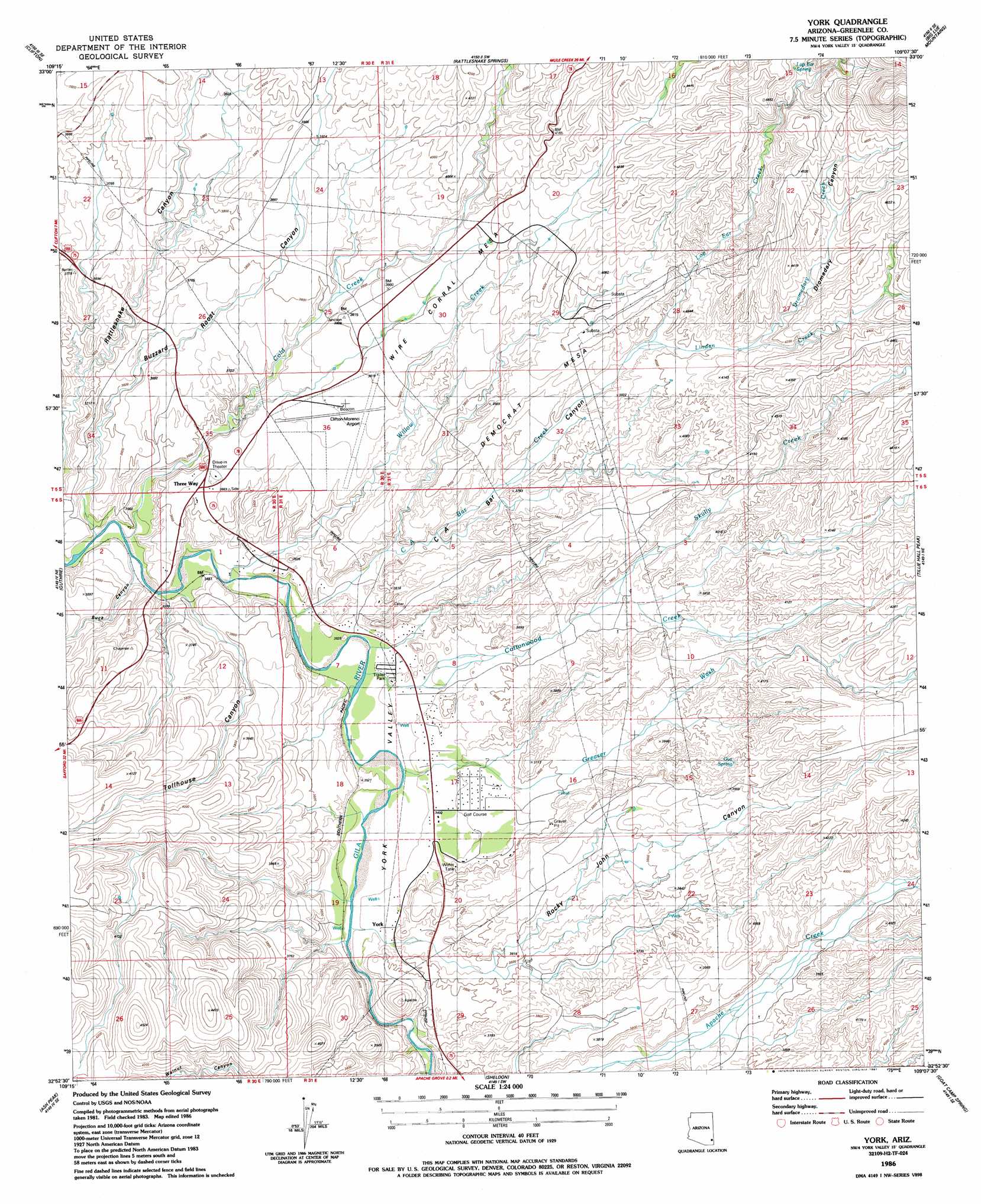
USGS Topo Quad 32109h2 - 1:24,000 scale
| Topo Map Name: | York |
| USGS Topo Quad ID: | 32109h2 |
| Print Size: | ca. 21 1/4" wide x 27" high |
| Southeast Coordinates: | 32.875° N latitude / 109.125° W longitude |
| Map Center Coordinates: | 32.9375° N latitude / 109.1875° W longitude |
| U.S. State: | AZ |
| Filename: | o32109h2.jpg |
| Download Map JPG Image: | York topo map 1:24,000 scale |
| Map Type: | Topographic |
| Topo Series: | 7.5´ |
| Map Scale: | 1:24,000 |
| Source of Map Images: | United States Geological Survey (USGS) |
| Alternate Map Versions: |
York AZ 1986, updated 1987 Download PDF Buy paper map York AZ 2011 Download PDF Buy paper map York AZ 2014 Download PDF Buy paper map |
| FStopo: | US Forest Service topo York is available: Download FStopo PDF Download FStopo TIF |
1:24,000 Topo Quads surrounding York
Coronado Mountain |
Mitchell Peak |
Dix Creek |
Harden Cienega |
Wilson Mountain |
Copperplate Gulch |
Clifton |
Rattlesnake Spring |
Big Lue Mountains |
Mule Creek |
Gila Box |
Guthrie |
York |
Tillie Hall Peak |
Crookson Peak |
Tollgate Tank |
Ash Peak |
Sheldon |
Goat Camp Spring |
Steeple Rock |
Dry Mountain |
Whitlock Mountains Ne |
Hot Well |
Duncan |
Canador Peak |
> Back to 32109e1 at 1:100,000 scale
> Back to 32108a1 at 1:250,000 scale
> Back to U.S. Topo Maps home
York topo map: Gazetteer
York: Airports
Greenlee County Airport elevation 1134m 3720′York: Populated Places
Three Way elevation 1106m 3628′York elevation 1073m 3520′
York: Springs
Gus Spring elevation 1193m 3914′Lop Ear Spring elevation 1385m 4543′
York: Streams
C A Bar Creek elevation 1048m 3438′Cold Creek elevation 1043m 3421′
Cottonwood Creek elevation 1054m 3458′
Dromedary Creek elevation 1239m 4064′
Greaser Wash elevation 1054m 3458′
Linden Creek elevation 1185m 3887′
Lop Ear Creek elevation 1188m 3897′
Skully Creek elevation 1134m 3720′
Wampoo Wash elevation 1185m 3887′
Willow Creek elevation 1044m 3425′
York: Summits
Big Mesa elevation 1315m 4314′Democrat Mesa elevation 1196m 3923′
K Six Mountain elevation 1627m 5337′
Wire Corral Mesa elevation 1186m 3891′
York: Valleys
Buck Canyon elevation 1061m 3480′Buzzard Roost Canyon elevation 1046m 3431′
C A Bar Canyon elevation 1058m 3471′
Rocky John Canyon elevation 1073m 3520′
Tollhouse Canyon elevation 1065m 3494′
York Valley elevation 1055m 3461′
York digital topo map on disk
Buy this York topo map showing relief, roads, GPS coordinates and other geographical features, as a high-resolution digital map file on DVD: